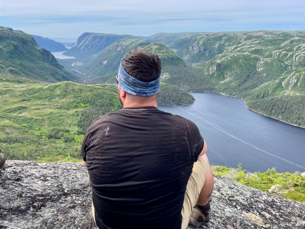
The Long Range Traverse hike has to be one of the best backpacking routes in Canada. This epic route through the Long Range Mountains offers a unique wilderness experience—and shouldn’t be taken lightly. In August, I travelled to Newfoundland for the first time to trek with four other outdoor enthusiasts. Here’s a look at our day-to-day on the Gros Morne Long Range Traverse.

I couldn’t have been more excited. Finally, I was going to experience the Long Range Traverse hike in Gros Morne! While I considered hiking solo, I ultimately decided to put together a group for extra safety and great company. After many solo hikes, I was happy to have a fun crew to explore with. I gotta say, the west coast of Newfoundland is unlike anything I’ve found in Canada. If you’re looking for an unforgettable adventure, consider adding the Long Range Traverse hike to your list!
This post includes affiliate links. If you make a purchase through one of the links, I may receive a percentage of the sale at no extra cost to you.
Table of Contents
About the Long Range Traverse Hike

Location: Gros Morne National Park, Newfoundland and Labrador
Distance: 35 km point to point
Difficulty: Difficult
Elevation: 700 m elevation gain
Time: 4 days / 3 nights
Dog-friendly: Not recommended. Bon Tours does not allow dogs on their boats.
Features: The Long Range Traverse routes through stunning artic-alpine terrain, offering challenging yet rewarding hiking conditions. Along the way, you have the chance to witness caribou and moose, and soak in incredible views of fjords, hills, lakes, and ponds (at least, when the fog lifts!). Unmarked and unmaintained, the Long Range Traverse hike is a rugged backcountry adventure, and certainly makes you work for the reward.
Looking for a full guide to the Long Range Traverse hike? Check out my other post: Your Complete Guide to the Long Range Traverse in Newfoundland. You’ll find essential details to help you plan your trip.
Long Range Traverse Hike Map
Finding the Trailhead

After cancellation the day before, we returned to Western Brook Pond for the BonTours boat shuttle. First, we walked the nicely groomed 1-km path to the lake. Most Long Range hikers start at Western Brook Pond, though it is possible to begin at the Gros Morne parking area. We planned to finish at the Gros Morne trailhead and left a shuttle vehicle waiting for us.
No matter if you’re hiking the Long Range Traverse or not, I’d recommend hopping on a BonTours boat tour of Western Brook Pond. You get to see the fjord from the water and hear all about this fascinating place. For trekkers, the tour is a nice bonus before the hard work begins.
Day 1 — Western Brook Pond to Marks Pond (10 KM)

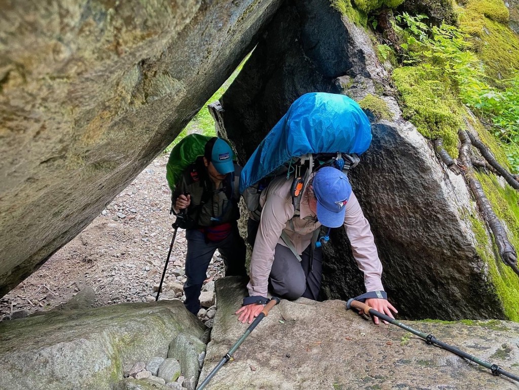
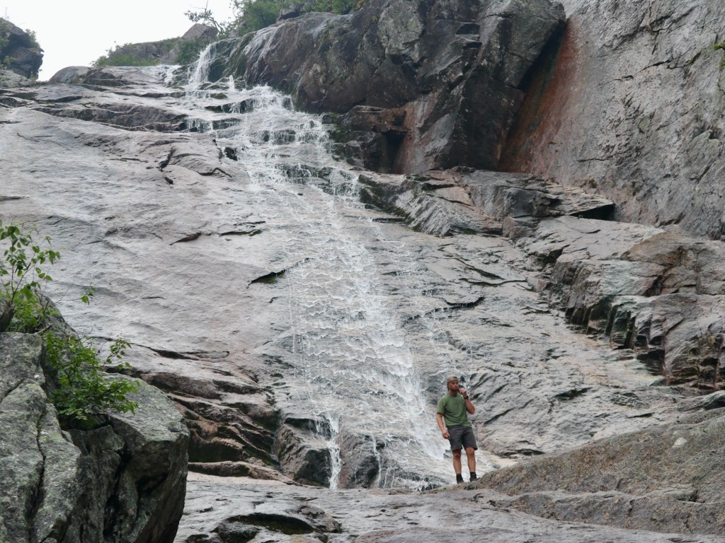
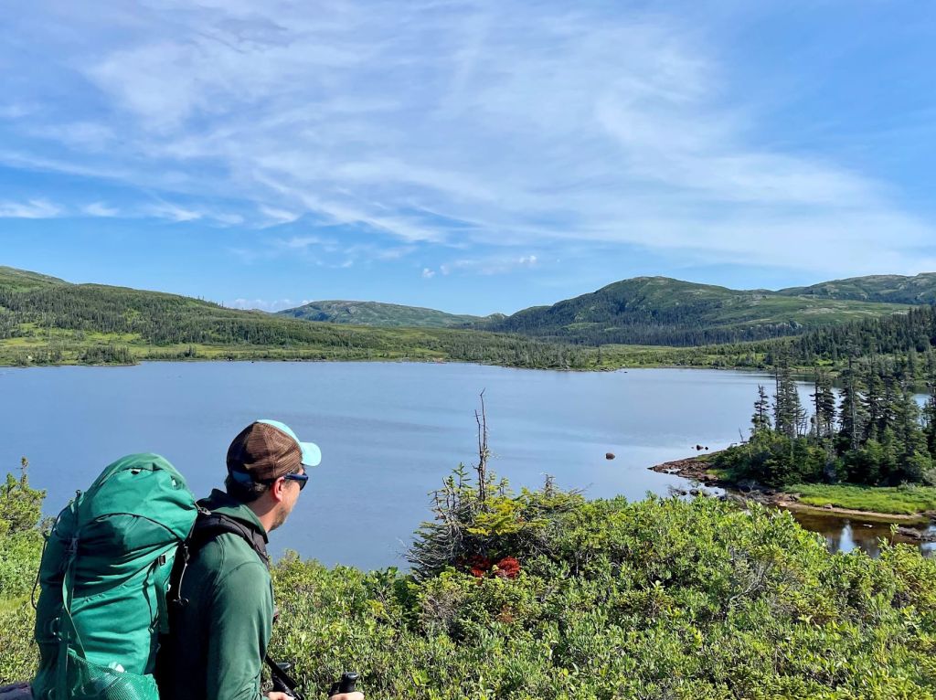
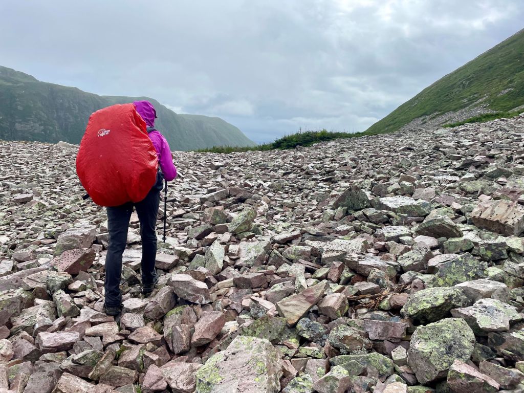
The boat arrived at the trailhead around 11am, and we disembarked with two other groups. Knowing the first day would be the toughest incline, we gained around 600 metres in under 4 km to the top of the fjord (don’t forget your hiking poles). We trekked through the cold, wet forest, up and down on slippery rocks, and steadily gained elevation. At the waterfall, we took the advice of Parks Canada staff and kept to the right. At this point, the route became much steeper on the packed-down trail. I was motivated by the thought of the “postcard view” from the top.
Unluckily, thick fog rolled in as we neared the Western Brook Pond viewpoint. And then came the rain, of course. We all tossed on our rain gear (I use this rain jacket), covered up our packs, and kept going toward Little Island Pond. Even though there’s no maintained trail, there is an obvious footpath most of the way. Though after Little Island Pond, we had to shift our mindset after following game trails for too long in the wrong direction. It was time to rely more on our navigation tools for directions.
As I mentioned, we planned to stay at Little Island Pond, but the tent sites were all full. After a quick rest, the group pushed on about 4 km to Marks Pond Campground. We arrived just before 8pm. Thankfully, only one couple was set up there. We hurriedly set up our tents (I brought my Marmot Tungsten 2-Person), ate a quick supper, and went straight to bed.
The official distance from Western Brook Pond to Marks Pond is 10 km, but my GPS tracked over 14 km for this distance. Hikers should overestimate the amount of time needed, and understand the official distances may not be exact.
Read more: Your Complete Guide to the Long Range Traverse in Newfoundland


Day 2 — Marks Pond to Hardings Pond (4.5 KM)

I had a decent night at Marks Pond, even though my sleeping pad deflated. Marks Pond doesn’t have wooden tent platforms but the sites are established and spacious. We had no trouble setting up five tents and found the food storage locker and pit toilet nearby. To carry my food, I like to use a lightweight dry bag. Water sources are very accessible at the campground, with Marks Pond (really more like a lake) and a brook providing fresh water. However, don’t forget to purify or filter the water before drinking (I brought this gravity filter for the group).
On the way to Hardings Pond, some hikers unknowingly veer southeast toward Candlestick Pond. We learned not to get too obsessed with game trails, relying instead on our GPS for directions. Boot prints helped confirm our path, but other hikers can get lost, too. Nevertheless, we continued on toward Hardings Pond, following many moose tracks and avoiding muddy sinkholes.
No one complained about our short day. Around 1:30pm, we reached Hardings Pond after three hours of hiking. Clear blue skies and the bright sun was a welcome contrast to the day before. We each set up camp and relaxed together for the afternoon. Hardings Pond has two tent platforms near the lake, and three more up on the hill.
We debriefed our day together at suppertime. If you’re hiking with a group, I highly suggest discussing the high and low points of each day (thanks for suggesting, Alex!). A few times, I felt like I was back at summer camp… but this time, for adults.
This time, the official distance seemed to be more quite accurate. My GPS tracked around 5.5 km between Marks Pond and Hardings Pond. Though we also veered off-route slightly, so we probably added some extra distance.
Read more: The West Coast Trail: 7 Days on Vancouver Island’s Iconic Trek


Day 3 — Hardings Pond to Lower Green Island Pond (7 KM)

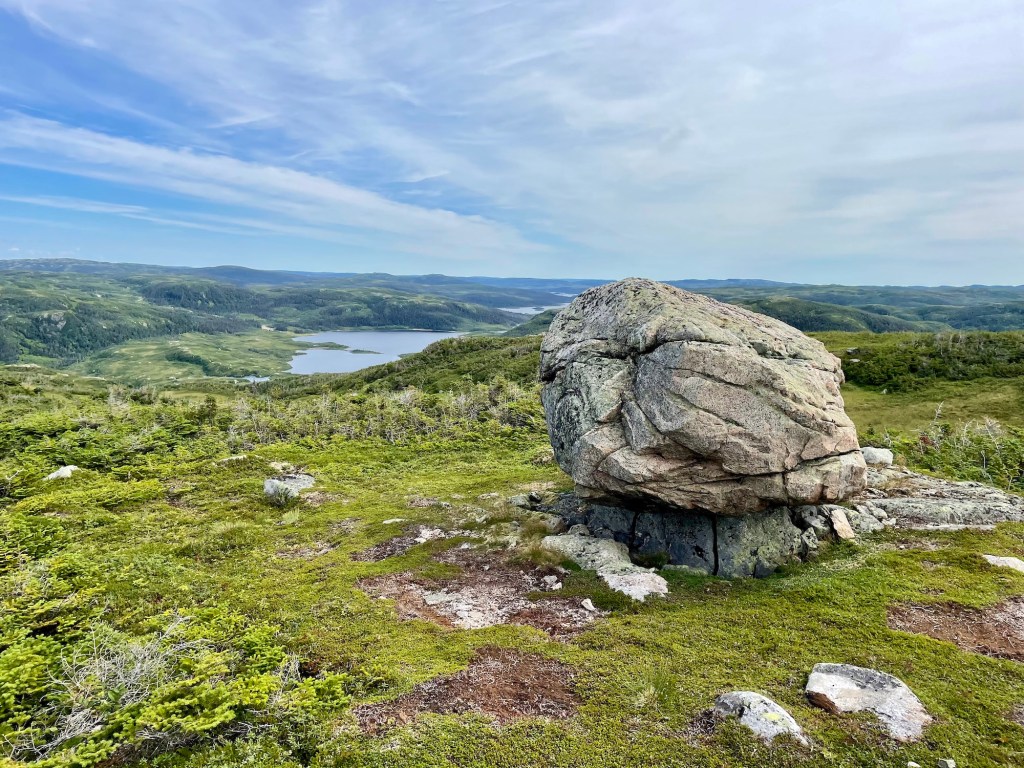
How did we get so lucky? Another beautiful, sunny day on the Long Range Traverse! After a good night’s rest, we packed up and left camp around 10:30. Our morning hike included about 200 metres of elevation gain in under 2 km. We huffed and puffed our way up the gradual slope, looking for the “big rock” for our rest.
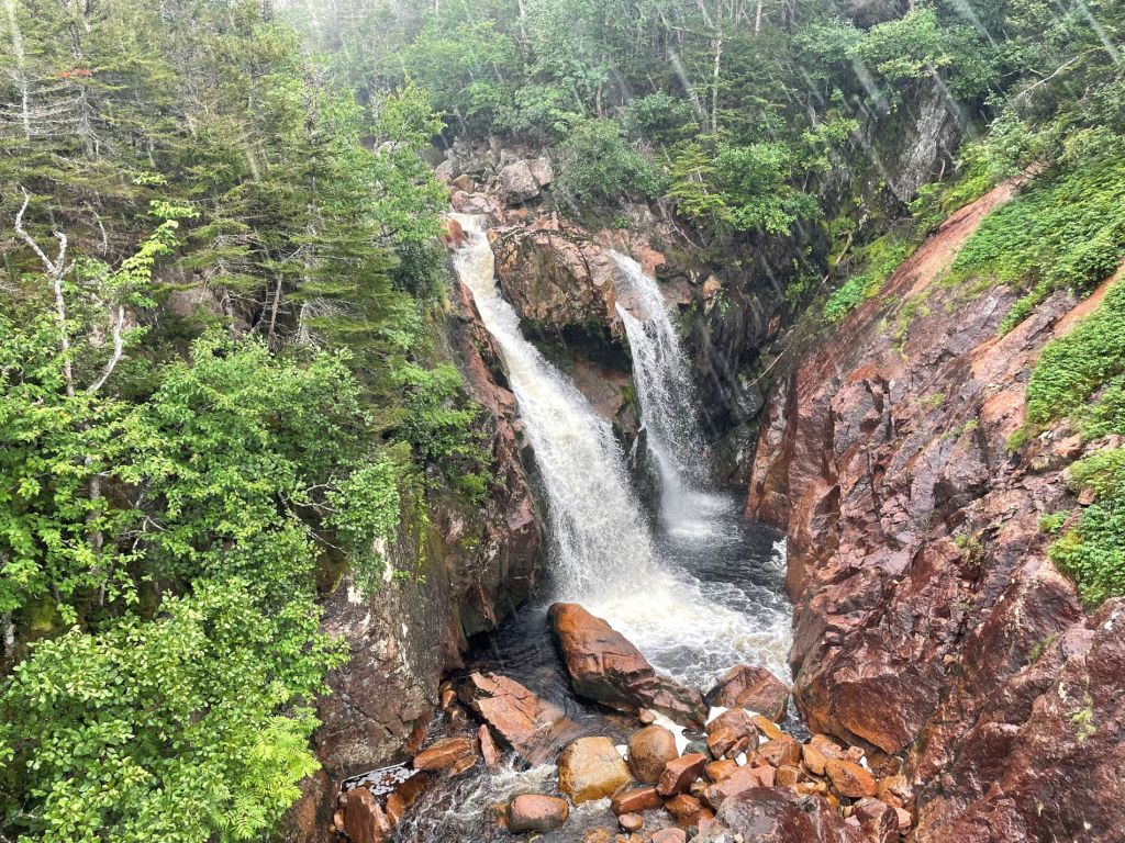
Before starting our trek, Gros Morne Adventures told us about a side trip to Bakers Brook Pond. We decided to go for it. To make our trip easier, we dropped our packs on the route and made a GPS location pin. That being said, we also had a decent sense of the area (in case the GPS failed). Our side trip was not straightforward and took some effort to find the right area. Swaths of tuckamore made navigation extremely difficult. Our 5 km roundtrip took an additional 4 hours to complete (and was likely more than 5 km). The “postcard view” of Western Brook Pond was very foggy, so I’d say the spectacular view of Bakers Brook Pond was completely worthwhile.
After retrieving our packs, we set off for Green Island Pond Campground. The landscape opened up with deep-green meadows and rolling hills. At one point, we found the only patch of snow on the route. We continued to find moose droppings and tracks, but still no moose! If you’re lucky, hikers have the chance to see caribou, black bears, moose, and other wildlife in Gros Morne National Park. Always keep a safe distance.
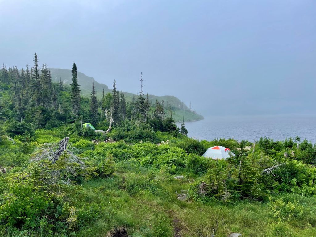
We finally reached Lower Green Island Pond Campground around 7:30pm. Luckily, two tent platforms were available with enough ground space for our crew. Hikers can push forward about 250 metres to find 3 more tent platforms at Upper Green Island Pond. The campground was quite windy and cool, so I was very glad to have my down jacket (I use this one). And the wind helped keep the bugs at bay. Again, a food storage locker and pit toilet is available.
Note: The Bakers Brook Pond side trip took us about 4 hours roundtrip. You’ll want to consider your own comfort in dropping your packs and being able to retrieve them.


Day 4: Lower Green Island Pond to Gros Morne Mountain Trailhead (13 KM)

Day four on the Long Range Traverse started like every other. I woke up, grabbed my ziplock of toilet paper, and sauntered toward the green pit toilet. On the return, I saw my whole group out of their tents and staring at the hill behind me. Alex put his wide-open hands on each side of his head and then I knew. MOOSE! I quickly ran back to camp to snatch my camera. A beautiful bull moose grazing on the hillside. Could this day get any better?
After all the excitement, we packed up and left camp just after 9 o’clock. We reached Bakeapple Viewpoint after about 3km, with awe-inspiring views of Tent Mile Gulch. Walk up the hill to find the most impressive look. I could’ve spent all day here, but the wind was strong and chilly.
It took about 4 hours to reach Ferry Gulch from Green Island Pond. At the base of Gros Morne, Ferry Gulch Campground is the last backcountry camping option on the Long Range Traverse. Beginner backpackers might want to overnight at Ferry Gulch as an alternative to the Long Range. At the campground, you’ll find 3 wooden tent platforms, 3 picnic tables, a food storage locker and a bear hang, and 2 outhouse toilets.
Note: Did you know there are over 3,500 moose in Gros Morne National Park? In fact, the province boasts over 100,000 at any one time! If you want to see a moose (from a safe distance, of course), visiting Newfoundland is probably your best chance.


Gros Morne Mountain Summit

A few of us decided to summit Gros Morne Mountain as a side trip. Gros Morne is the second highest mountain in Newfoundland, at 806 metres above sea level. How could we say no to summiting Gros Morne on our Long Range Traverse adventure?
After dropping our packs at Ferry Gulch, we hiked one way to the summit and reach the summit sign in an hour. Views of Ten Mile Pond and the rolling hills abound until the rain and fog take over. By the time we reach the summit, visibility was very poor. After a few quick photos, we returns to Ferry Gulch, retrieved our packs, and pushed on to Gros Morne Mountain parking lot. Plan 3 to 4 hours to finish the trail.
Read more: Keji Southern Lakes: 4 Days of Canoeing in Nova Scotia


What To Bring on the Long Range Traverse

Here is my packing list for the Long Range Traverse:
- Osprey Kestrel 68
- Waterproof pack cover
- Tent
- MEC Talon sleeping bag
- Therm-a-rest NeoAir
- Sleeping bag liner
- Siltarp
- Plastic Birkenstocks
- Scarpa hiking boots
- Arc’teryx Beta LT rain shell
- Rain pants
- OR Rocky Mountain High Gaiters
- Jetboil Flash
- Campsuds soap
- Osprey 2L reservoir
- Nalgene water bottle
- Komperdell hiking poles
- Lighter / matches
- GSI mug
- Spoon
- Sunscreen
- Sunglasses
- Bug spray
- Toilet paper
- PackTowel
- Toothbrush / toothpaste
- MSR TrailShot filter
- Petzl headlamp
- Paracord
- Buff
- Mora Knife
- First aid kit
- 2 merino wool t-shirts (like this Icebreaker tee)
- 1 long sleeve (love this Patagonia Capilene)
- 1 pants
- 2 shorts
- 1 merino leggings
- 3 merino underwear
- 3 – 4 merino wool socks
- Down jacket (love this Patagonia down sweater jacket)
- Fleece sweater
- Winter hat / gloves
- Map / compass
- Satellite comms (Zoleo)
- Powerbank (Anker)
- GoPro
- Canon DSLR
- ID
- Parks Canada pass
- Hiking permit
- Food

Know Before You Go

Reservation: You can reserve the Long Range Traverse by calling 1-709-458-2417. Backcountry permits must be purchased at the Rocky Harbour Visitor Centre.
Boat Shuttle: Book your boat shuttle with BonTours at bontours.ca.
Freshwater: You won’t have any trouble finding freshwater on the Long Range Traverse. Campgrounds are all located near lakes and brooks, and there are many lakes along the route. Remember to filter or purify water before drinking.
Rain Gear: Heavy rain, fog, and high winds can happen any time of year. Bring appropriate rain gear for hiking and camping, such as waterproof layers and tarps.
Bear Country: The Long Range Traverse is in black bear habitat. Keep your distance and pack out food waste and garbage. Black bears are often timid but carry bear spray just in case.
Bugs: Mosquitoes and blackflies are common on this route. Bring bug spray and consider a bug jacket.
Safety: Prepare a trip plan including where you are going, who you are with, and when you plan to return. Provide instructions of what to do if you do not return at the anticipated time. Leave this plan with someone you trust. Carry a first aid kit with you. I suggest taking a wilderness first aid course before attempting the Long Range.
Emergency Rescues: Parks Canada conduct rescues on the Long Range Traverse every year. Sometimes these rescues could have been avoided with more preparedness or better decision-making. Parks Canada will initiate a rescue if you do not return your backcountry permit within 3 days (good weather) of your scheduled completion.
Note: The Long Range Traverse is considered a challenging route. Hikers should be physically fit and have navigation and route finding skills prior to attempting this hike. I would not recommend the Long Range Traverse for novice backpackers. Not sure if you’re prepared? Check out my Long Range Traverse guide.
Long Range Traverse Hike Video
Thank you to Parks Canada for contributing to my backcountry adventure! Together with Parks, I want to help hikers have a safe and memorable experience on the Long Range Traverse.
Have you hiked the Long Range Traverse in Gros Morne National Park? What was your experience like? Leave a comment below!
Save this for later? Hover over the image to add to Pinterest!

Thomas Coldwell has always been fond of the outdoors. He loves hiking, paddling, and camping, and thoroughly enjoys creating outdoor adventure resources for people like you. Originally from Nova Scotia, Thomas has lived in four Canadian provinces (NS, NB, ON, AB) and has travelled in 20 countries and counting.

This is an amazing review! Thank you so much. I’m from New York State in the United States and a co-worker of mine just came back from a hunting trip near this trail. My wife and I did the Grand canyon Rim to Rim in 2022 and we are looking for one more big accomplishment. This trail seems along the same complexity if not maybe a little bit harder due to the ground technicalities. The weather in the Grand canyon was probably the biggest challenge and that was just making sure not to drink too much or not enough water. The trails were pretty much perfect and water crossings were easy with the right shoes. This hiking trail seems to be much more technical but maybe a little bit more forgiving on the weather? Not including the reign of course. Thank you again for such a great clear review . It will help us decide whether we do this trailer or not. I think the only major setback is it costing us thousands to get there lol
Thanks for your comment (I’m replying from Dulles Airport enroute – not too too far from you). Glad you found my guide helpful. It sounds like the LRT would be a great adventure for you both! I suspect you’ll find the tuckamore and fog a unique terrain/navigation challenge (compared to Grand Canyon). When the fog is thick, it can be difficult to navigate without a marked trail. Reach out if you have any questions that aren’t covered here. Cheers!