The official Blue Ridge Parkway map is funded by the Blue Ridge Parkway Foundation and printed & distributed by Eastern National, both partners of the National Park Service. The map is free in all of the Parkway’s visitor centers. You may download it from this website as four individual 8.5″ x 11″ pages.
In addition to the official Parkway map, you will find the following map types on this page:
- printed maps that can be ordered online,
- Blue Ridge Parkway trail maps,
- Blue Ridge Parkway campground maps,
- Blue Ridge Mountain motorcycle route maps.
Official Blue Ridge Parkway Map Downloads
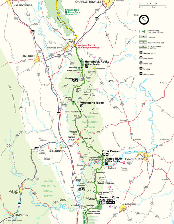
Page #1
MP 0 – 95
Download
Page #2
MP 95 – 210
Download
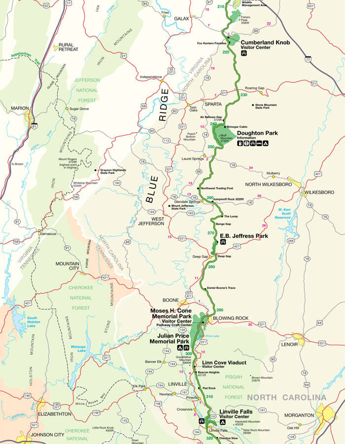
Page #3
MP 210-325
Download
Page #4
MP 325-469
Download
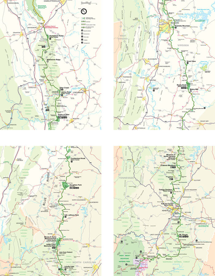
All Pages
MP 0-469
Download
Printed Maps You Can Order Online
These three maps are an invaluable resource for anyone wanting to drive along the entire Blue Ridge Parkway. Together, the maps cover every section of the Parkway from where it begins at milepost 0 to its end at milepost 469.
Map Details Buy Now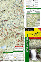
Each Trails Illustrated map contains detailed topographic information, clearly marked trails, recreational points of interest, and navigational aids. National Park series maps contain useful details for planning your visit. State series titles cover popular recreation areas, ideal for done-in-a-day activities.
Map Details Buy Now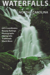
GPS coordinates, beauty ratings, full-color photographs, hiking information, trailheads, and more! This new full-color map includes over 300 waterfalls located in Western North Carolina, with detailed descriptions for more than 125 of them.
Map Details Buy NowBlue Ridge Parkway Trail Maps
There are more than 100 Blue Ridge Parkway hiking trails that provide visitors with an up-close view of the wilderness surrounding the most scenic drive in America. On these trails you will find captivating vistas, wildflowers, rolling pastures, waterfalls, abundant wildlife, and peaceful forests. Trails are suited for all levels of hiking experience and range from leisurely strolls to difficult climbs.
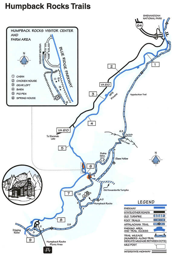
Humpback Rocks Trails – Milepost 5.9
The Humpback Rocks area at the northern end of the Blue Ridge Parkway offers a wonderful variety of trails for both the serious and casual hiker. Visitors will find both the natural and cultural world of the southern Appalachian mountains opening up before them.
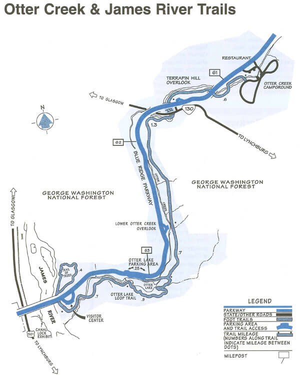
Otter Creek and James River Trails – Milepost 63.6
As Otter Creek descends to the James River, the Blue Ridge Parkway dips to its lowest elevation, roughly 650 feet above sea level. This area’s abundant water and warmer temperatures support plant and animal communities that are unlike those found at other areas on the Parkway.
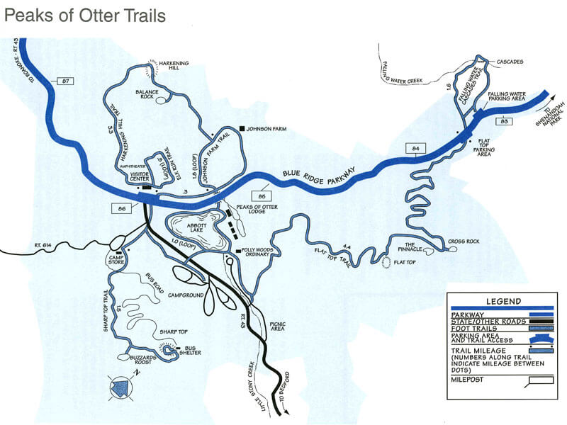
Peaks of Otter Trails – Milepost 86
Sharp Top Trail, 1.5 miles to the summit, is the most popular Peaks of Otter trail and originates at the campstore across from the Visitor Center. This is a steep and strenuous route and should be attempted only by those in good health.
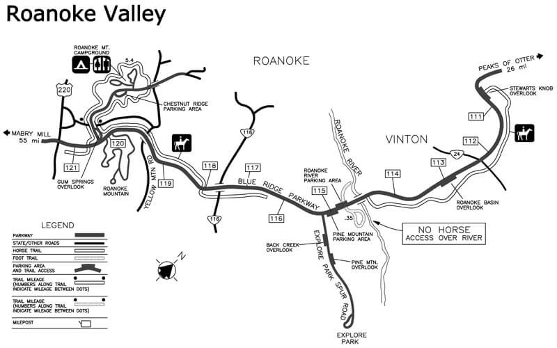
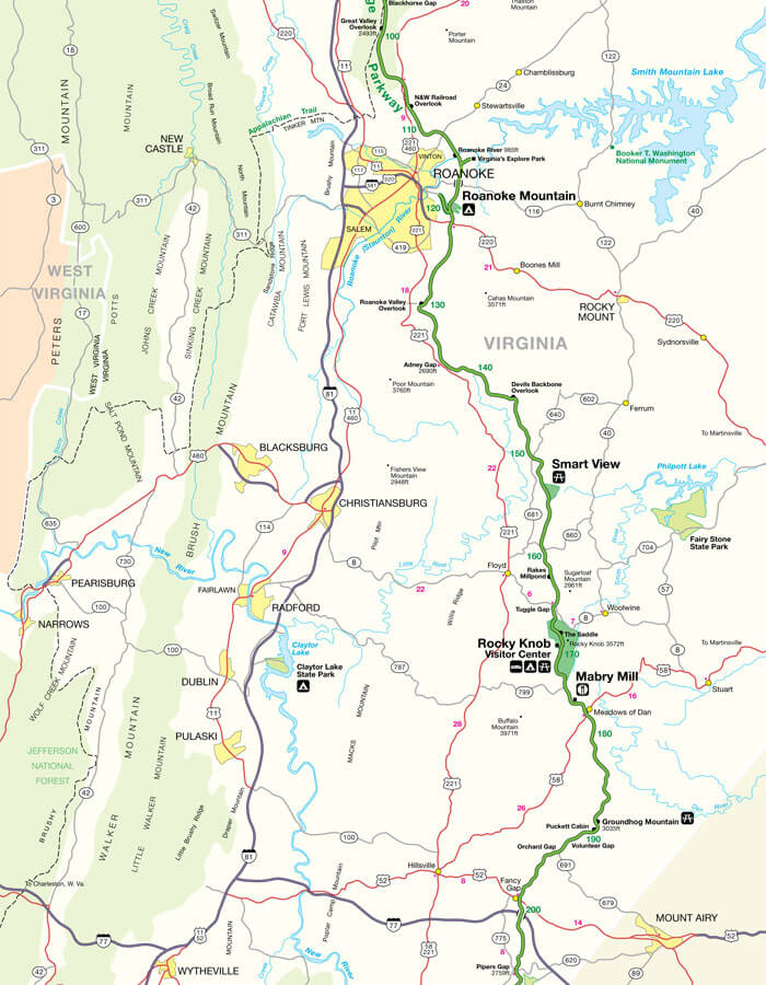
Roanoke Valley Trails – Milepost 110
These horse and foot trails around Roanoke Campground and near the Roanoke River include Roanoke River Trail and Roanoke Mountain Summit Trail.
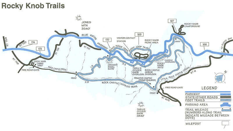
Rocky Knob Trails – Milepost 169
The lush and forested slopes of Rock Castle Gorge suggest that man has been an infrequent visitor here, but that is not the case. A century ago this gorge supported a substantial community of 30 families.
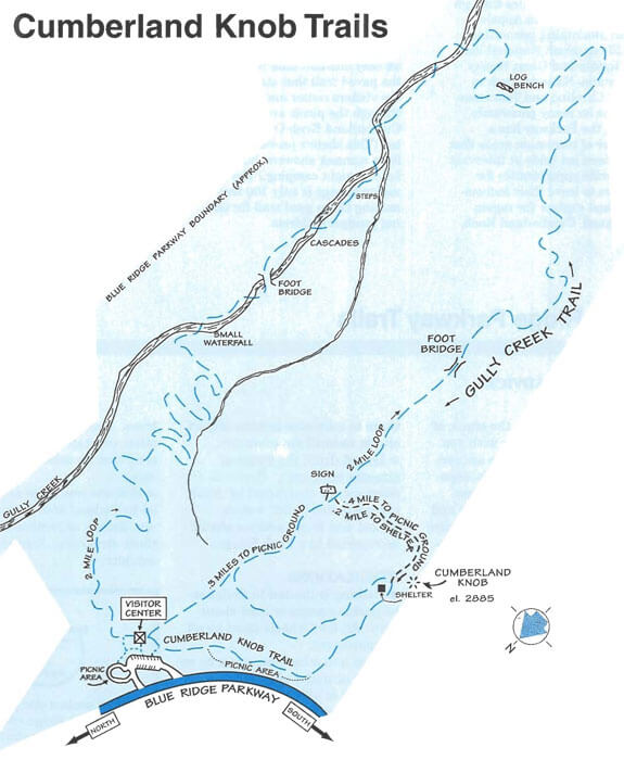
Cumberland Knob Trails – Milepost 217.5
Cumberland Knob, with more than 2,000 acres, has trails built for the enjoyment of both casual strollers and energetic hikers.
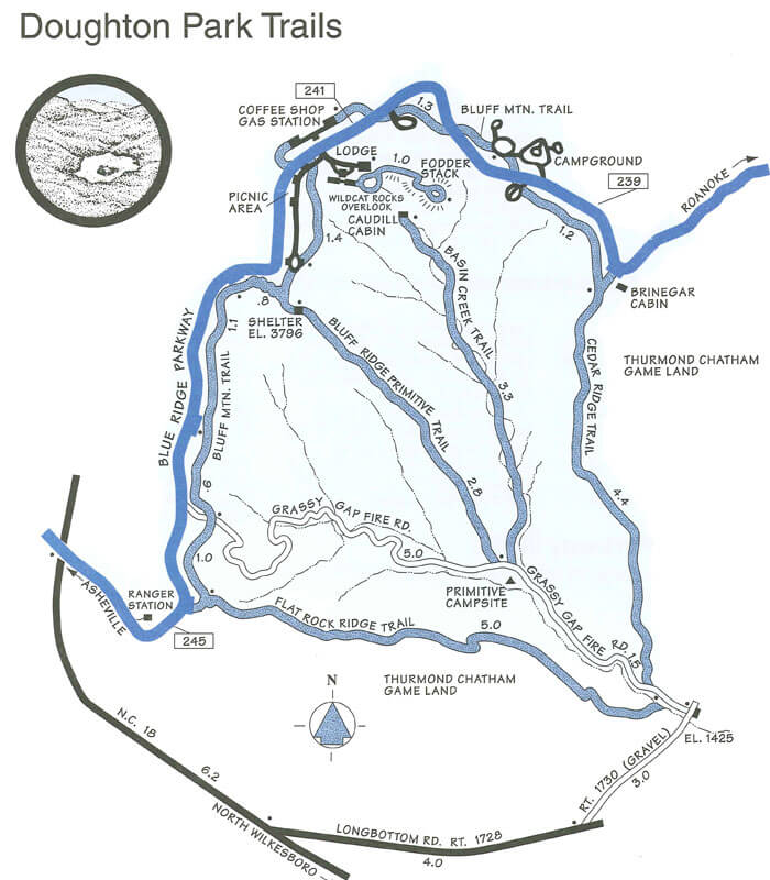
Doughton Park Trails – Milepost 241
More than 30 miles of hiking trails meander through Doughton Park’s pastures and along its streams. Visitors can stretch their legs on modest strolls or embark on more ambitious, day-long outings.
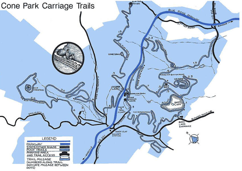
Cone Park Carriage Trails – Milepost 294
The 25 miles of gently sloping carriage roads in Cone Park offer many opportunities for leisurely hiking.
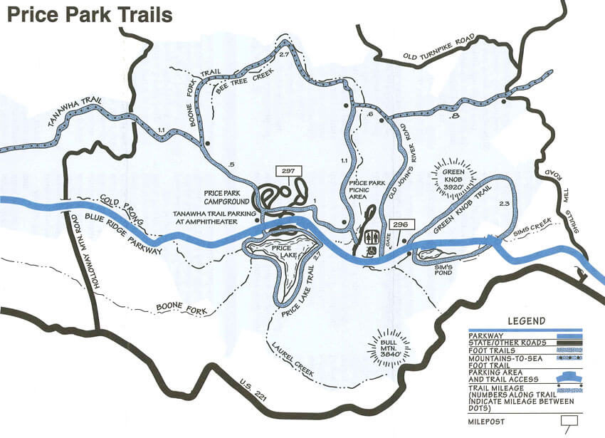
Price Park Trails – Milepost 296
Julian Price Memorial Park comprises 4,200 acres of rolling mountain land with elevations from 3,400 feet to nearly 4,000 feet. Visitors who take to the trails will find extremely varied and scenic terrain.
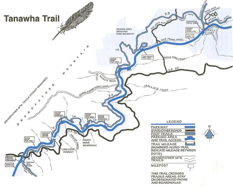
Tanawha Trail – Milepost 305.5
The Tanawha Trail, stretching 13.5 miles from Julian Price Park to Beacon Heights, parallels the Blue Ridge Parkway on Grandfather Mountain in North Carolina.
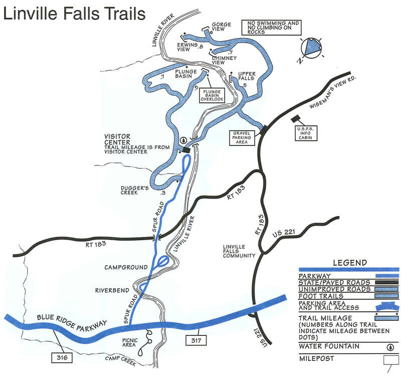
Linville Falls Trails – Milepost 316.4
Two main hiking trails lead to beautiful views of the Linville Falls. Both begin at the Linville Falls Visitor Center and pass through remnants of a virgin hemlock forest mixed with other familiar trees such as white pine, oaks, hickory, and birch.
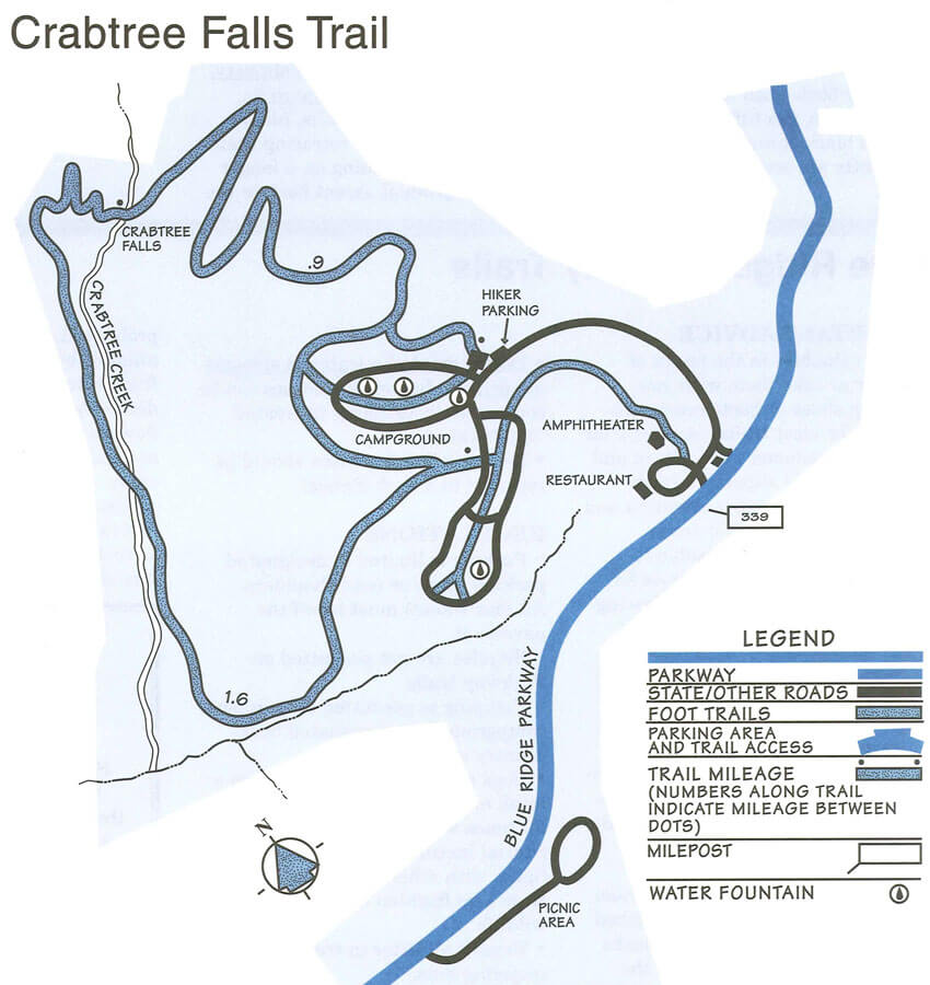
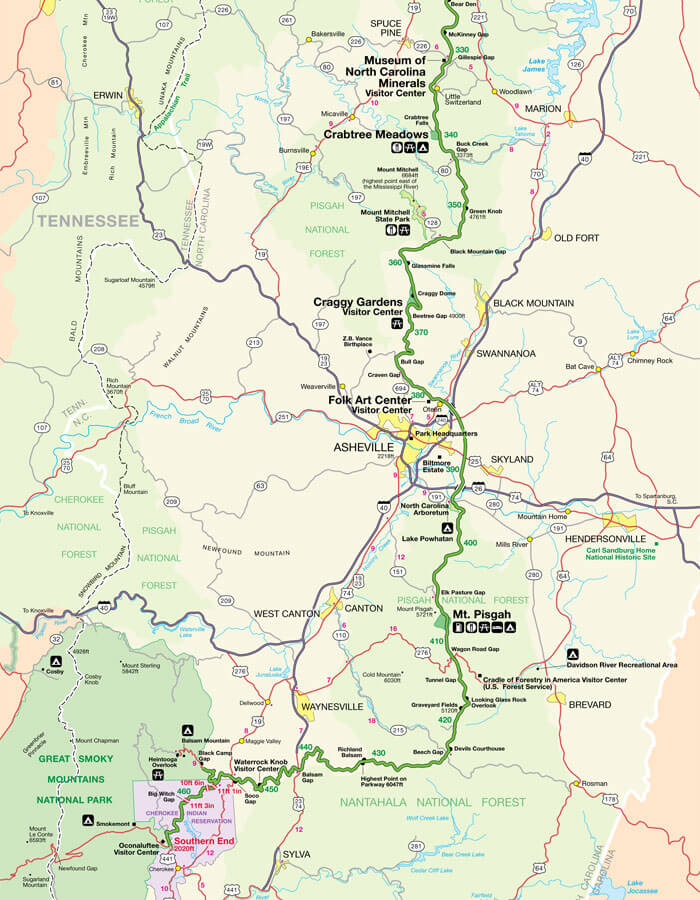
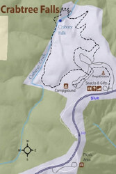
Crabtree Falls Trail – Milepost 339.5
The 2.5-mile loop trail to Crabtree Falls is moderate to strenuous. Sturdy shoes or hiking boots are recommended because of the incline and rocky terrain.

Craggy Gardens Trails – Milepost 364.5
North of Asheville, North Carolina, the Blue Ridge Parkway passes through the Great Craggy Mountains, and area of exposed rock surfaces and high peaks that provides breathtaking views of distant southern Appalachian ridges.
Blue Ridge Parkway Campground Maps
The campground areas along the Parkway offer many facilities and activities, including campsites equipped with a fireplace and table, scheduled seasonal activities for adults and children, fishing, and self-guiding hiking trails.
Otter Creek Campground
(Milepost 60.9)
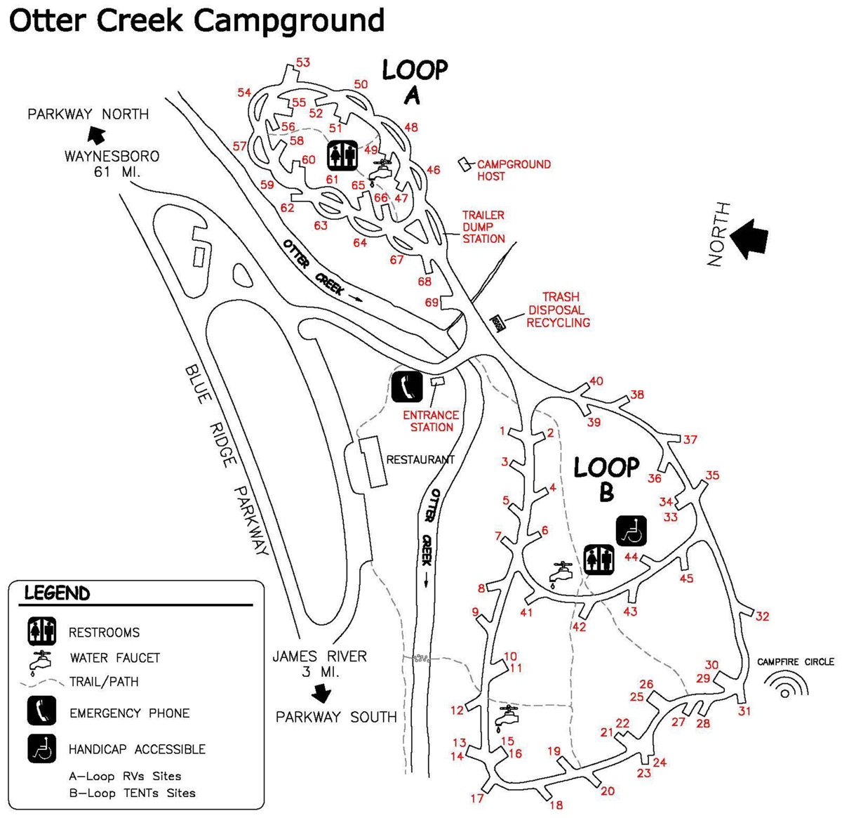
Download Map (PDF)
Peaks of Otter Campground
(Milepost 86.0)
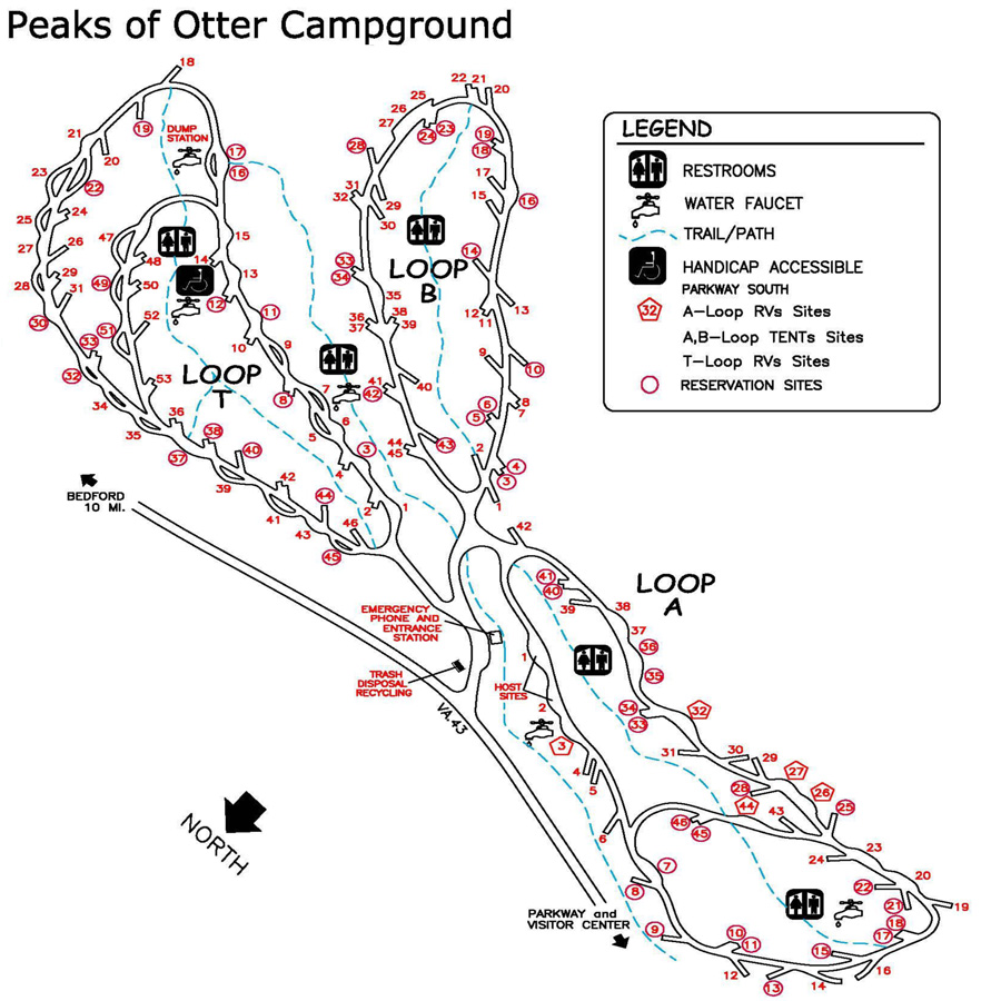
Download Map (PDF)
Rocky Knob Campground
(Milepost 169)
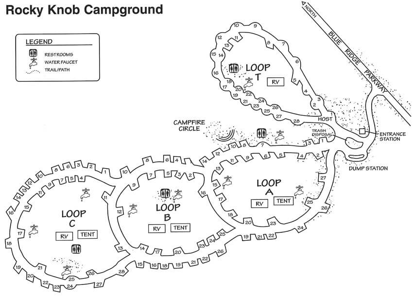
Download Map (PDF)
Doughton Park Campground
(Milepost 239.0)
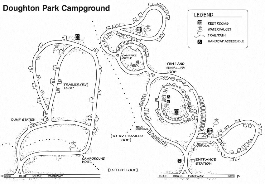
Download Map (PDF)
Crabtree Meadows Campground
(Milepost 169)
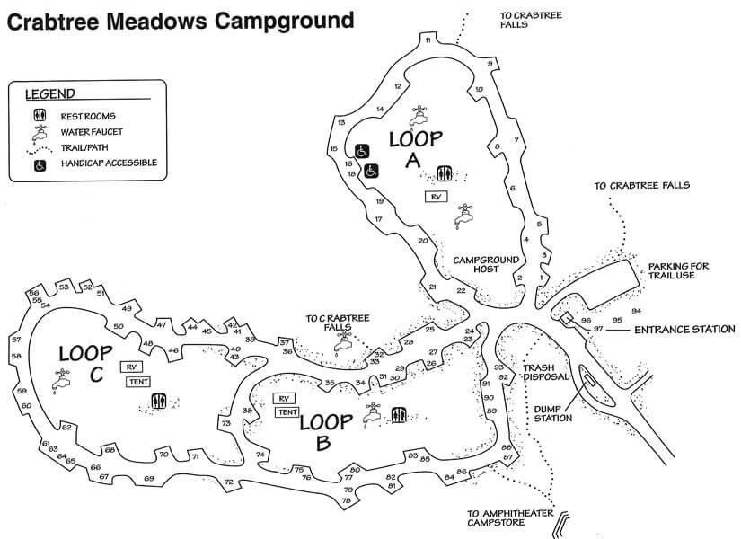
Download Map (PDF)
Blue Ridge Mountain Motorcycle Route Maps
Riding a motorcycle in the Blue Ridge takes more route planning time than riding in a car, truck, or RV. Motorcyclists have special needs, such as more frequent fuel stops, understanding of road surfaces, and knowledge of the whole route ahead of time. Here are some resources to help plan a trip with the motorcyclist in mind.
Our BlueRidgeMotorcycling.com Website
 BlueRidgeMotorcycling.com is a website dedicated to motorcycling in the Blue Ridge Mountains. The Blue Ridge area is considered a motorcycle mecca due to its breathtaking views and sweeping curves, countless scenic backroads, and the 469 stop sign- and traffic light-free miles of the Blue Ridge Parkway.
The website includes interactive motorcycle ride maps, recommendations of motorcycle-friendly travel destinations, motorcycle safety tips, and “The Road Journal” motorcycle blog.
America Rides Map’s Blue Ridge Parkway Series

A series of 6 pocket maps covering the entire Blue Ridge Parkway from start to end with more than 3000 miles of great motorcycle rides described. This series contains all 6 maps which trace the Blue Ridge Parkway from Waynesboro, Virginia to Cherokee, North Carolina.
Map Details Buy NowHawk Hagebak’s Motorcycle Adventure Books
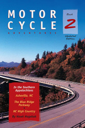 Hawk Hagebak’s books expand riding horizons for motorcyclists touring the mountains of the Southeast. Whether you’re a sport biker, a cruiser, or somewhere in between, having a guide book will add to the enjoyment of your ride. Not only will it help keep you from getting lost, it will show you the best places to go and what to expect when you get there: motorcycle-only resorts, national and state parks, and the best places to eat, shop, and park. His books include:
- Motorcycle Adventures in the Southern Appalachians: North Georgia, Western North Carolina, East Tennessee
- Motorcycle Adventures in the Southern Appalachians: Asheville NC, The Blue Ridge Parkway, NC High Country
- Motorcycle Adventures in the Central Appalachians: Virginia’s Blue Ridge, Shenandoah Valley, West Virginia Highlands