Nova Scotia digs out after epic snowfall as storm heads to Newfoundland
The heaviest snow from a multi-day, historical event is now done with the Maritimes, allowing for cleanup efforts to begin. Attention turns to Newfoundland on Tuesday for what's left of the epic snowstorm
Many across Nova Scotia started to dig out on Monday after a weekend that brought historic snowfall to parts of the province.
Sydney, N.S., had both its largest two- and three-day snowfall events on record, with 95 cm reported as of Monday afternoon local time. The data goes back to the late 1800s.
RELATED: PHOTOS: Unusual snowstorm buries parts of the East Coast in 100 cm
Most schools opted to close their doors across Cape Breton and Halifax Monday morning. Many flights at Halifax Stanfield International Airport are cancelled, as well, with Marine Atlantic also cancelling some of its crossings from North Sydney to Port aux Basques, N.L.
The heaviest snow is now done with the Maritimes, as the cleanup efforts can begin. Attention turns to Newfoundland on Tuesday for what's left of the epic snowstorm.
Conditions gradually improve in the Maritimes, but travel still not recommended
The stalling nature of the low-pressure system is what made the setup remarkable for eastern Nova Scotia. Although on paper it's a weaker storm than what White Juan was, the amount of available moisture that continuously swept across Cape Breton is what contributed to the record-setting snowfall totals.
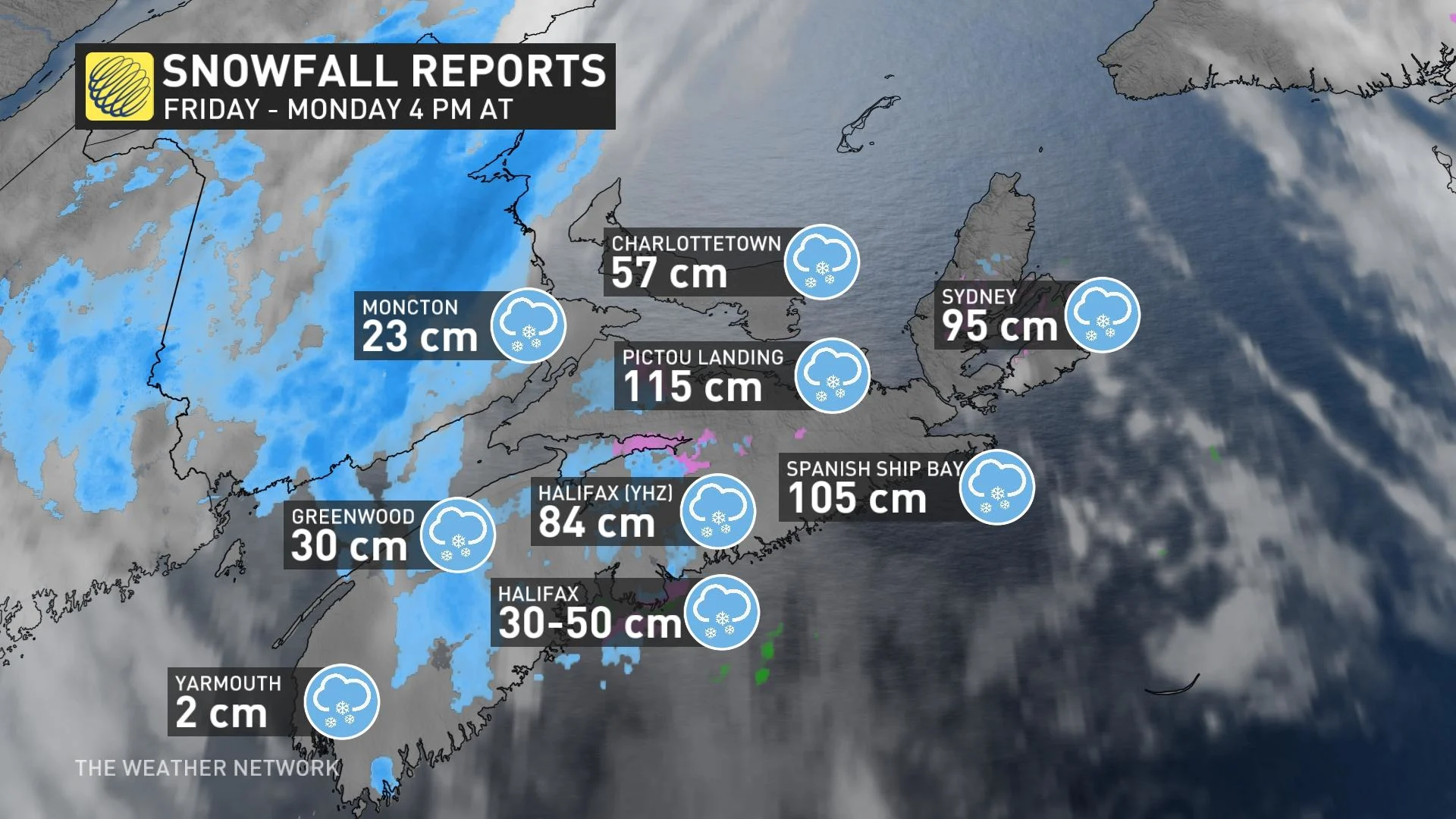
As of Monday afternoon, a whopping 84 cm of snow has been recorded at the Halifax airport. A total of 96 cm was reported on the ground, with some existing snow there ahead of this storm. This is the most amount of snow on the ground ever recorded for the region, dating back to 1960 when record keeping began.
Elsewhere, Pictou Landing has documented a whopping 115 cm of snowfall, while Spanish Ship Bay has observed 105 cm.
MUST SEE: El Niño and the polar vortex take centre stage for winter’s final chapter
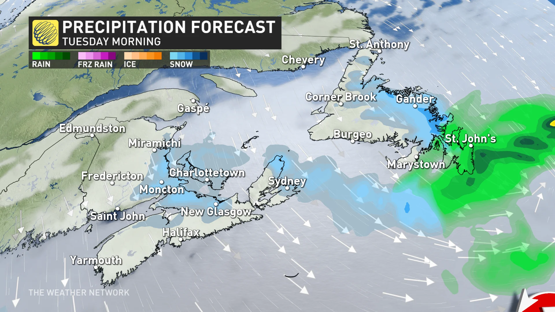
Newfoundland
The next wild card is St. John’s and the Avalon in Newfoundland, where as much as 20 cm of snowfall could fall on Tuesday. There is a wide variation in model solutions, ranging from 5-30 cm, so we’ll be watching this carefully.
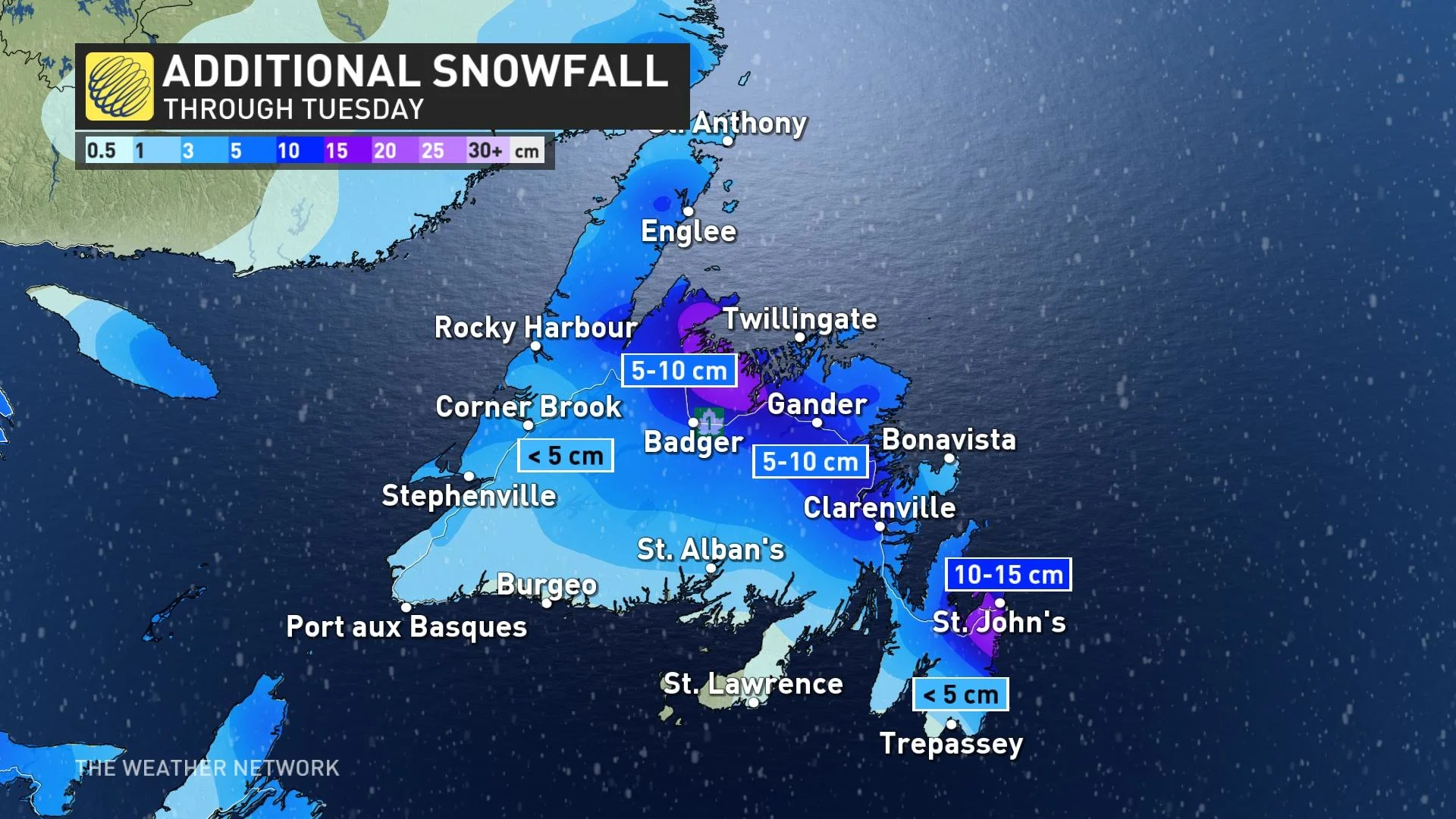
It’s most likely that St. John’s will fall into the 10-20 cm snowfall range by Tuesday evening and overnight.
Five to 10 cm of snow will also fall along portions of the Trans-Canada Highway, from Clarenville to South Brook.
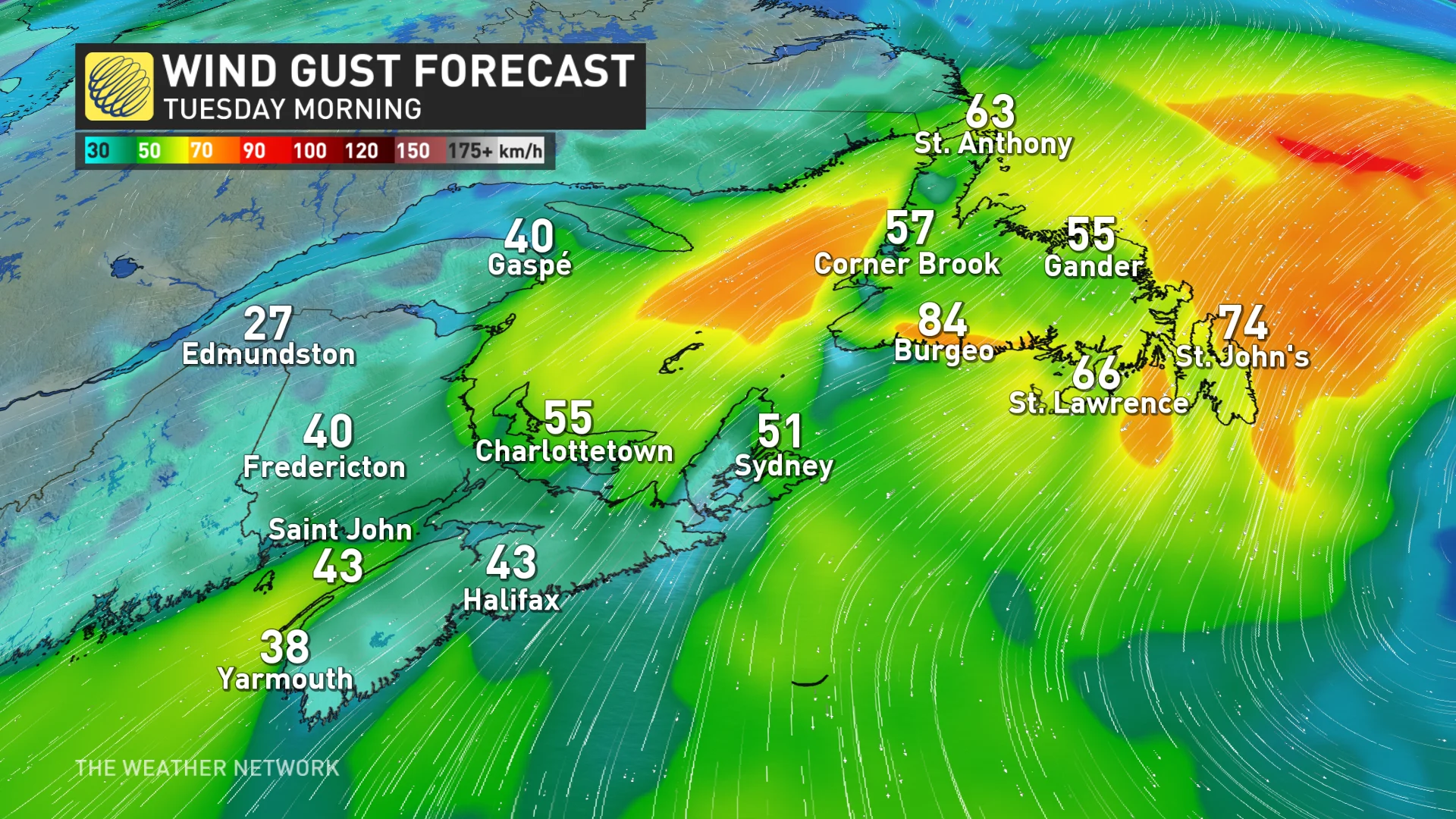
Wind gusts will slowly pick through the day, with gusts between 50-70 km/h on Monday, and 60-80 km/h throughout the day on Tuesday. This could result in blowing snow and reduced visibilities at times.
Stay with The Weather Network for the latest weather details across Atlantic Canada.
With files from Tyler Hamilton, a meteorologist at The Weather Network.