Google Street View cars return to Romania
26 March 2021

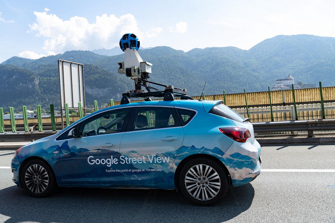
Google Street View cars have returned to Romania for updates to local Google Maps Street View images of cities, roads, and highways. They will reach over a hundred localities in the coming months.

Starting March 26, the Google Street View cars will take 360-degree images of areas and towns across the country, from Bucharest, Constanta, Calarasi, Ploiesti, Onesti, or Pascani to Sibiu, Cluj, Sighetul Marmatiei, or Arad, local Agerpres reported.

Street View is a popular Google Maps service that allows people to see panoramic images from many parts of the world, including roads, cities, historical monuments, cultural landmarks, or wildlife (on land and on or in the water), and even from space. The service is also available in Google Earth and the Google Maps app for mobile phones.

Street View has been available in Romania since 2010 when the first images of the most important cities were published on Google Maps. Street View coverage across the country took place in 2012 when photos were taken on 40,000 km of roads, 39 cities, and hundreds of tourist attractions. The service’s expansion in Romania has constantly continued since then, with images from major cities being updated and new tourist attractions such as Turda Salt Mine, Bran Castle, Alba Iulia Fortress, Brukenthal National Museum, or the Danube River being added to the list.

The previous update of Street View images in Romania took place in 2019. In 2018, in partnership with WWF Romania (World Wildlife Fund), over 1,500 km of canals and roads in the Danube Delta were photographed so that anyone with an internet connection can virtually explore the beauties of the place through Street View images.

irina.marica@romania-insider.com

(Photo source: Cineberg Ug/Dreamstime.com)

Normal

Google Street View cars return to Romania

26 March 2021

Google Street View cars have returned to Romania for updates to local Google Maps Street View images of cities, roads, and highways. They will reach over a hundred localities in the coming months.

Starting March 26, the Google Street View cars will take 360-degree images of areas and towns across the country, from Bucharest, Constanta, Calarasi, Ploiesti, Onesti, or Pascani to Sibiu, Cluj, Sighetul Marmatiei, or Arad, local Agerpres reported.

Street View is a popular Google Maps service that allows people to see panoramic images from many parts of the world, including roads, cities, historical monuments, cultural landmarks, or wildlife (on land and on or in the water), and even from space. The service is also available in Google Earth and the Google Maps app for mobile phones.

Street View has been available in Romania since 2010 when the first images of the most important cities were published on Google Maps. Street View coverage across the country took place in 2012 when photos were taken on 40,000 km of roads, 39 cities, and hundreds of tourist attractions. The service’s expansion in Romania has constantly continued since then, with images from major cities being updated and new tourist attractions such as Turda Salt Mine, Bran Castle, Alba Iulia Fortress, Brukenthal National Museum, or the Danube River being added to the list.

The previous update of Street View images in Romania took place in 2019. In 2018, in partnership with WWF Romania (World Wildlife Fund), over 1,500 km of canals and roads in the Danube Delta were photographed so that anyone with an internet connection can virtually explore the beauties of the place through Street View images.

irina.marica@romania-insider.com

(Photo source: Cineberg Ug/Dreamstime.com)

Normal
 

facebooktwitterlinkedin

1

Romania Insider Free Newsletters