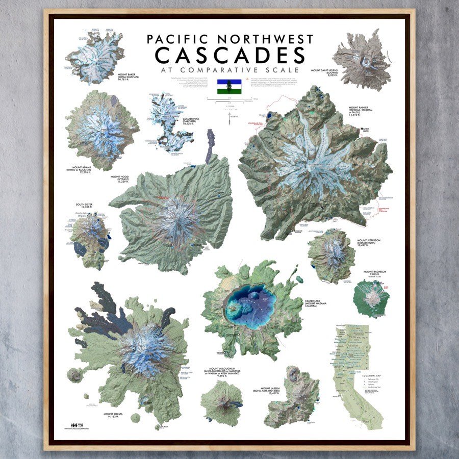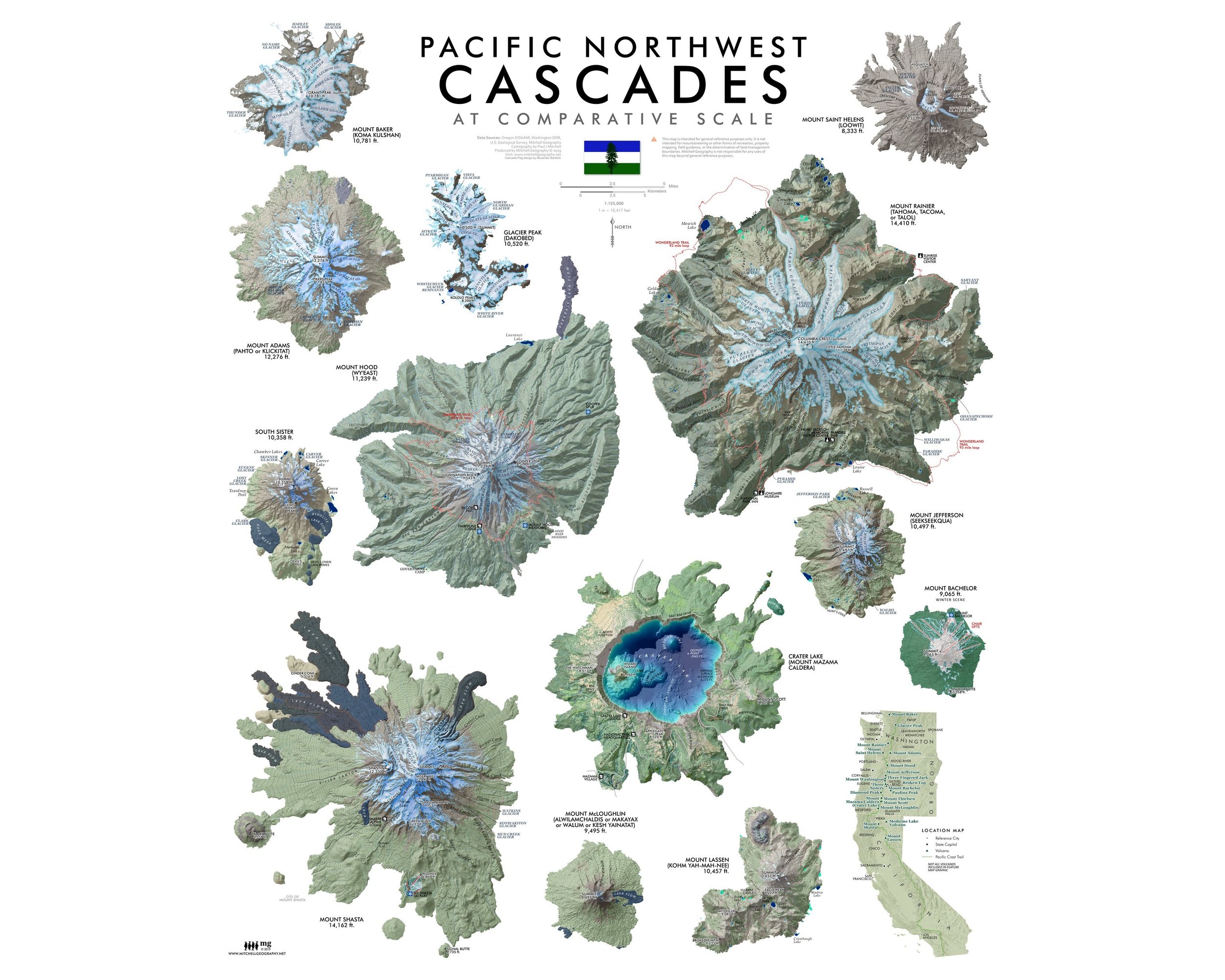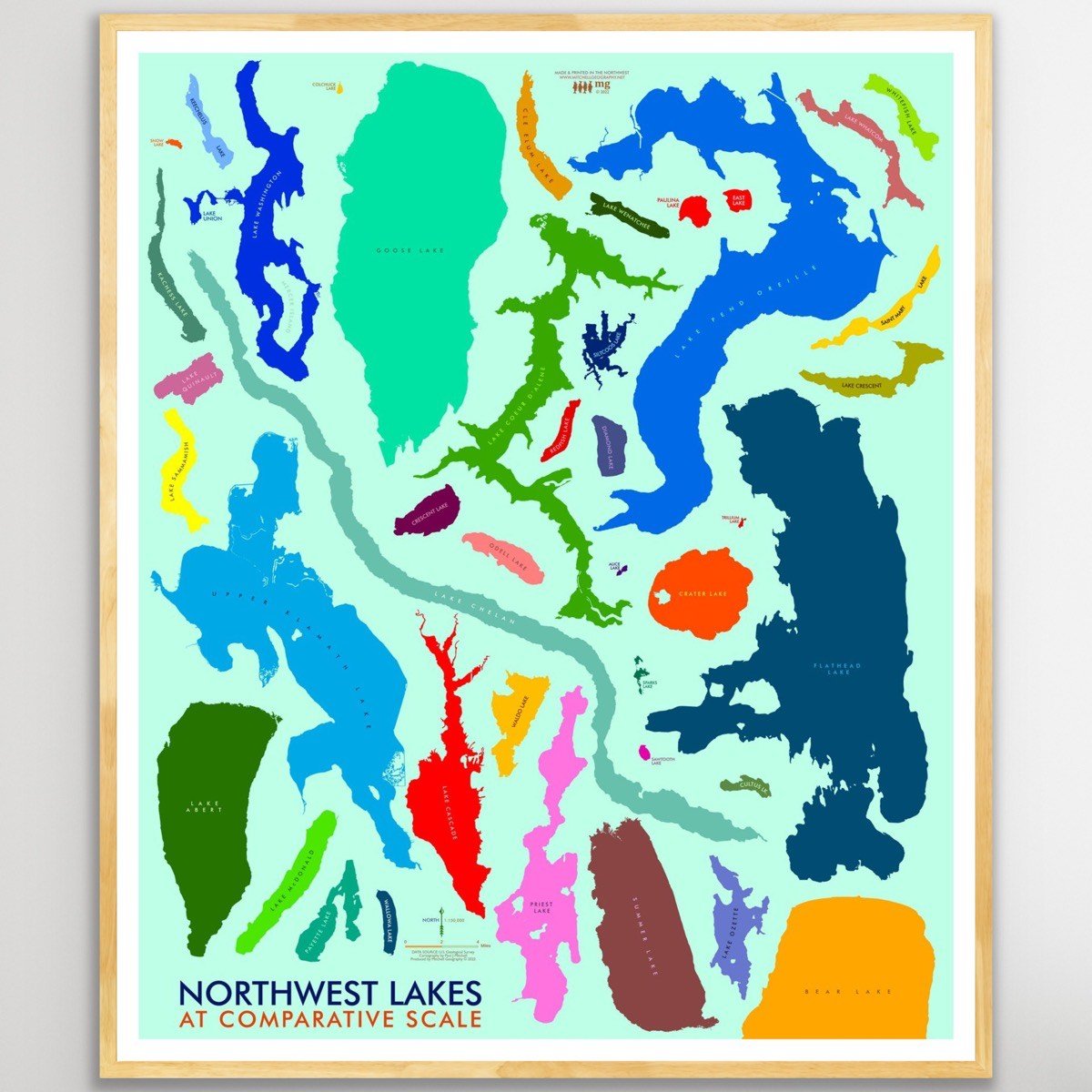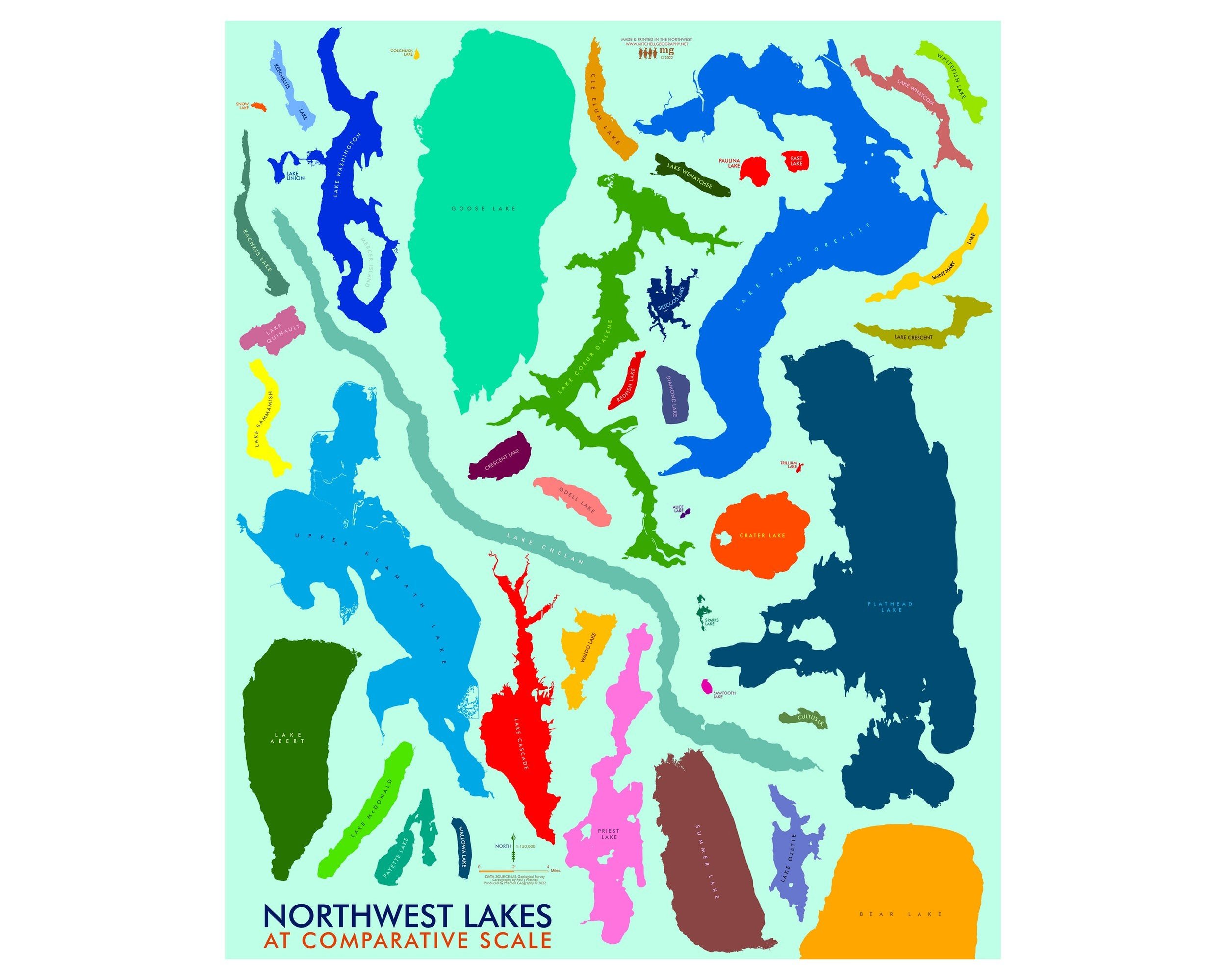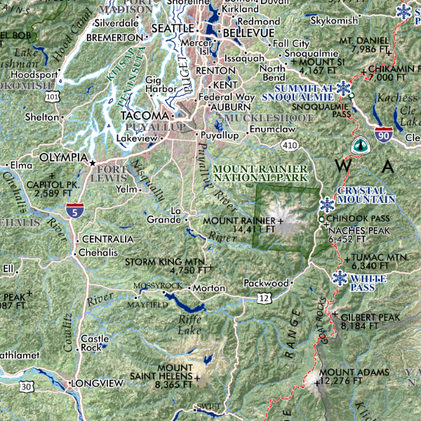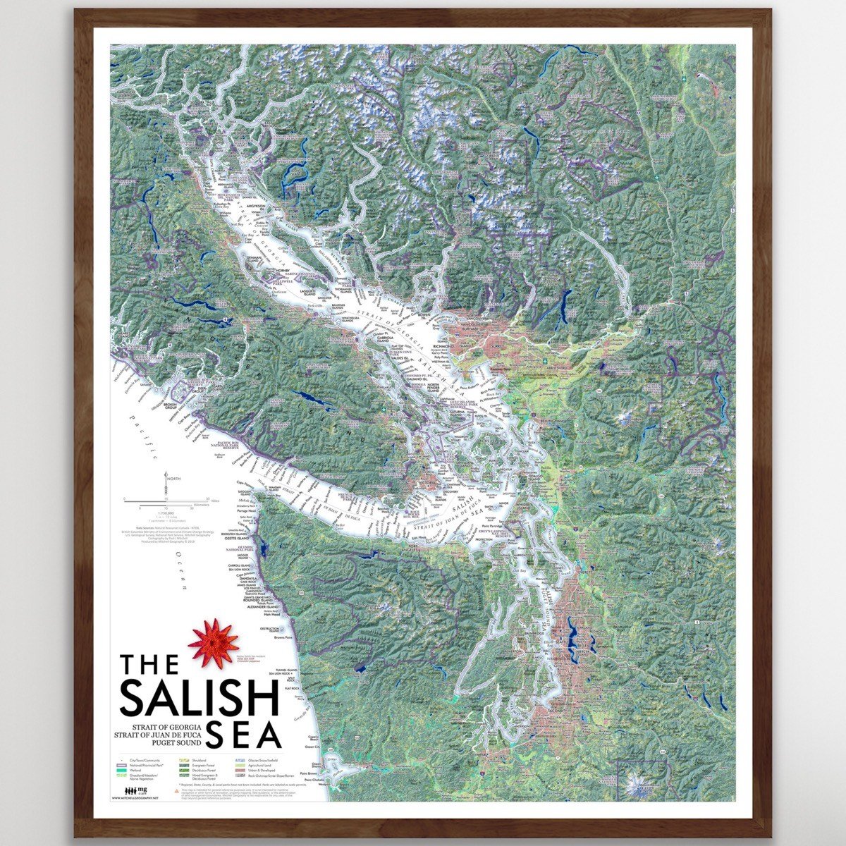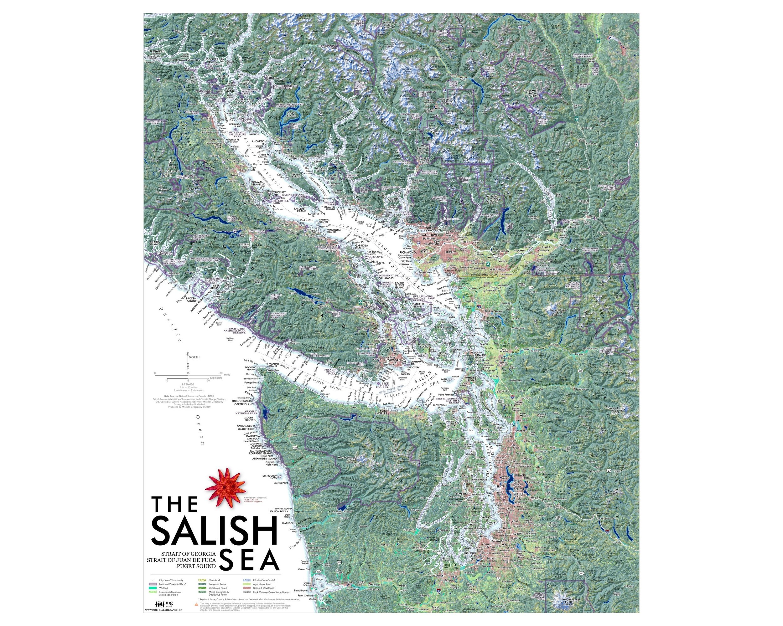

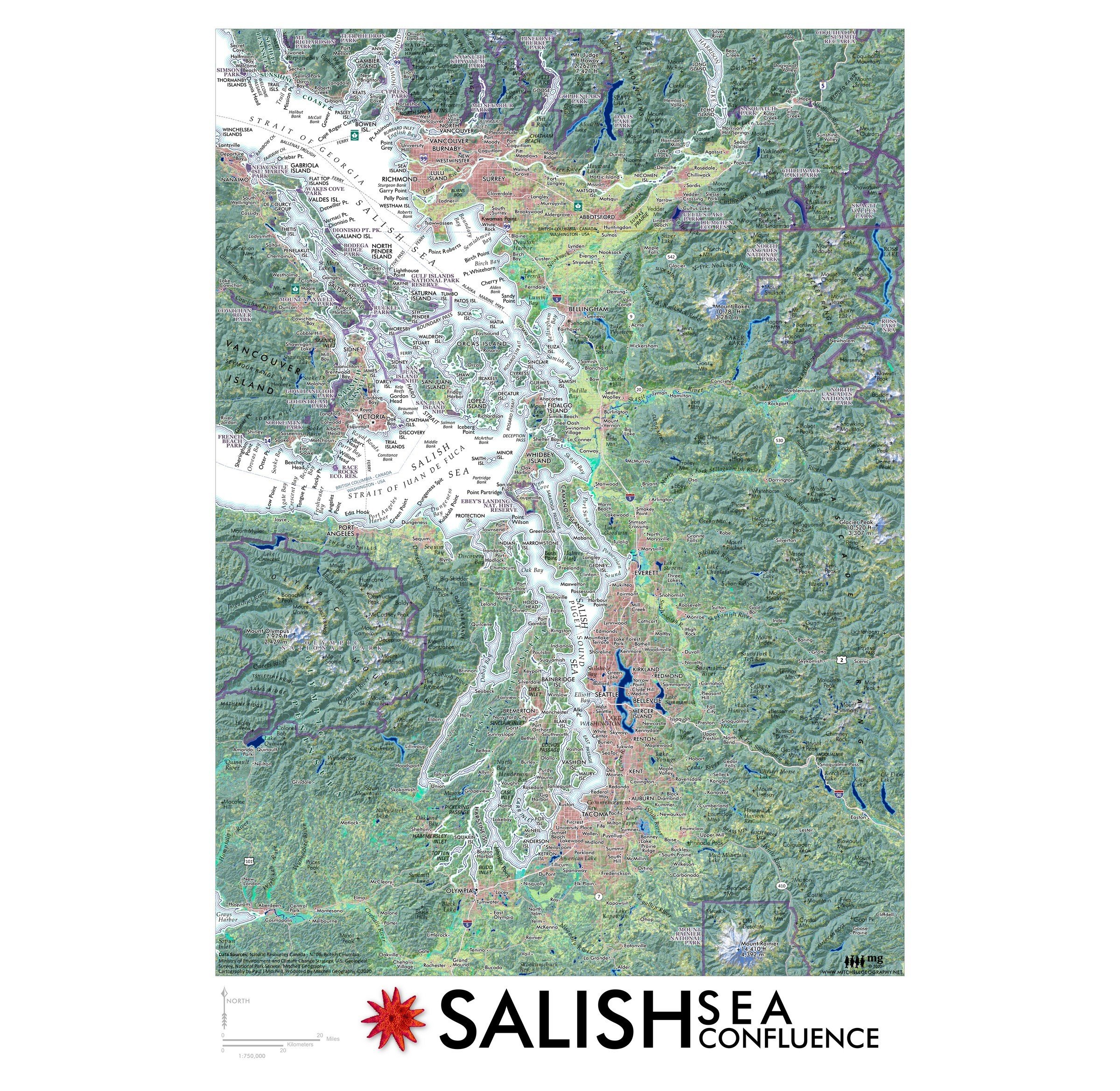

Salish Sea Confluence
1:750,000
13 inch by 19 inch flat wall map, printed on heavy fine paper. Shipped rolled or flat, order volume dependent.
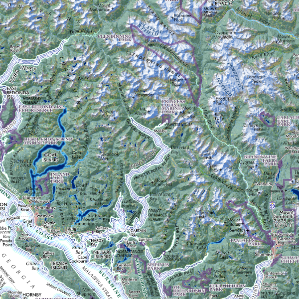
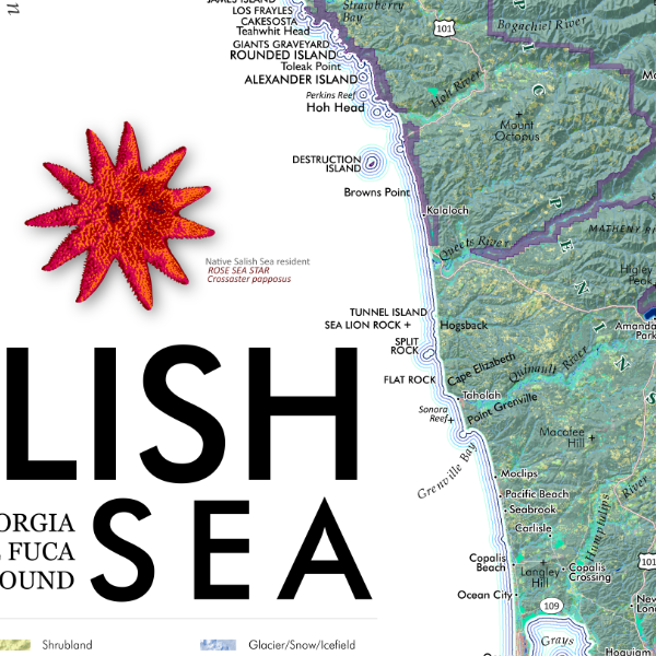
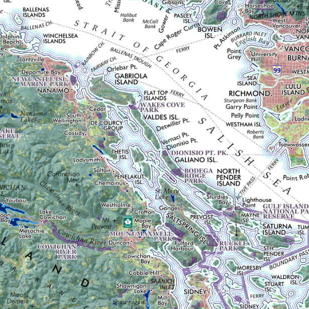
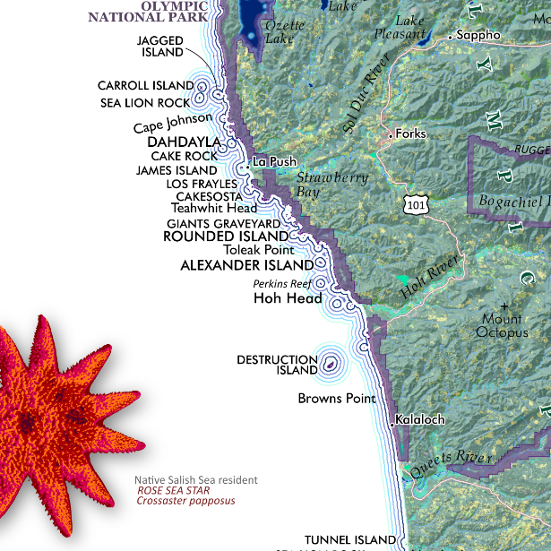
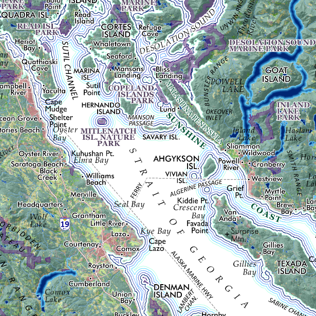
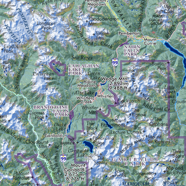
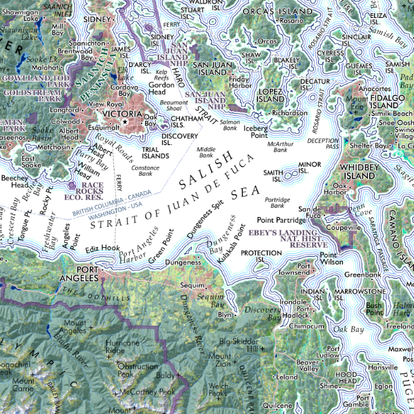
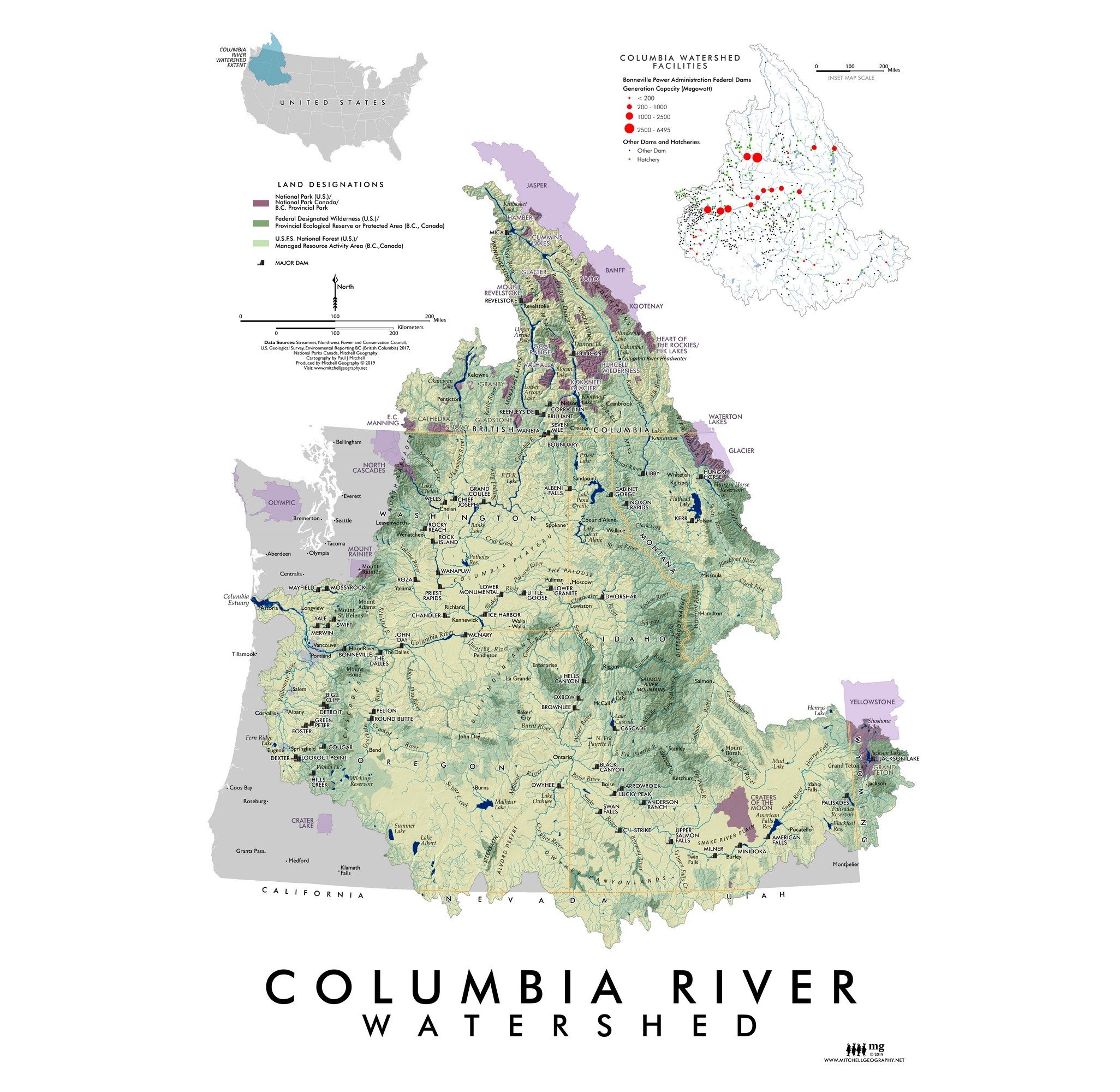
A truly regional perspective — mapped at the same scale as my larger 20 x 24 inch Salish Sea map this 13 inch x 19 inch print focuses upon the confluenc, so to speak of the three water bodies which comprise the Salish Sea: the Strait of Georgia, Strait of Juan de Fuca, and the Puget Sound. Not only the meeting point of these water bodies, this map features the cities and towns which contain the vast majority of the Salish Sea’s contemporary population centers. With Vancouver at the north and Olympia in the southern extent; national/provincial parks, ferry routes, rivers, islands, peninsulas, prominent landforms, cities and small towns are mapped and labeled for reference.