Grenada Caribbean Map stock illustrations
Browse 970+ grenada caribbean map stock illustrations and vector graphics available royalty-free, or start a new search to explore more great stock images and vector art.
Most popular
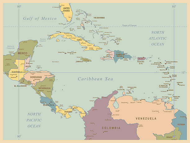
Lesser Antilles political map. The Caribbees with Haiti, the Dominican Republic and Puerto Rico in the Caribbean Sea. With capitals and national borders. English labeling. Illustration. Vector.
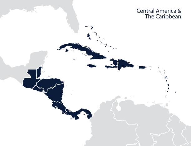
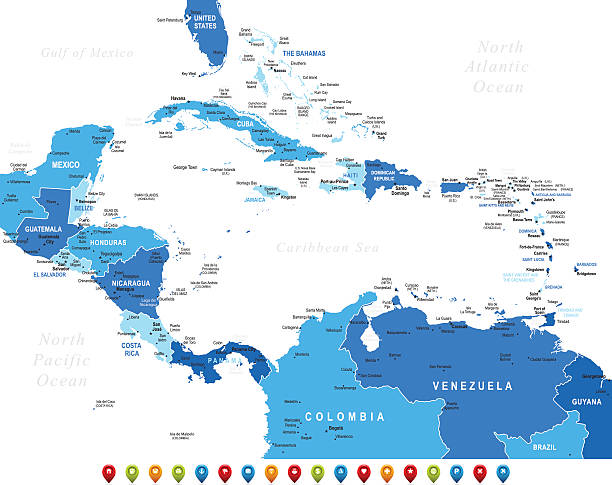
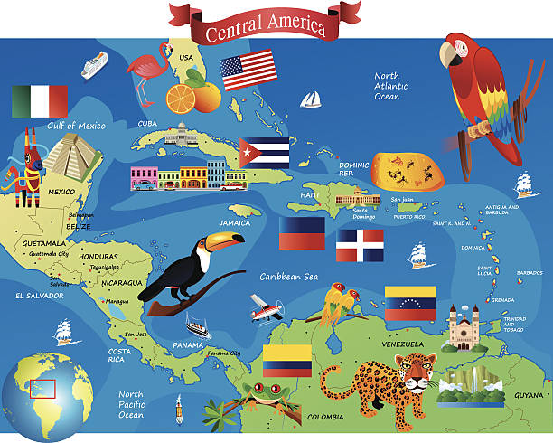
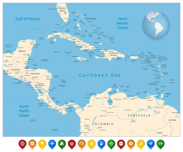
Central America and the Caribbean map. Vector
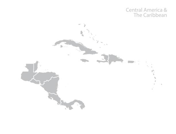
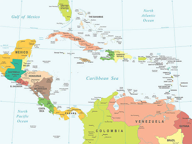
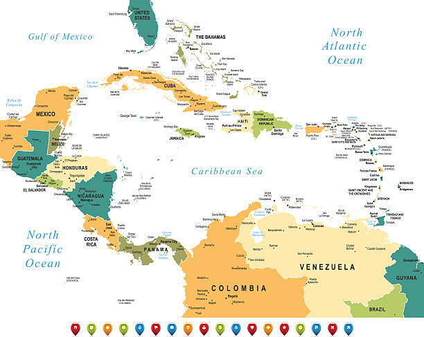
Central America and The Caribbean Map with Geographical Borders
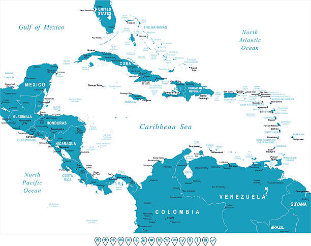
High detailed Map of Central America with national borders, countries and navigational icons
Central America and the Caribbean map. Vector
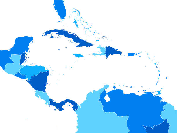
Empty Blue Map of Central America
Lesser Antilles political map. Caribbees with Haiti, Dominican Republic and Puerto Rico in the Caribbean Sea. Gray illustration with English labeling on white background. Vector.Illustration. Vector.
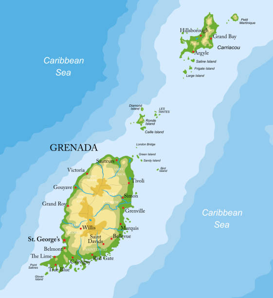
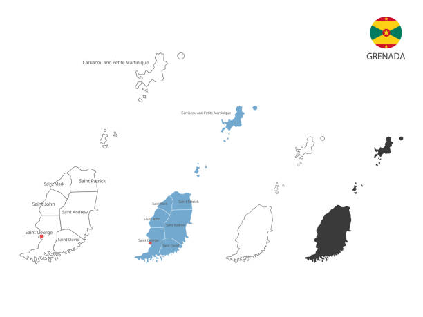
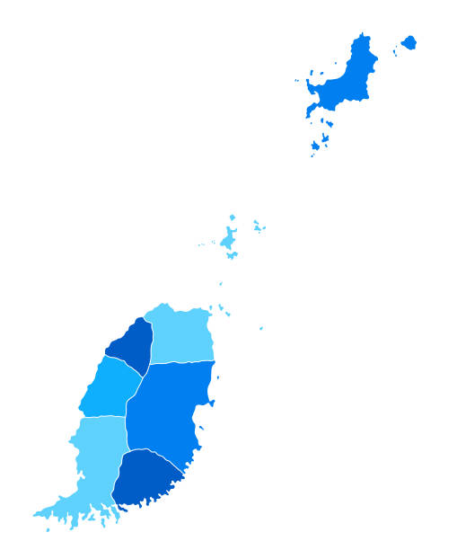
Highly detailed physical map of Grenada islands ,in vector format,with all the relief forms,regions and big cities.
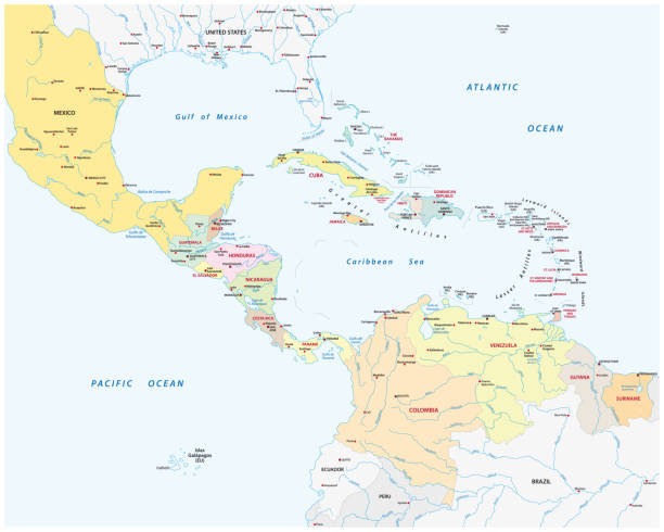
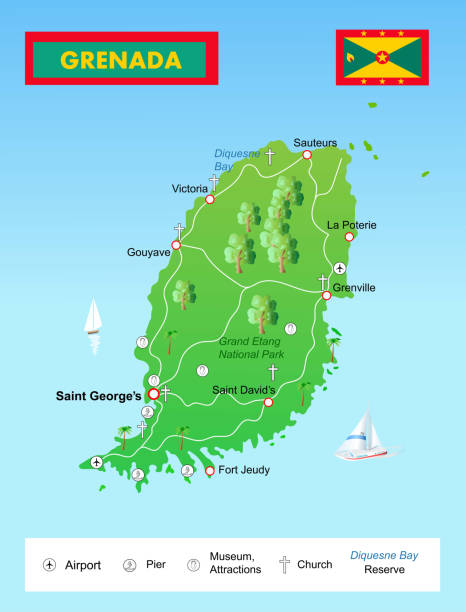
Illustration Grenada Island map
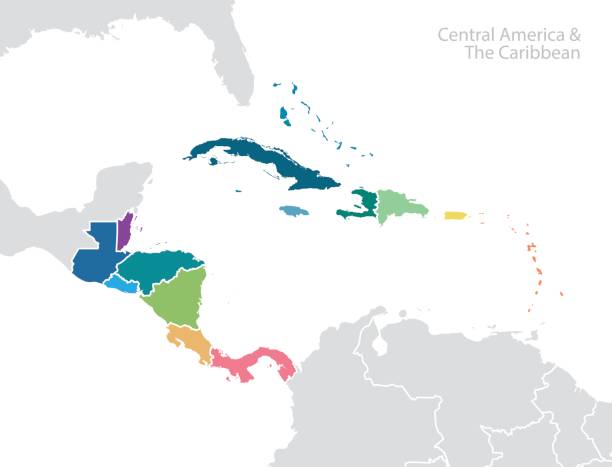
Central America and the Caribbean map. Vector
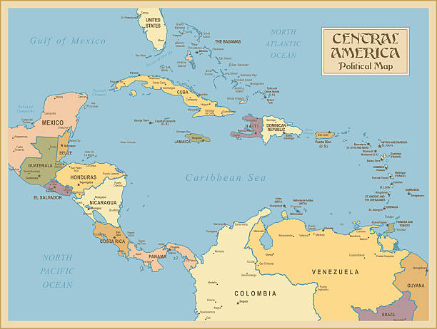
Colored Empty Map of Central America with Country Names and Capital Cities
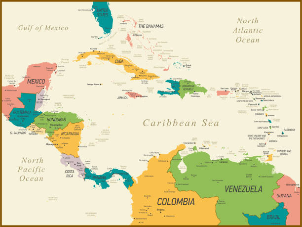
Central America and The Caribbean Map with Geographical Borders
Vector Map http://legacy.lib.utexas.edu/maps/world_maps/world_physical_2015.pdf http://legacy.lib.utexas.edu/maps/europe/poland_physio-2000.jpg
Central America map - highly detailed vector illustration
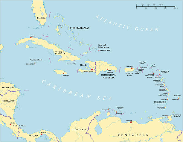
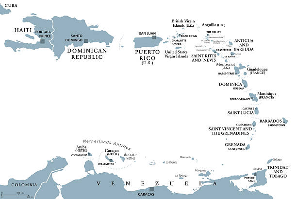
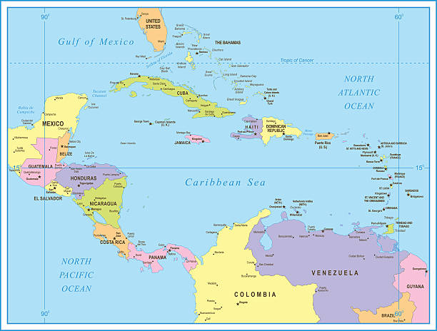
Political map of Caribbean - Large And Lesser Antilles - with capitals, national borders, most important cities, rivers and lakes. Vector illustration with English labeling and scaling.
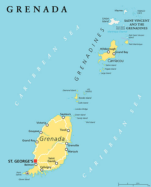
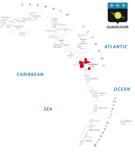
Grenada political map with capital St. Georges. Island Country and part of the Windward Islands and Lesser Antilles in the Caribbean Sea. English labeling and scaling. Illustration.
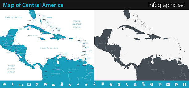
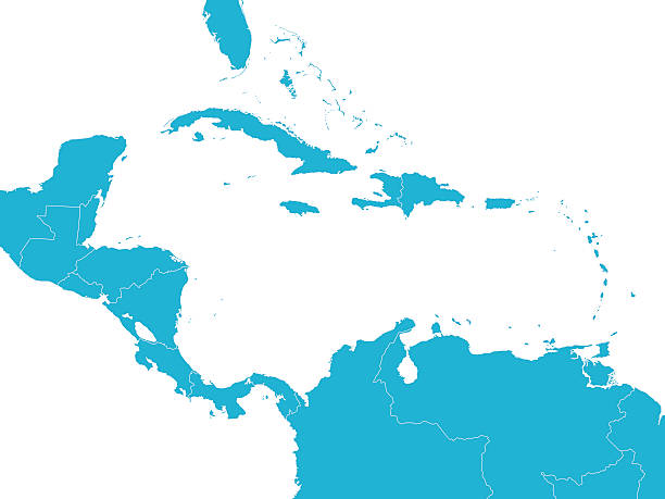
Vector maps of Central America with variable specification and icons
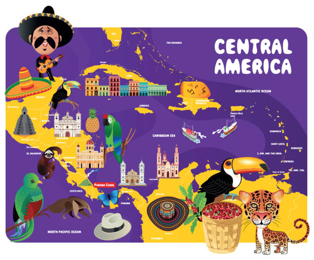
Central America - Retro Map
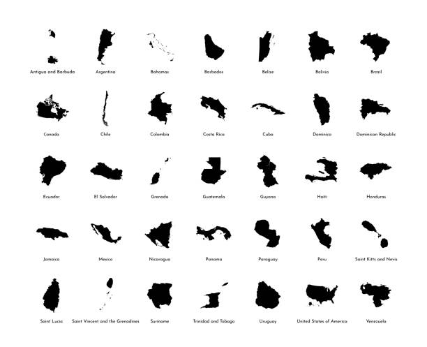
Vector illustration set with simplified maps of all South, North and American states (countries). Black silhouettes, white background
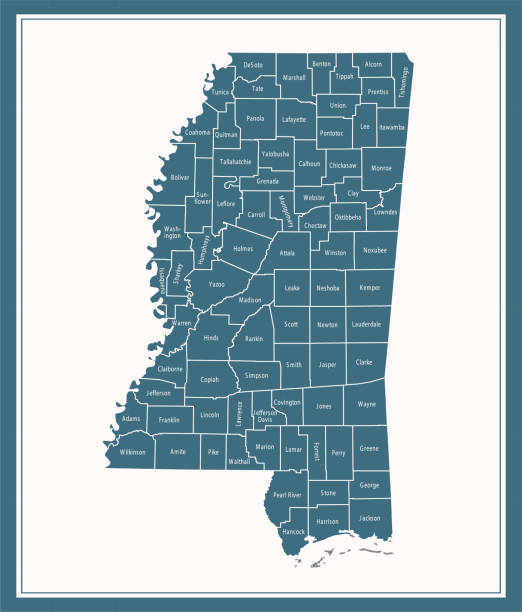
Downloadable county map of Mississippi state of United States of America. The map is accurately prepared by a map expert.

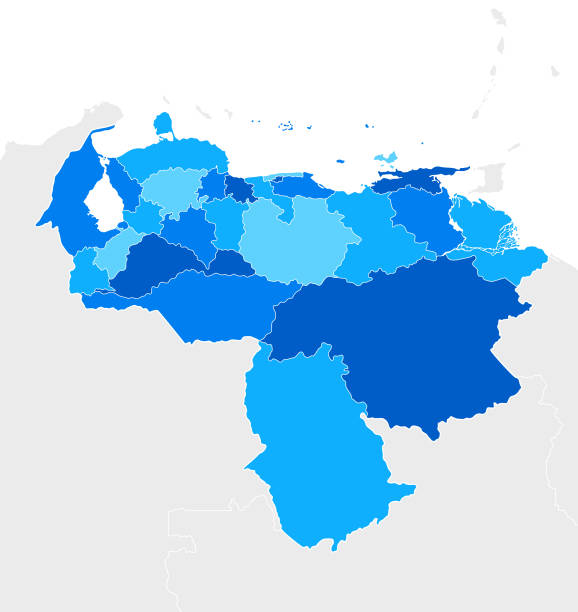
Political map of Venezuela with capital Caracas, with national borders, most important cities, rivers and lakes. Illustration with English labeling and scaling.

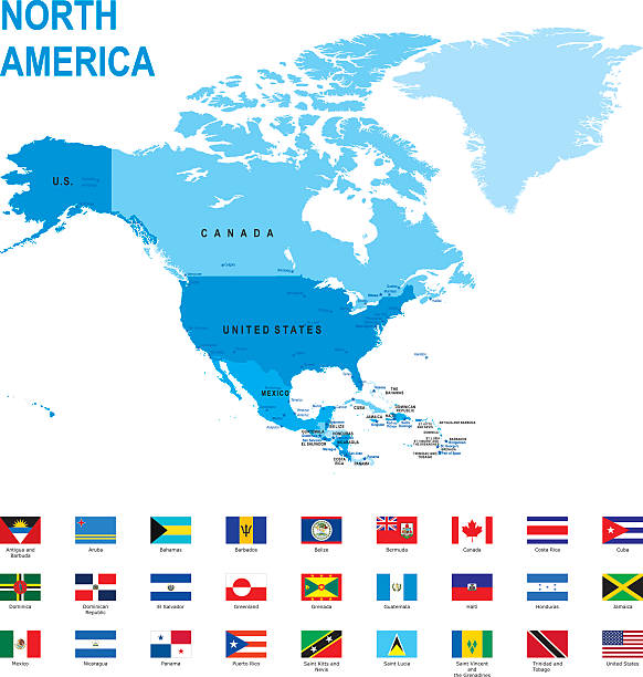
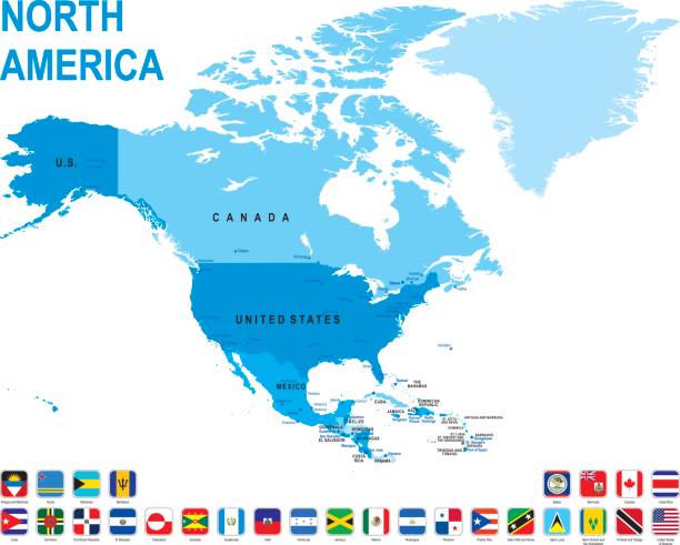
Map of North America.
Vector isolated illustration icon with black silhouette of simplified map of Grenada. White background
A set of pixel perfect vector icons for country maps from A to Z (Part 2).
Central America map - highly detailed vector illustration
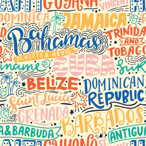
Around the World. CARIBBEAN vector lettering seamless pattern. Country and major cities. Vector illustration
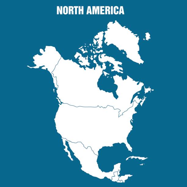
Vector Illustration of North American Continent
High detailed Map of Central America with national borders, countries and navigational icons
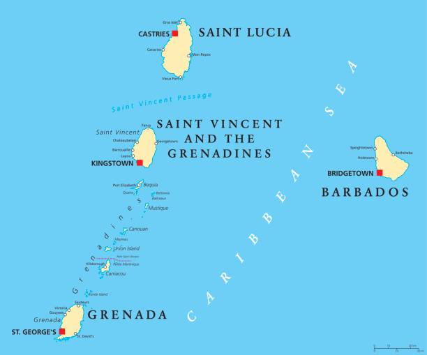
Barbados, Grenada, Saint Lucia, Saint Vincent and the Grenadines political map. Island countries in the Caribbean, part of Lesser Antilles and Windward Islands. Illustration. English labeling. Vector.
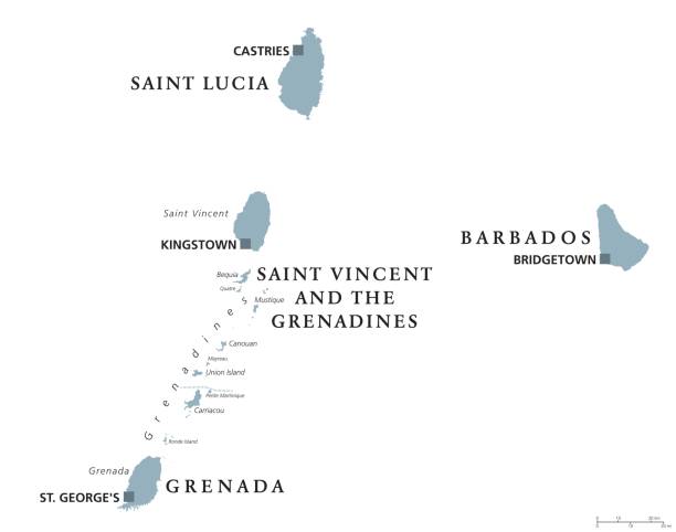
Barbados, Grenada, Saint Lucia, Saint Vincent and the Grenadines political map. Caribbean islands, part of Lesser Antilles and Windward Islands. Gray illustration over white. English labeling. Vector.
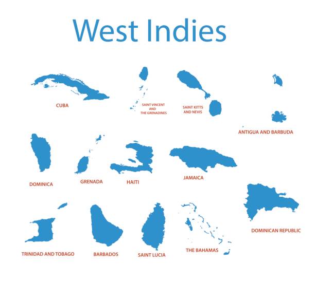
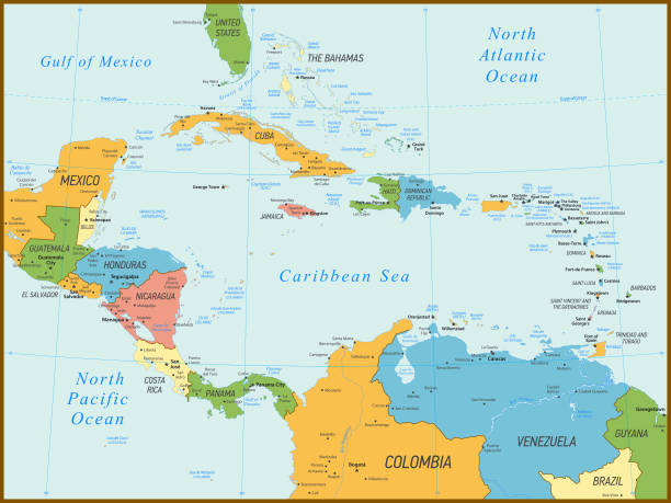
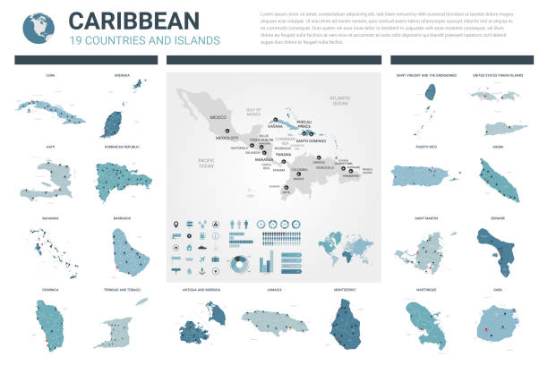
Political Map of the Caribbean and colorful map markers. Highly detailed vector illustration.
Bahamas Map with National Bahamian Flag and geographical borders
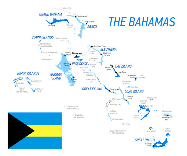
Bahamas Map with National Bahamian Flag and geographical borders
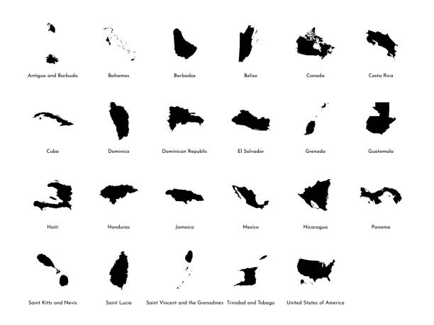
Vector illustration set with simplified maps of all North America states (countries: USA, Mexico, Bahamas, Canada, Costa Rica, Cuba and others). Black silhouettes, white background. Alphabet order
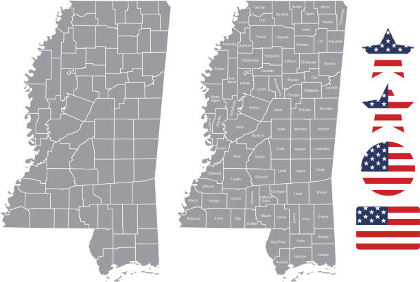
The maps are accurately prepared by a GIS and remote sensing expert.
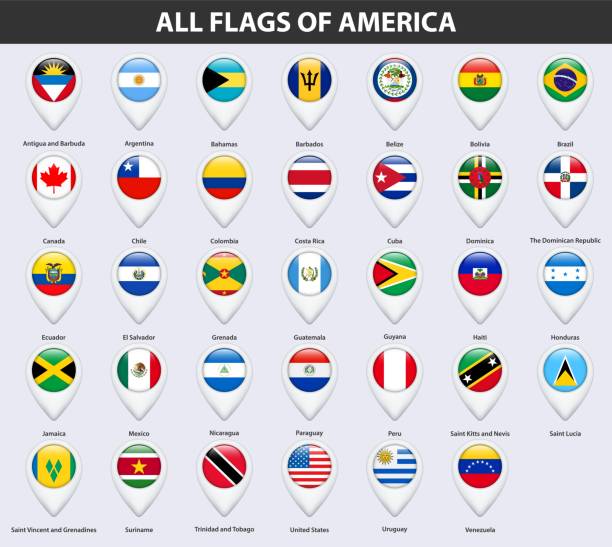
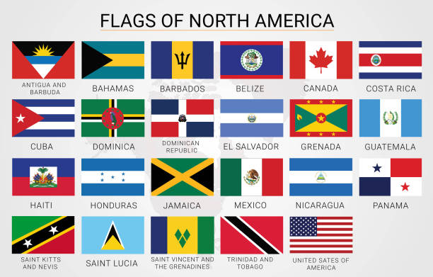
American Flags Collection (part 2nd of 3)
http://dikobraz.org/map_2.jpg
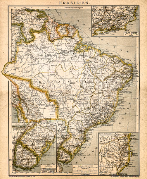
Antique illustration of a South America map
lesser antilles outline vector map with Gudeloupe
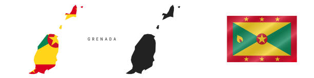
Grenada. Map with masked flag. Detailed silhouette. Waving flag. Vector illustration isolated on white.
Detailed Bahamas map with navigation icons
Central America - Retro Map
Blue map of North America with flag against white background. The url of the reference to political map is: http://www.lib.utexas.edu/maps/world_maps/united_states_foreign_service_posts-september_2011.pdf
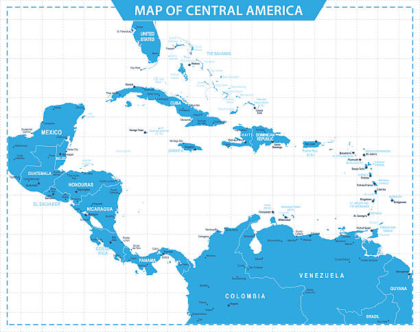
Vector map of Central America with infographic elements
Panama detailed map with navigation icons
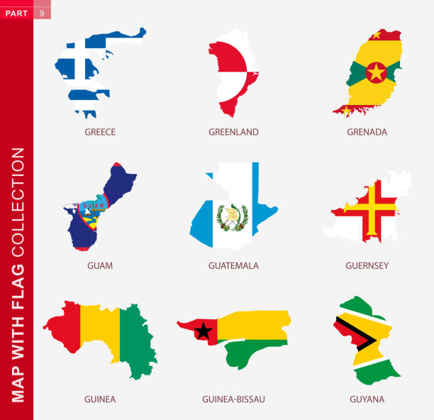
Map with flag collection, nine map contour with flag of Greece, Greenland, Grenada, Guam, Guatemala, Guernsey, Guinea, Guinea-Bissau, Guyana
Grenada flag - flat collection. Flags of different shaped twelve flat icons. Vector illustration set
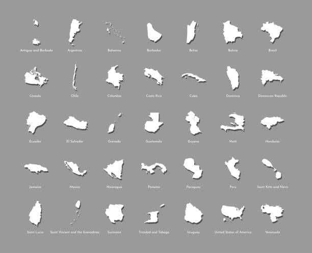
Vector illustration set with simplified maps of all South, North and Cental American states (countries). White silhouettes, grey background. Alphabet order