This copy is copyright protected.
Copyright © 2024 Geographicus Rare Antique Maps
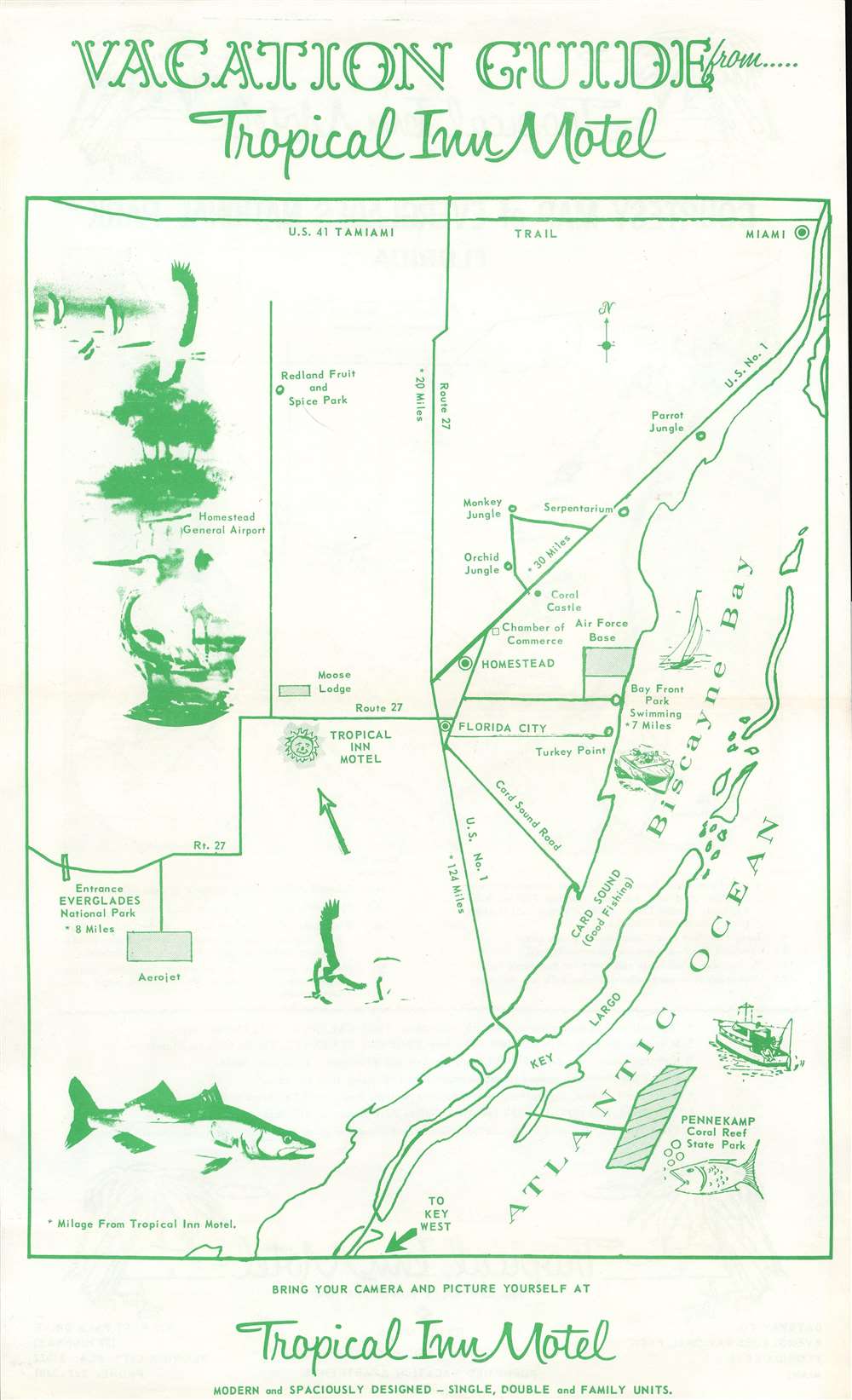
1965 Tropical Inn Motel Map of Everglades National Park, Florida
EvergladesNP-tropicalinn-1965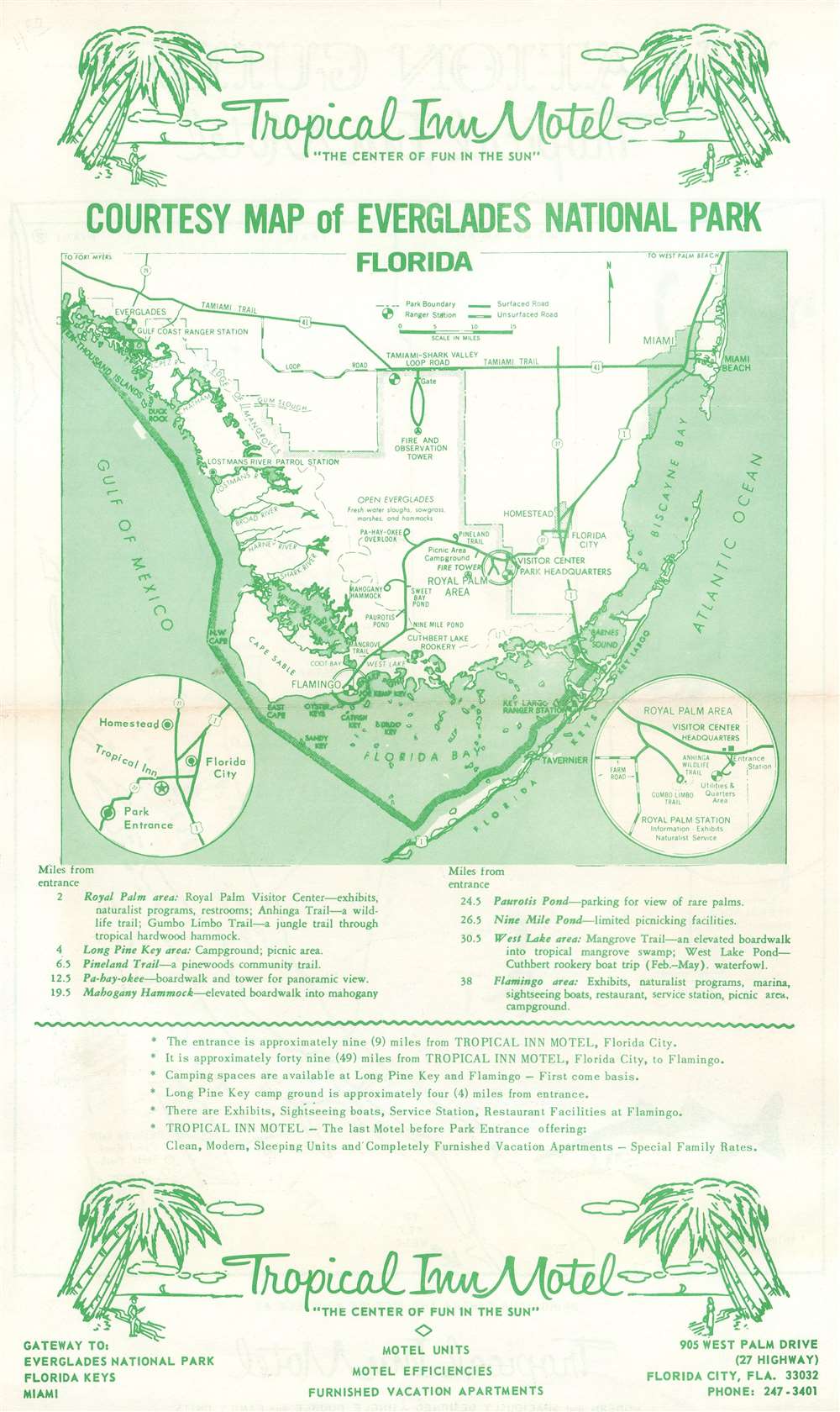

Copyright © 2024 Geographicus Rare Antique Maps | Geographicus Rare Antique Maps
This copy is copyright protected.
Copyright © 2024 Geographicus Rare Antique Maps