
US weather forecast: Furious deep low-pressure system swirls in from Pacific to dump a FOOT of snow as 'Pineapple Express' strikes
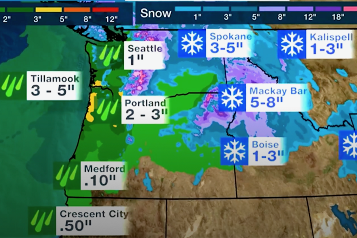
Snow and rain predictions for Western states of the US
THE WEATHER CHANNEL

A furious Pacific winter storm threatens a torrent of rain and more than a foot of snow as the United States braces for the ‘Pineapple Express’.
A deep low-pressure system trailing a swirling band of downpours will continue to sweep the west coast through the start of the week.
The so-called ‘Pineapple Express’ storm, or ‘atmospheric river’, will pull a wintry deluge across Washington, California, Nevada and Idaho before moving further inland ahead of midweek.
Up to a foot and a half of snow could blanket the worst hit regions with depths of between one and eight inches expected more widely, experts warn.
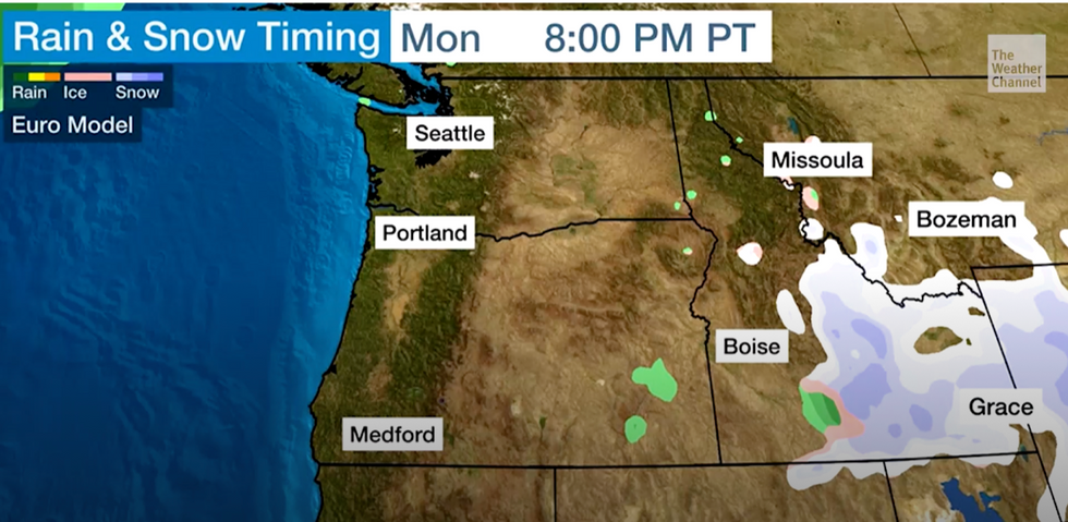
Snow moves across the US through the week
THE WEATHER CHANNEL
Orelon Sidney, meteorologist for The Weather Channel, said: “The Pacific Northwest continues to get a soaking and we have a bone fide Pineapple Express.
“Moisture is coming out of the Pacific near Hawaii and slamming into the northwest coast.
“As we get into Monday, we will see more of the precipitation inland, especially across parts of Idaho and Montana, and we are going to see a lot of snow there.
“In terms of snow amounts, you are going to see five to eight inches in places like Mackay Bar and some locations could see over a foot and a half.”
The storm deluge was due to set in over the weekend, although warnings for severe weather continue through the start of the week.
Mountainous and hilly regions will be in the firing line for snow while floods are likely lower down.
Seattle and Portland may bear the brunt of the rain sparking warnings for those in the region to prepare for floods.
Sidney said: “High elevations means snow, low elevations means more rain and, in fact, we have the possibility of some excessive rainfall along the Oregon and Washington coasts as well as inland places like Seattle, Portland, and you want to watch out if you are in a flood-prone area.
Meanwhile, eastern coasts are braced for heavy rain and thunder driven by a separate cyclonic system.
The storm will be powered by an ‘amplified upper-level trough’–a pattern of pressure high in the atmosphere which helps to deepen surface-level storms.
Falling temperatures could trigger snow in the region with ‘excessive rainfall’ sparking flood concerns.
A spokesman for the National Weather Service (NOAA) said: “An amplified upper-level trough will support a deep mid-latitude cyclone as it moves through the Midwest and East Coast over the next couple of days.
“There's a slight risk of excessive rainfall leading to flash flooding for parts of the Northeast Coast and southern New England.
“Moderate to heavy snow will develop on the backside of this system as cold air flows into the interior Northeast and down the spine of the Northern and central Appalachians.”


