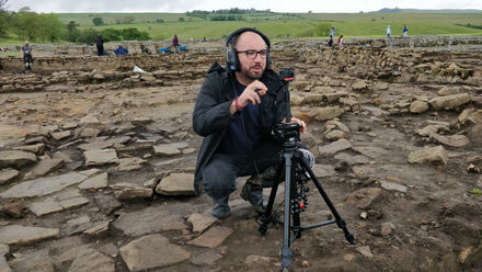
I am the Aerial Investigation and Mapping Manager, North part of Historic England’s Archaeological Investigation Team which covers the whole of England. I have mostly been working from home since COVID struck but today I am in a noticeably quiet York office as I need access to historic aerial photographs. These images are vertical photographs from the 1940s taken by the RAF, Ordnance Survey and others, as well as oblique aerial photographs typically taken by archaeologists for the discovery and monitoring of archaeological sites.
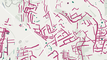
I am currently working on the Verlucio Environs project, mapping 39sq km of the West Wiltshire landscape using aerial photographs and lidar. Verlucio is a fortified Roman town and was originally mapped from aerial photographs and lidar as part of a multi-disciplinary archaeological project the ‘National Archaeological Identification Survey Lowland Pilot: West Wiltshire’ Combined Aerial and Ground-based Research to Understand the Archaeology of the Avon Vale, West Wiltshire | Historic England. The results of the aerial mapping stage of the initial project revealed archaeological features dating from the Neolithic to the twentieth century. The free-draining green sand geology around Sandy Lane revealed numerous Roman and pre-Roman archaeological sites as cropmarks.
The environs project aims to build on these amazing results and increase the aerial survey coverage around Verlucio; with follow-up ground based archaeological investigations planned. The environs project is in its initial stages and the results of the mapping so far suggest that the archaeological remains in this area survive mainly as earthworks and are medieval or post medieval in date. There seems to be fewer signs of the Roman and pre-Roman landscape in this area, though this picture may change as the project develops.
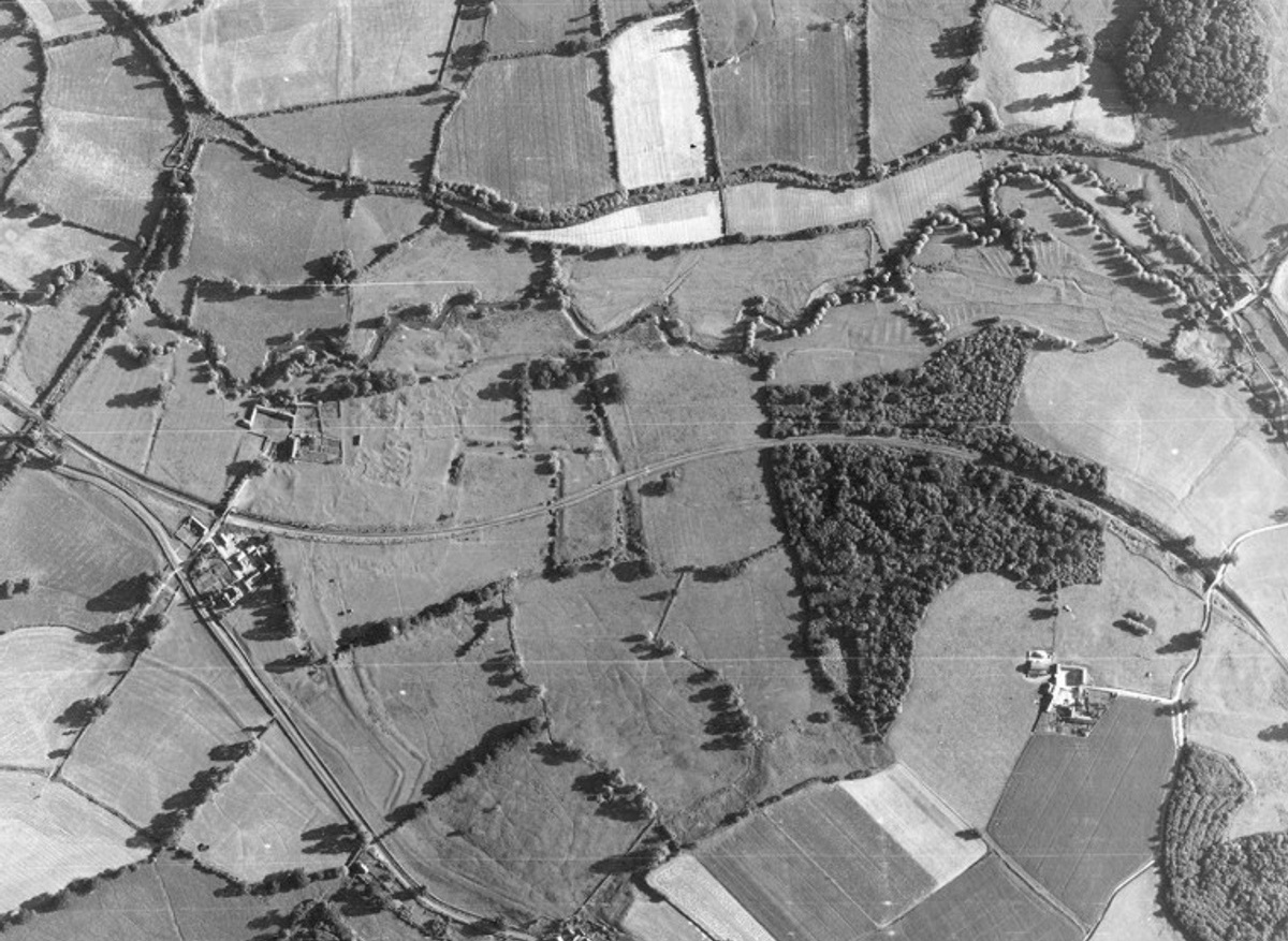
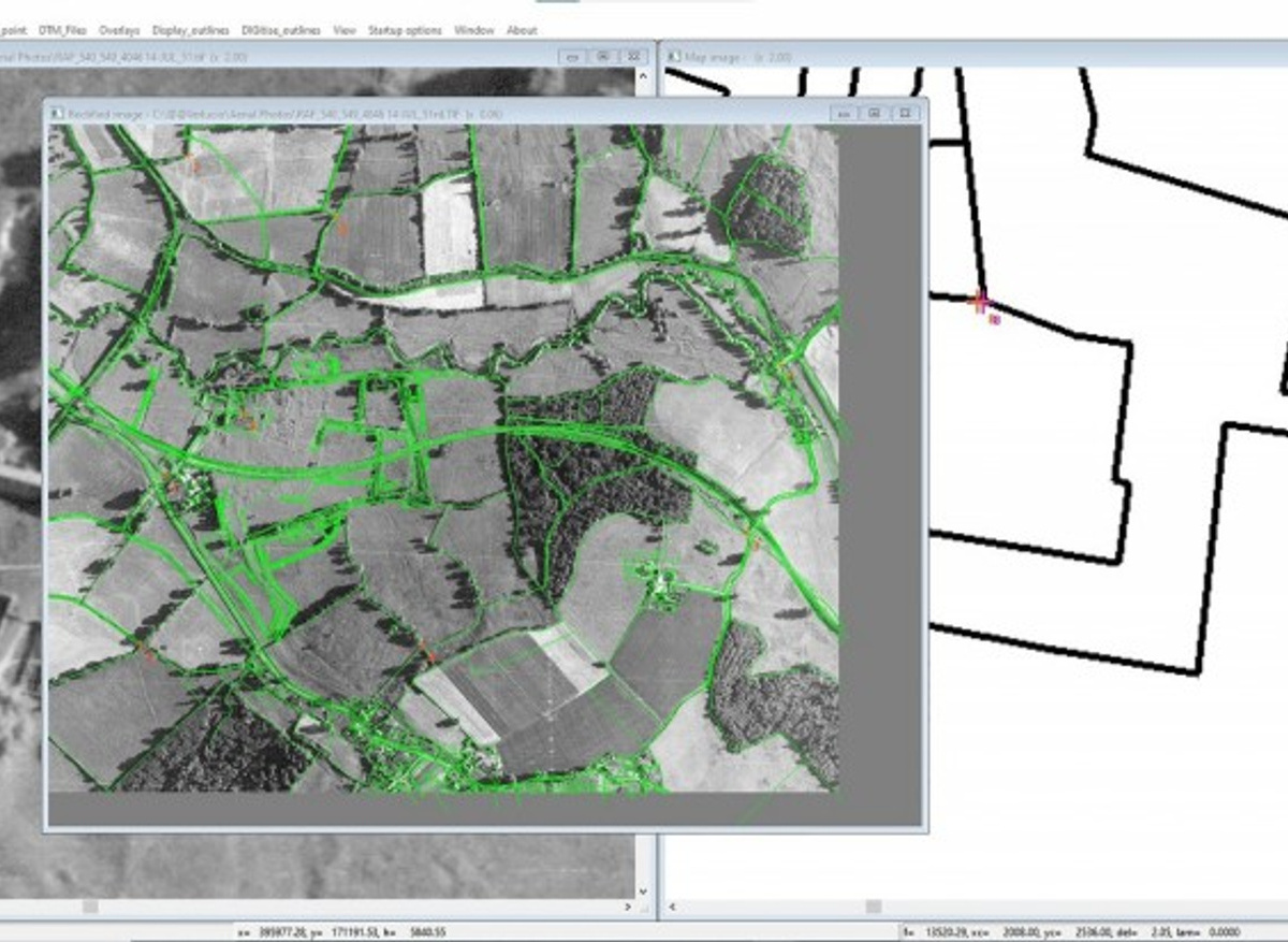
I am currently focussed on mapping the archaeological earthworks which represent the remains of Stanley Abbey. I view every available aerial photograph of the site and pick the best images to work with; in this case an RAF vertical photograph dating to July 1951 is showing the remains particularly well. Although the summer months are not typically ideal for photographing archaeological earthworks, the long shadow on this image suggest the sun was low in the sky when the photograph was taken and the shadows and highlights help pick out the surviving details of the site.
Another advantage of the vertical coverage is that the sorties are flown in such a way that the earthworks can be viewed in 3D using a stereoscope. The view provided through the stereoscope both magnifies the image and exaggerates the height so identification of archaeological earthworks is easier.
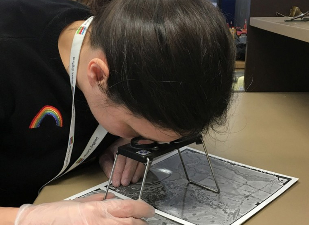
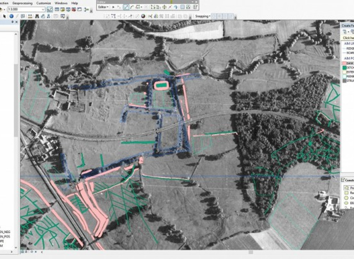
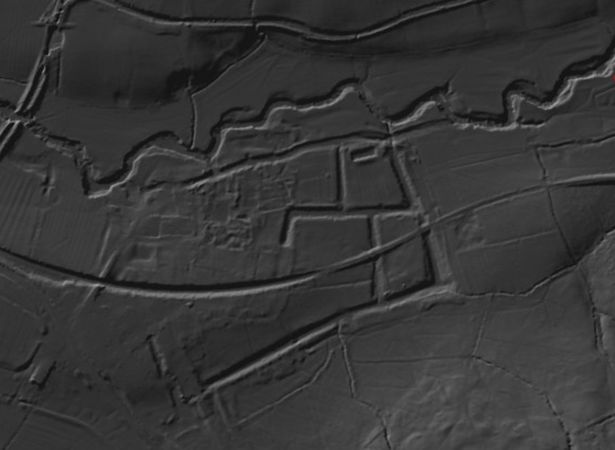
I scan and rectify the best photograph using specialist software (Aerial). This ensures that the photograph is accurately geo-located. The next step is to add the rectified image into a GIS (Geographic Information Systems) package, in this case Esri ArcMap. Here, I can begin to trace the archaeological remains and add interpretations. I can also compare the 1951 image against a visualisation of lidar flown in 2019, this allows me to ensure I am picking out as much detail as possible for the final mapping product.
You will be able to read a summary of our project results in the Historic England Research Report Series Research Reports | Historic England once the mapping and recording is complete. This project forms one of many similar aerial investigation and mapping projects that have been undertaken over the last 30 years, covering much of England. We are aiming to launch an aerial archaeology mapping explorer in the Autumn, it will be a fantastic resource for anyone with an interest in the archaeology of their place.
Contact details
Sally Evans
Historic England