Picture Alaska: Nature’s UFOs and how they form
Lenticular clouds are a spectacular sight to see among the Alaskan scenery
ANCHORAGE, Alaska (KTUU) - The wonders of the Last Frontier; it’s what brings many to see the beauty of our state. From the Arctic Coastline to the Southeast Panhandle, Alaska has a lot to offer in sights and scenery.
Even our skies hold wonders — from the mesmerizing aurora borealis as it dances across the night sky, to clouds that come in all shapes and sizes.
Rarer clouds are often seen here in the Last Frontier, more so than in much of the Lower 48. A lot of the reason has to do with our topography and just how far north we lie in the northern hemisphere. One could look to the sky and see Kelvin-Helmholtz clouds, noctilucent clouds or a UFO. Lenticular clouds, as they are more commonly known as, have sparked several reports through the years of UFOs due in large part to their unique shape.
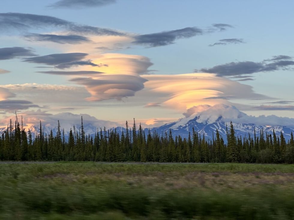
The clouds, which often form near mountains, provide a visual representation of just how fluid our atmosphere is and a great lesson in the science behind certain cloud formations.
The scientific name of these “flying saucer” clouds are known as altocumulus lenticularis (meaning shaped like a lentil). These clouds have come to be known as clouds that resemble stacked pancakes. But how do they form?
The key ingredient is moisture-rich air and an object directly in the path of the wind. Because lenticular clouds can reach altitudes of up to 40,000 feet, the majority of these strange-looking clouds form near mountains. As the moist air slams into the mountain, it is forced upwards, where science comes into play. The moisture within that air condenses to form a cloud, this altitude is known as the lifted condensation level and can be used as a general estimate of the height of a cloud base. This rising air continues to form clouds until it reaches a stable layer or faster winds aloft cut off the top of the cloud, also known as wind shear.
As the air continues to move over the crest of the mountain it begins sinking. As the air sinks, it warms, which evaporates the cloud droplets giving the cloud its unique and saucer-like appearance. While giving the appearance of remaining stationary, they are a very good indicator of strong winds aloft.
Pilots are known for avoiding areas with lenticular clouds, as their presence means that severe turbulence is very possible. However, glider pilots do enjoy their presence as they use the upward movement of the air in order to climb higher.
So the next time you see a lens-shaped cloud in the sky that resembles a UFO, think of just how fluid our atmosphere is and the invisible forces at work that sometimes provide a visual representation.
Copyright 2023 KTUU. All rights reserved.


