We saved Mount Katahdin for our New England 67 finish. It is one of the most iconic mountains in the Northeast and one that we’ve both dreamt of since we began hiking 4,000 footers in New England. With all that anticipation and expectation, hiking Katahdin via Knife Edge Trail exceeded even our wildest dreams. It was truly one of those surreal otherworldly outdoor experiences that leaves a lasting memory and has the potential to change your life. Sounds dramatic, I know, but this place is special.
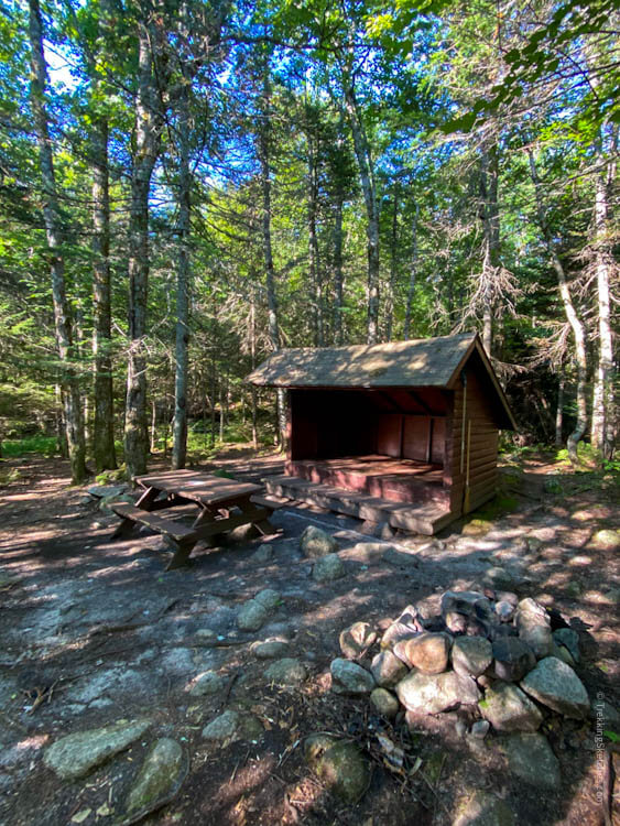
To set ourselves up to hike Knife Edge to Baxter and Hamlin peaks on Mount Katahdin, we made reservations at Roaring Brook Campground in Baxter State Park. Because you can hike Knife Edge right from the campground, it’s by far the most popular in the park. Sites can be reserved up to 4 months ahead of time on this reservation page. There’s a full explanation of How to Make a Summer Reservation here. If you reserve exactly 4 months ahead of time, the online system only lets you reserve your first night – the others are still locked. So I had to make 3 different reservations on 3 consecutive nights to secure our spot. When we arrived, the park ranger let us know that if you call in, they can make a reservation for your whole trip as long as your first night is no more than 4 months away. Sounds pretty antiquated, but there’s the info – calling in just might be the best way.
If you don’t get a campsite there, but are camping elsewhere in the park, you can just drive and park in the day use area to hike from Roaring Brook. If you are staying outside the park, however, you’ll need to get a day use parking reservation to park at the trailhead. As the Friends of Baxter explain here, Maine residents can purchase that starting April 1 while non-residents can purchase them within 2 weeks of the date.
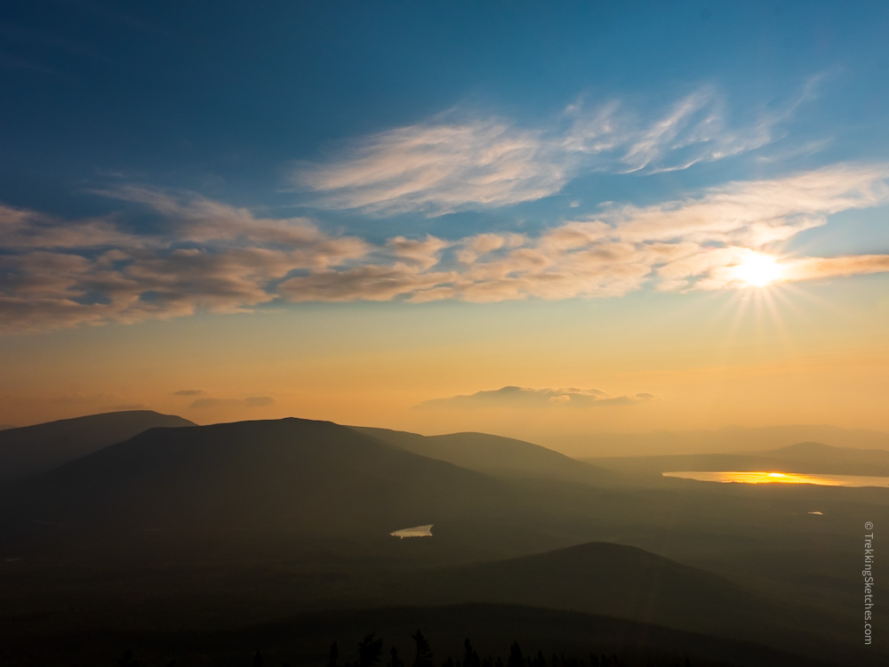
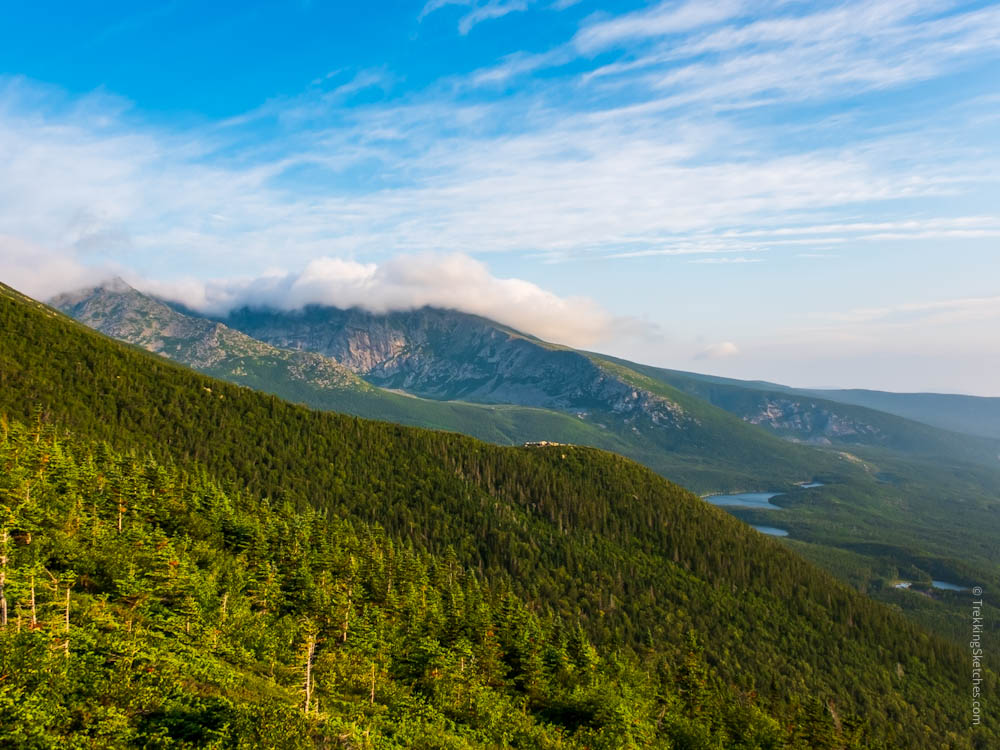
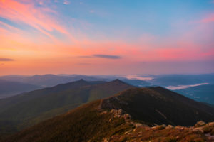
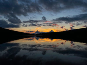
With an early start before 5am, we hoped to get a good sunrise from the trail as we climbed. We jumped on the trail right next to the campground office for a quick 0.1 mile jaunt before turning left and starting up Helon Taylor Trail. As expected when hiking a 4,000 footer in Maine, the trail was rocky with steep ascents. In particular, there were pretty large rock boulders, making us take really big and tiring steps. After about an hour, we started getting peaks through the trees to the rising sun behind us. Once we got a clearer view, we were struck by just how red and hazy the sky was – an impact of the wildfire smoke that drifted all the way across the country from the west.
Trailhead at Roaring Brook Campground
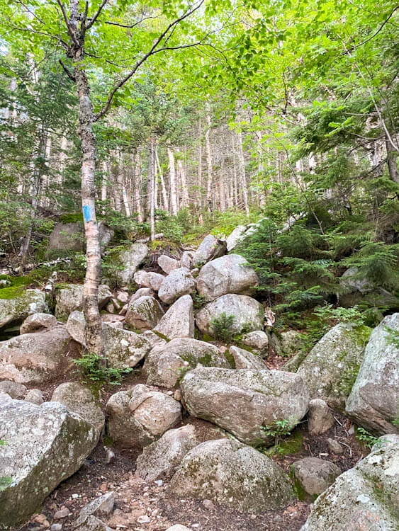
Helon Taylor Trail
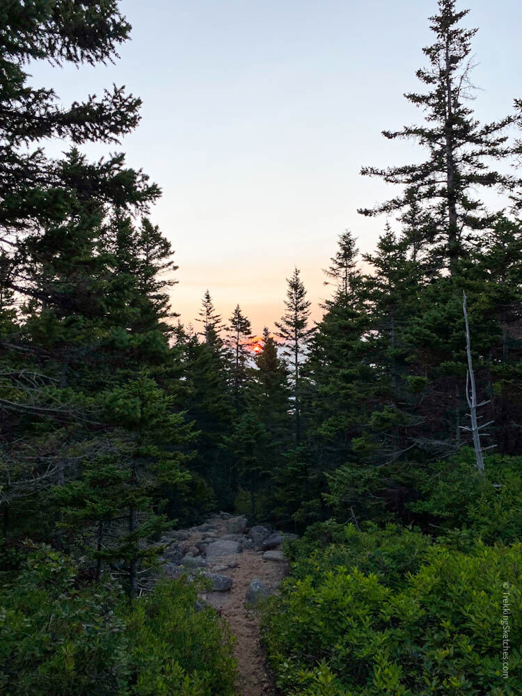
First peek of the rising sun
Sunrise over Baxter State Park
As we climbed higher into scrubby subalpine vegetation, we came to a section of large rocky open trail where we caught our first unobstructed views of mountain slopes and lakes lit up with a golden glow. We entered into another small patch of trees and when we emerged, we spotted Knife Edge. The clouds were rising swiftly from the basin over the sharp ridge giving Knife Edge the appearance of a smoking volcano!
Golden morning views
Morning views of Hamlin Ridge
Above treeline on Helon Taylor Trail
Clouds rising like volcano smoke
At this point, we would remain above treeline for most of the hike and the wind seemed to be strengthening. It was really whipping and hitting us with gusts that made it tough to stand upright. Knowing that we had the notoriously narrow and dangerous Knife Edge Trail ahead of us, we were pretty worried. We agreed to continue on for the moment, but to evaluate the wind speed and potential danger before committing to Knife Edge. So we kept climbing up the highest section of Helon Taylor trail, which was quite rocky and challenging, to get to Pamola Peak.
Into the alpine zone
Climbing above treeline
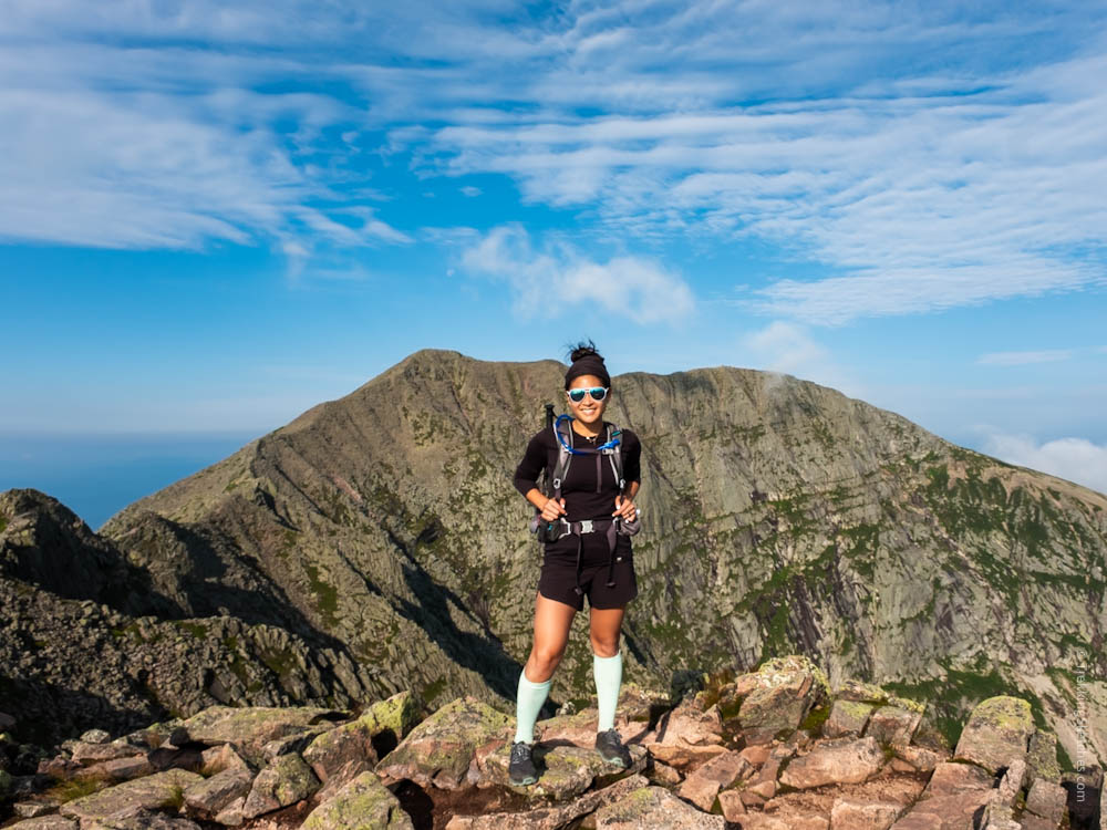
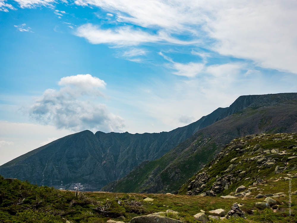
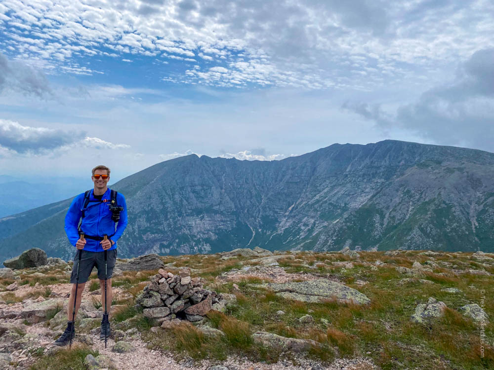
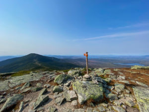
On Pamola Peak, I was struck with awe at the view of Katahdin in front of us with Knife Edge stretching out to our left. We could even see across the basin and trace the ridgeline to Hamlin Peak, where we would finish the New England 67 and then descend. It’s always something special to see the day’s hiking route so clearly. We took our time here and enjoyed taking pictures and soaking in the views on such a beautiful morning.
Admiring the view of Katahdin from Pamola Peak
Just an incredible morning!
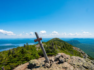
View of Katahdin's Baxter Peak and Knife Edge Trail
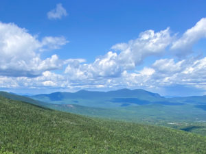
View across the basin to Hamlin Peak
Knife Edge
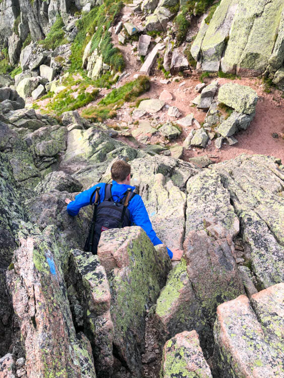
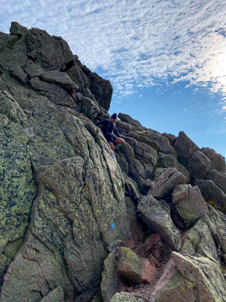
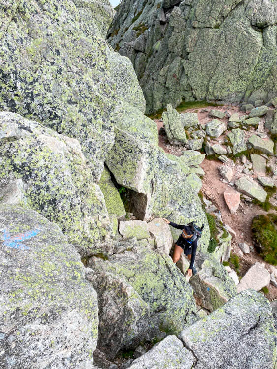
The winds died down a bit and stopped gusting so strongly so we felt comfortable taking on Knife Edge. We got a tip that the first bit of Knife Edge, called The Chimney, would be the toughest climbing of the route. This was absolutely true and we were glad to have that intel. The Chimney drops down a ridiculously steep rock face and then climbs the other side up to Chimney Peak. This didn’t feel like hiking or even rock scrambling—it felt like rock climbing! There’s nothing that would require a rope and harness, but a fall could be catastrophic. We took it slow and were really careful with our foot placement and hand holds for safety. If I thought the whole route would be like this, I wouldn’t really want to hike it. So, know that The Chimney is really difficult, but doable when being careful and thoughtful about where to place your hands and feet.
Climbing down into The Chimney
The toughest descent of Knife Edge Trail
Climbing up Chimney Peak
View of Katahdin and Knife Edge from Chimney Peak
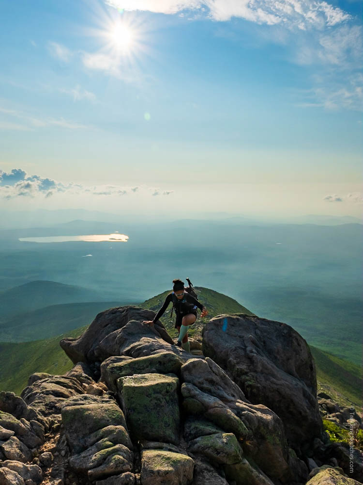
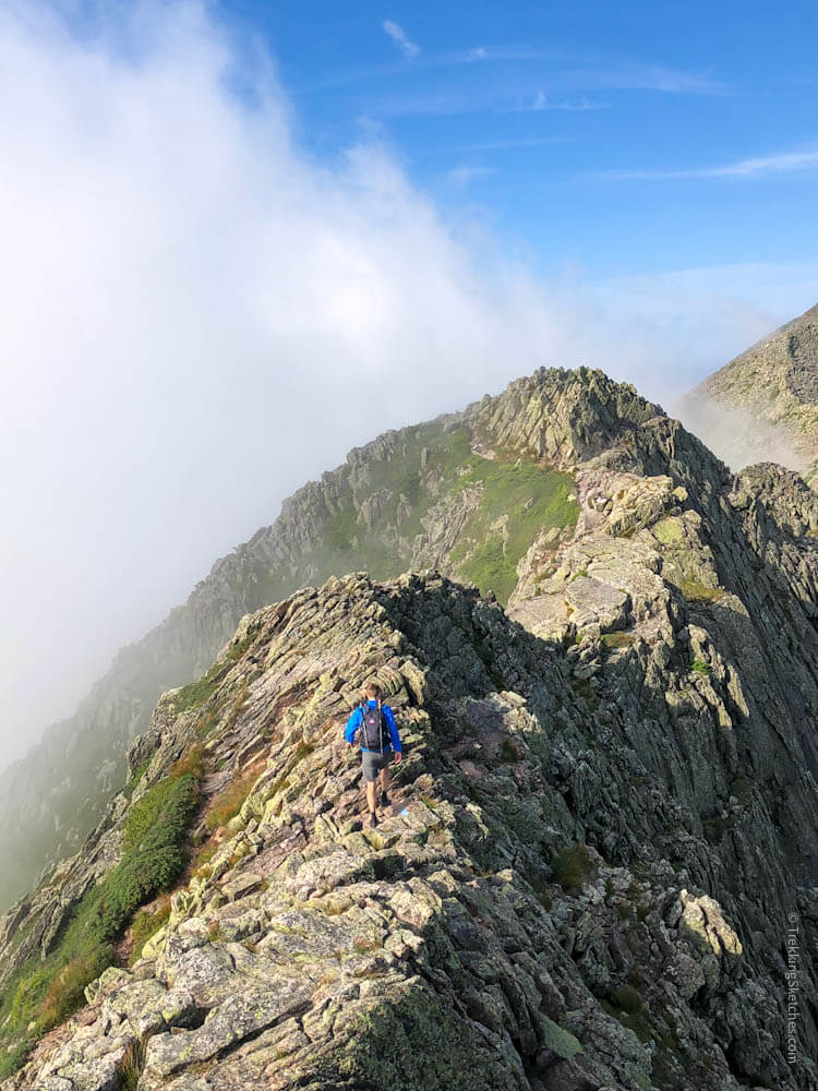
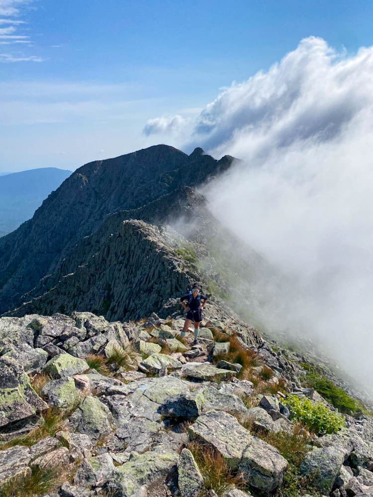
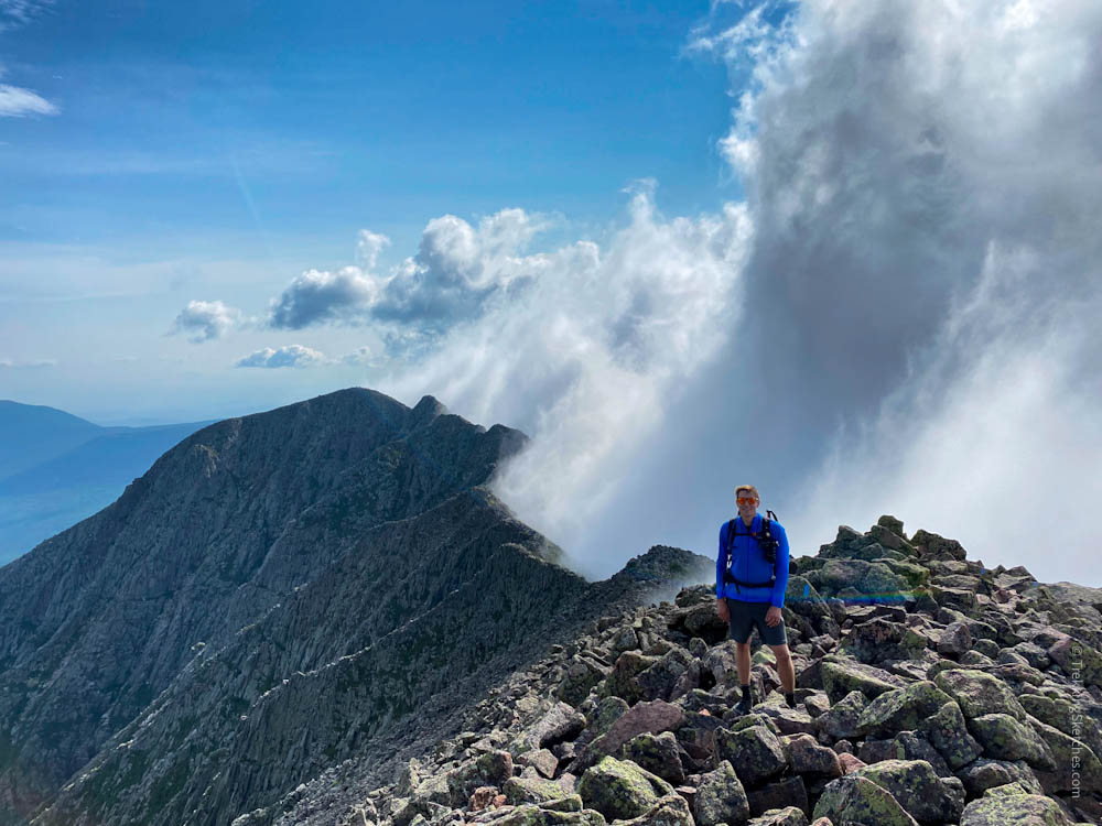
Once beyond Chimney Peak, Knife Edge continues along a razor thin ridgeline – hence its name. We traversed the treacherous terrain mostly bent over for stability in the wind and crouching or crawling through wind gusts and the most precarious sections. I was not shy about making my way on all fours! Kathy said I moved like Gollum from Lord of the Rings. The morning was stunning and the weather was about as good as we could ever ask for. A rising layer of clouds from the valley met the prevailing winds topping Knife Edge to create a swirling divide right at the ridgeline. To our right was clear sky while to our left rose a towering plume of white vapor. It felt surreal and otherworldly to walk that dividing line where it seemed like disparate worlds met. That’s one of the most spectacular things about hiking above treeline for me – you’re still on Earth, but it can often feel like some other realm.
Hiking Knife Edge Trail
Almost across Knife Edge
An otherworldly experience with incredible conditions
Baxter Peak
Knife Edge Trail continues over the alpine rock jumble to Katahdin’s Baxter Peak. Here, at the northern terminus of the Appalachian Trail, is the famous Katahdin trail sign that so many thru-hikers stand atop when they complete their journey. We took a picture with the sign, but decided to wait on climbing it. The next time we’re here should be mid-way through our Appalachian Trail thru-hike and we’ll stand atop it then. We plan to hike a NOBO flip flop in 2022. This means we’ll hike northbound from New York to Maine and then flip down to hike southbound from New York to Georgia to complete the entire Appalachian Trail.
Rock hopping the last stretch to Baxter Peak
Standing with the famous Katahdin sign
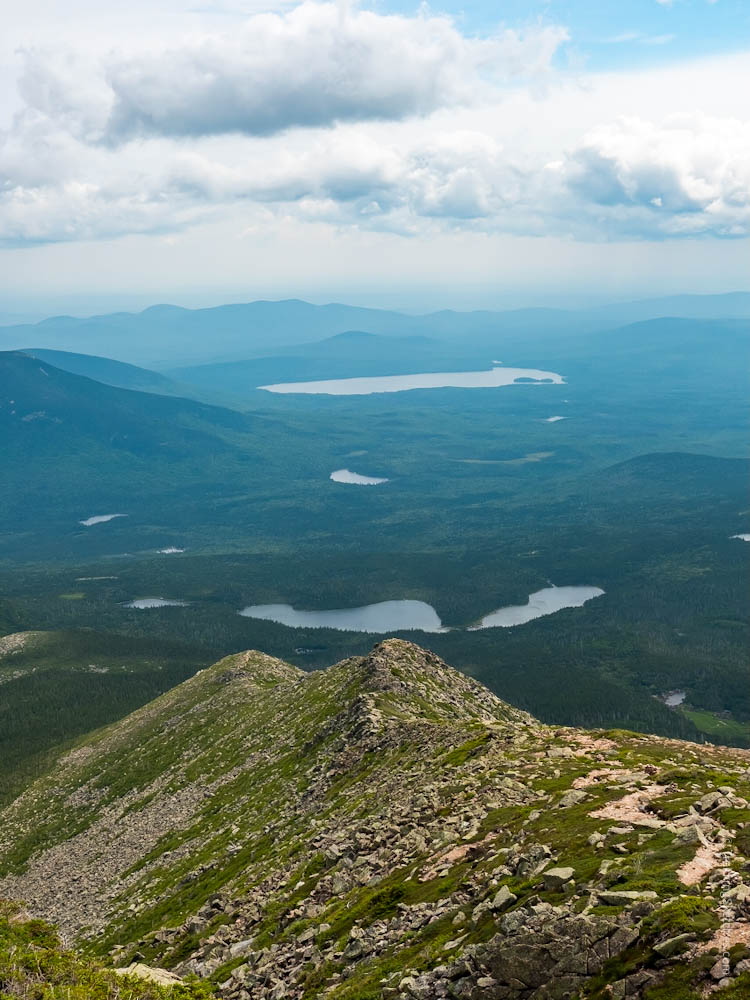
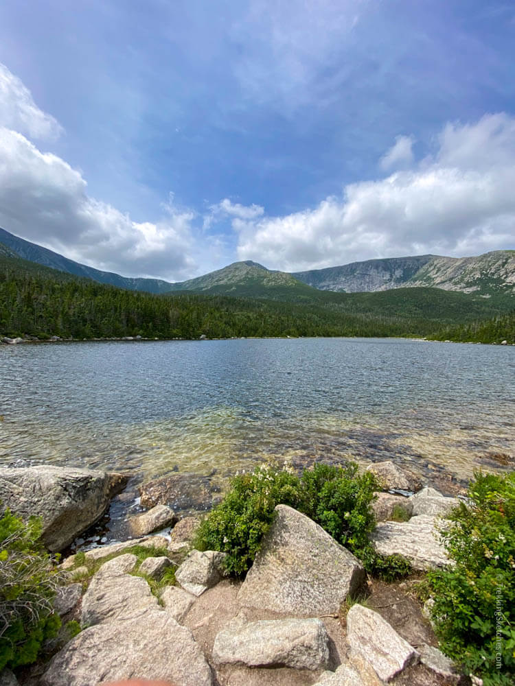
After enjoying our time on Baxter Peak and meeting some Appalachian Trail finishers, we continued down Saddle Trail toward our next and final New England 4,000 footer, Hamlin Peak. We could see the whole route as it stays above treeline the entire distance. North Brother, our previous day’s hike was even visible in the distance. As we walked, I noted the abundance of alpine vegetation in the area. It reminded me that human impacts along alpine trails are profound – just a few footsteps can trample the fragile leaves that have such a short growing season. From Saddle Trail, we also got some great views of the basin and the route we ascended over Knife Edge. The angle showed just how steep The Chimney really is and we couldn’t believe we actually climbed that!
Saddle Trail
View into the basin
Close up of The Chimney
Knife Edge Trail ridgeline
Hamlin Peak
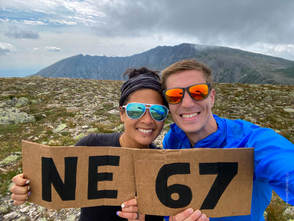
We eventually turned onto Hamlin Ridge Trail for our final ascent to Hamlin Peak. I literally danced my way over the last few steps to the trail sign. With that indescribable feeling of well-earned accomplishment, we celebrated our New England 67 finish while gazing out across the basin to Baxter Peak and Knife Edge. It didn’t quite feel real that we had actually hiked the incredible route.
Celebrating our NE 67 finish!
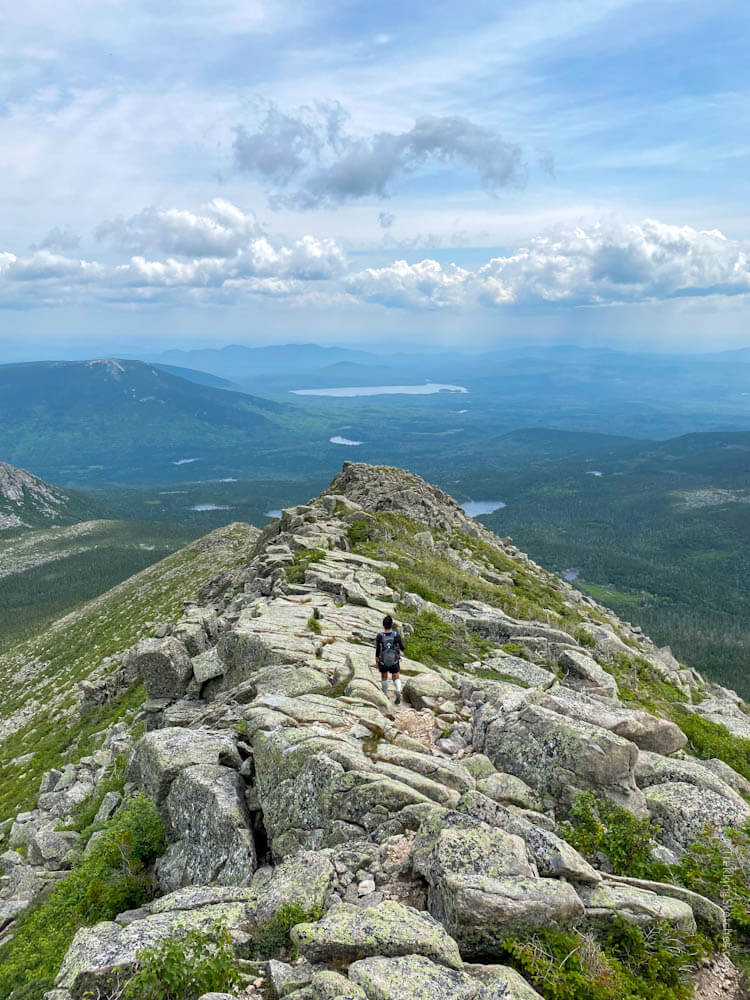
With our spirits soaring, we began our descent of Hamlin Ridge Trail. This is also a spectacular trail with really interesting terrain and outstanding views of Katahdin’s basin and some lakes of Baxter State Park. We enjoyed the way down, although my knees started feeling the effects of the jarring rugged terrain we’d been traversing the entire day.
In awe of this amazing route!
View into the basin from Hamlin Ridge Trail
Hamlin Ridge Trail
Descending Hamlin Ridge Trail
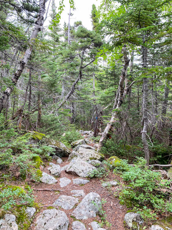
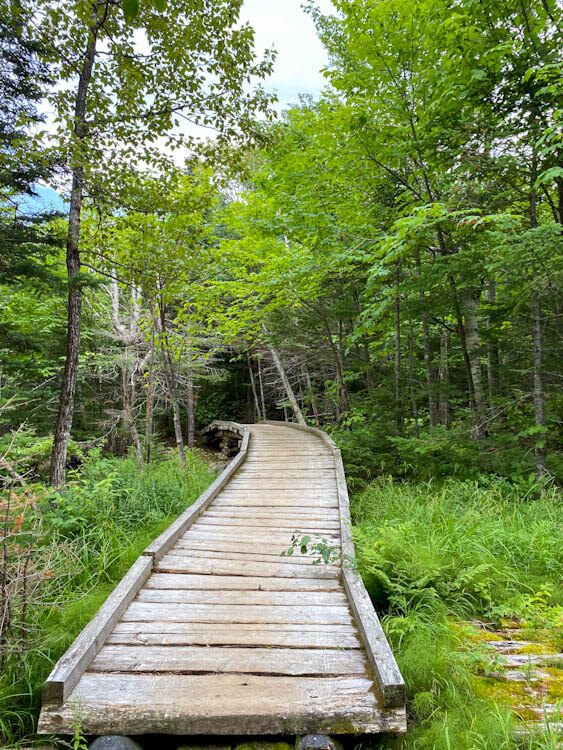
Once we got below treeline, we were pretty exhausted, but energized enough to push for the finish. The trail of course stayed rocky so there wasn’t really much reprieve, though. A great looking swimming spot, Lower Basin Pond, is down a super short side trail, but we were ready to get back to camp to relax after so many rough miles on trail. When we went over some longer boardwalk sections, we knew we were getting closer. We finally got back to Roaring Brook Campground and returned to our campsite to bask in the feeling of completing another once in a lifetime hike. We had finished our New England 67 and I couldn’t have been more filled up.


Be First to Comment