

Stand In The Door 1944
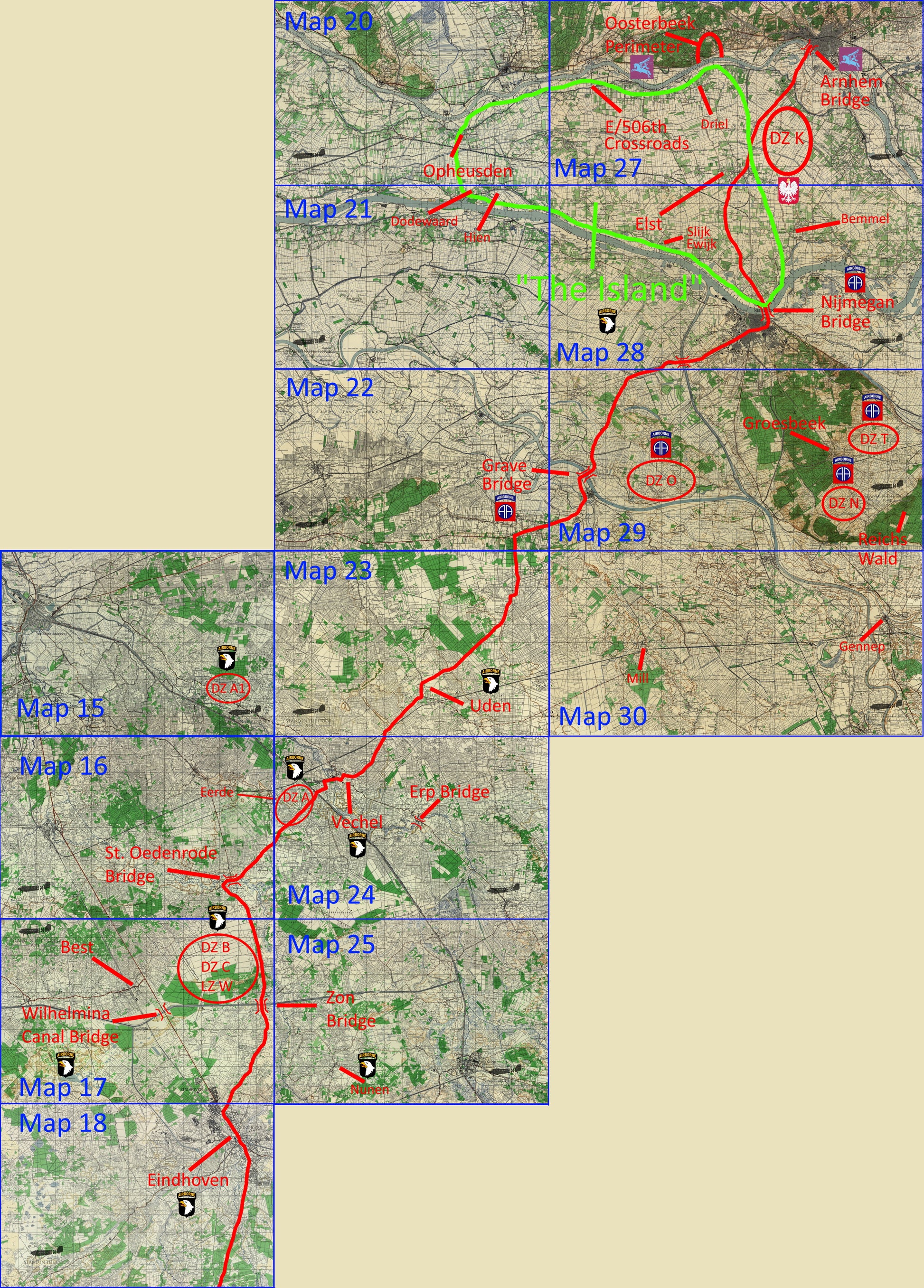
Holland Map 29- Groesbeek
Holland Map 29- Groesbeek
Couldn't load pickup availability
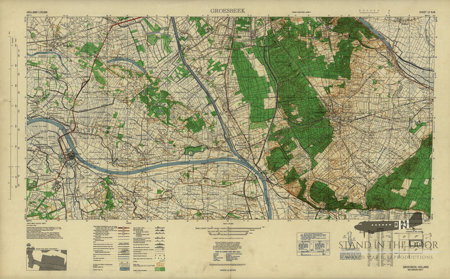
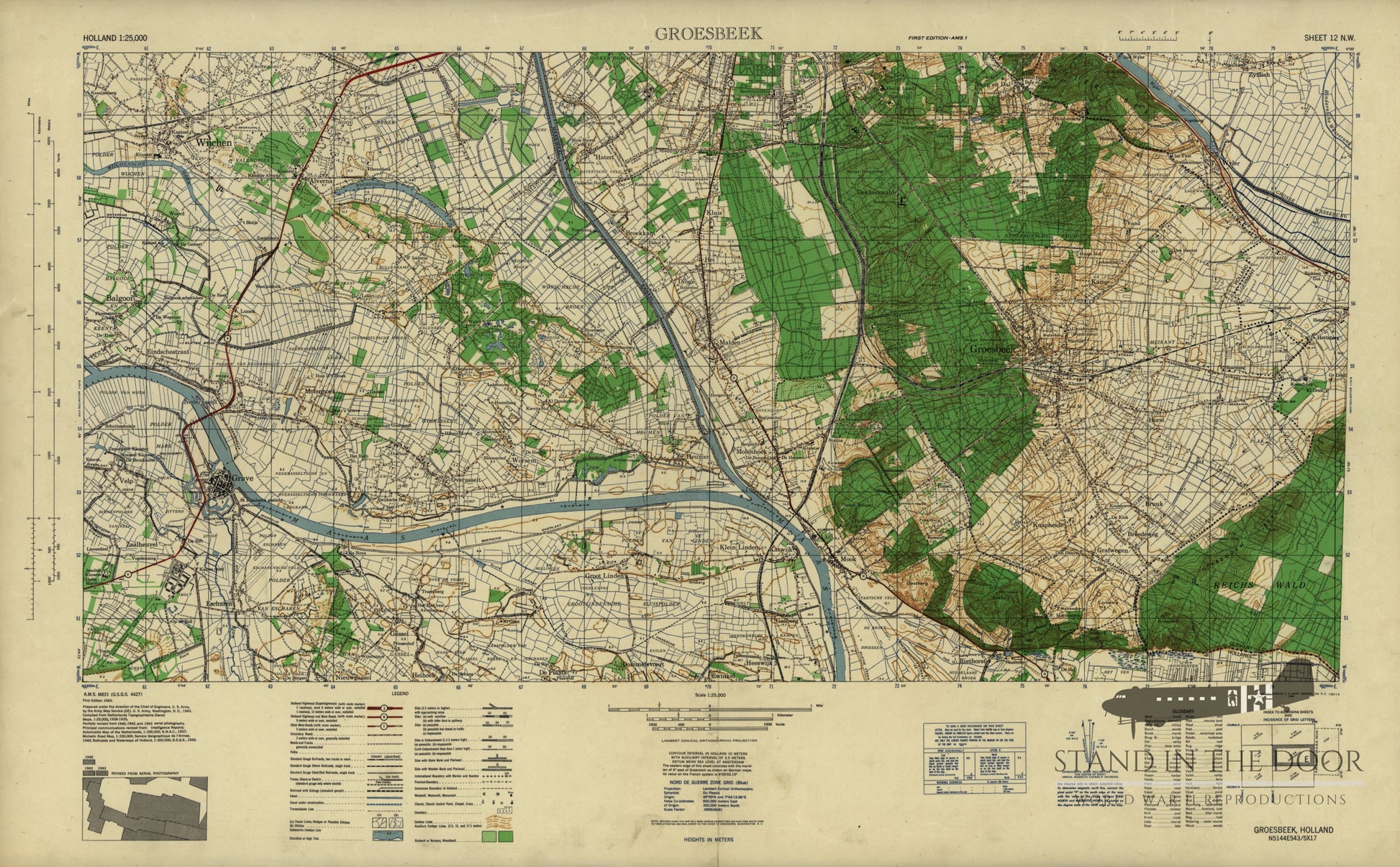
Reproduction "Groesbeek" map in 1:25,000 scale. This map would have been the most common map from Division Headquarters all the way down to platoon leaders, company commanders, and senior platoon/company NCO's of the 82nd Airborne Division showing their primary objective during Operation Market Garden for land navigation and tactical movements.
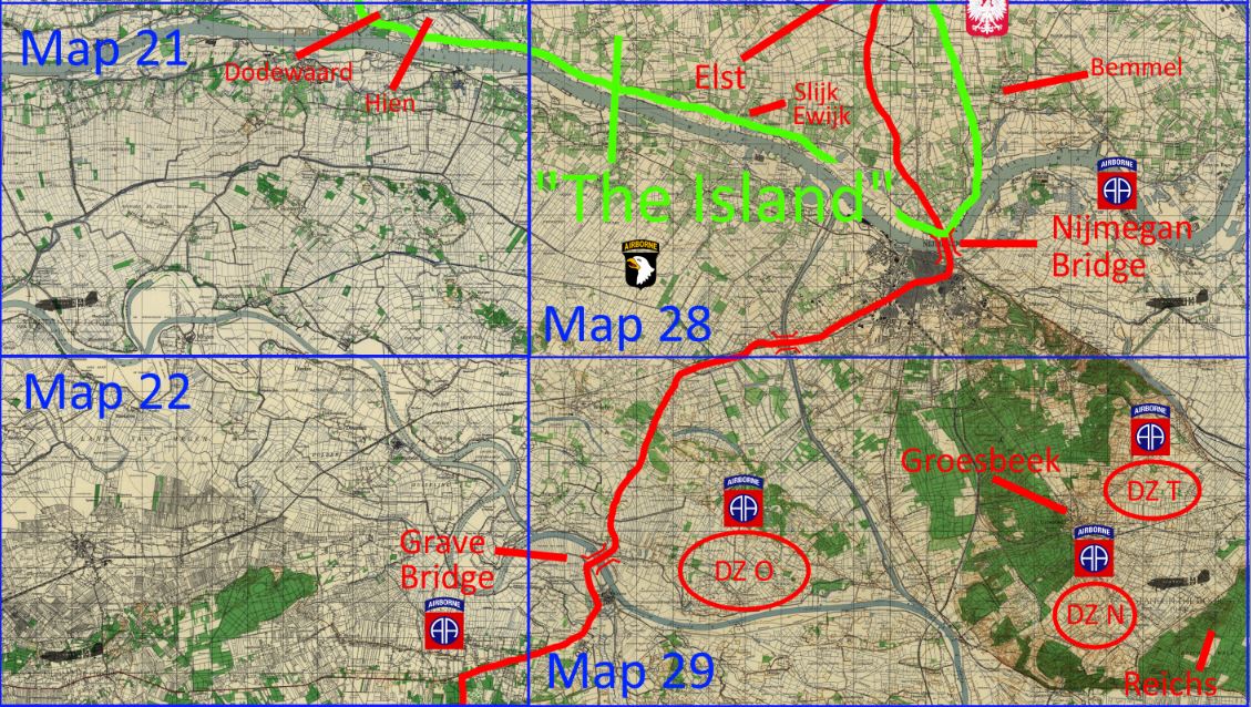
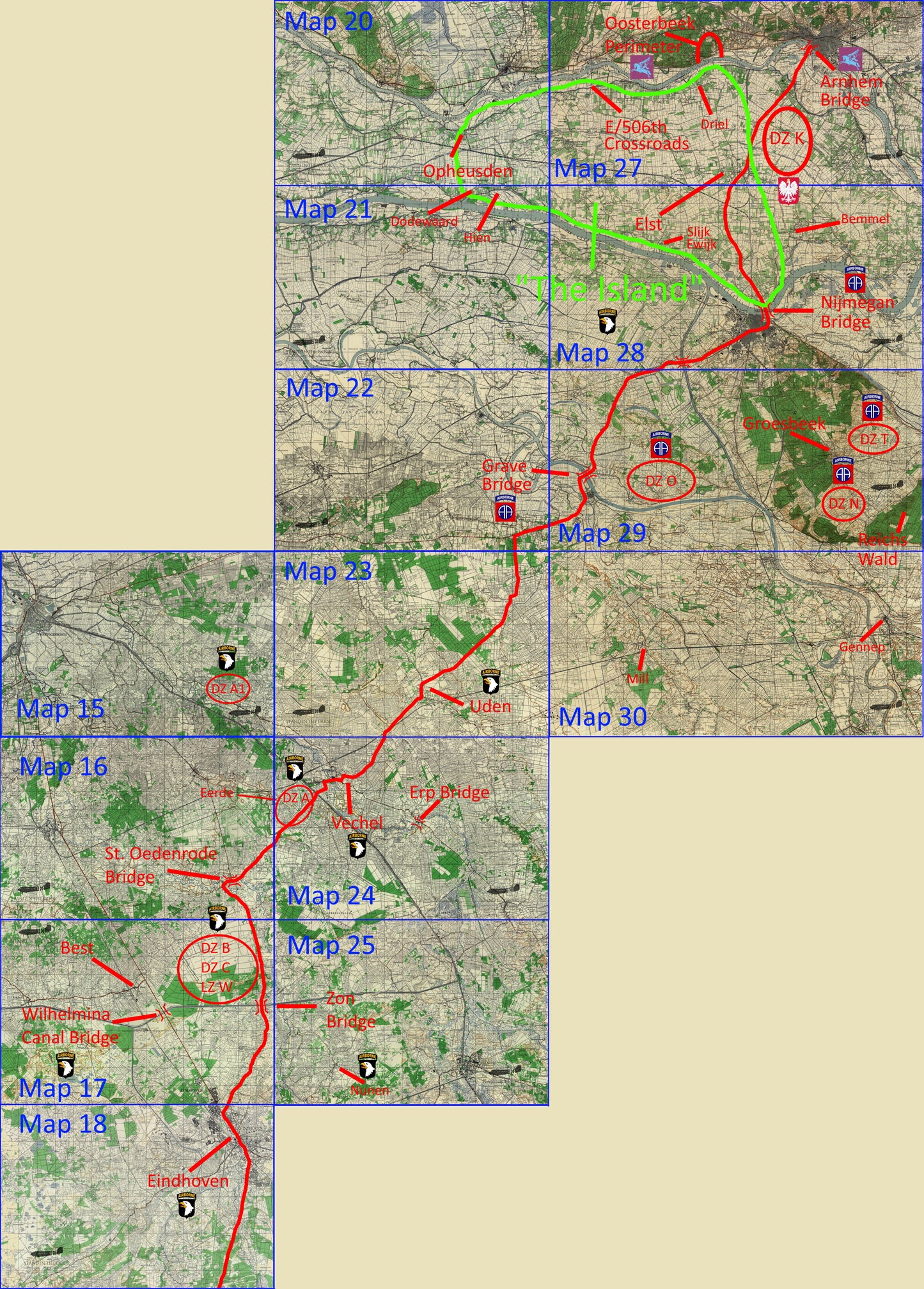
This map primarily shows the town of Groesbeek as well as the surrounding areas to the North, South, and West but also some to the East. In addition to the city of Groesbeek itself, this map also features the Groesbeek Heights, the town and bridge at Grave, and a section of "Hell's Highway" that British XXX Corps took on the way to Nijmegen Bridge which were all primary objectives of the 82nd Airborne Division.
Operation Market Garden took place over a tremendous distance and Division objectives covered more and more maps as the operation progressed. If you are looking for a map showing a specific area or objective from Operation Market Garden, let me know and I can most likely provide it for you.
Keep in mind that geographic maps used in World War Two were not being made in relation to the tactical environment of the battlefield. Most if not all cartographers (map makers) did not know where the D-Day invasion (or any other invasion) was going to take place so you often find that key objectives are split over several different maps. That being the case officers and NCO's often carried numerous maps not knowing if their tactical movement would keep them on one map or take them across several maps.
These reproductions are made from scans of the original maps and maintain the same size, color, and scale of the originals. The grid squares maintain their original size and can be used accurately with modern or vintage protractor tools. They have been color printed on one side of 20LB engineering paper leaving the back of the map white.
Whether folded and creased to fit in a pocket or map case for field use or kept flat to be framed for static display these maps will make great additions to any collection.
These maps (when purchased with other paper items) will be shipped in a 2" wide cardboard tubes so that the maps remain flat and unfolded. When purchased with any other item that cannot fit in a 2" shipping tube the maps will be folded several times and shipped in a regular package. Please note, that like all paper items, these maps may have small folds or imperfections, these are to be expected and are not considered "damaged" and are not eligible for returns.