


A two-part winter storm will bring heavy snow, ice and gusty winds to Wisconsin through early Friday. Our Spectrum News 1 Weather Experts will hone in on which of the counties will be affected the most in this county-by-county breakdown.
Southern Wisconsin will deal with a mixture of rain, sleet, freezing rain and snow, so storm totals will be dependent on type of precipitation.
Winter Storm Warning (in effect until 12 p.m. Thursday)
Main impact: Through Thursday morning
Total snow/sleet accumulations: 1 to 4 inches, with locally higher amounts possible farther north
Ice accumulations: Up to a quarter of an inch
Winds: Up to 40 mph
Winter Storm Warning (in effect until 6 p.m. Thursday)
Main impact: Through Thursday afternoon
Total snow accumulations: 8 to 12 inches, with locally higher amounts possible farther south
Winds: Up to 35 mph
Winter Storm Warning (in effect until 12 p.m. Thursday)
Main impact: Through Thursday afternoon
Total snow accumulations: 7 to 12 inches, with locally higher amounts possible
Winds: Up to 45 mph
Winter Storm Warning (in effect until 12 p.m. Thursday)
Main impact: Through Thursday morning
Additional snow accumulations: 13 to 17 inches
Winds: Up to 45 mph
Winter Storm Warning (in effect until 12 p.m. Thursday)
Main impact: Through Thursday morning
Additional snow accumulations: 13 to 17 inches
Winds: Up to 45 mph
Winter Storm Warning (in effect until 12 p.m. Thursday)
Main impact: Through Thursday morning
Total snow accumulations: 9 to 12 inches
Ice accumulations: A light glaze
Winds: Up to 40 mph
Winter Storm Warning (in effect until 12 p.m. Thursday)
Main impact: Through Thursday morning
Total snow accumulations: 9 to 12 inches
Ice accumulations: A light glaze
Winds: Up to 40 mph
Winter Storm Warning (in effect until 12 p.m. Thursday)
Main impact: Through Thursday morning
Total snow accumulations: 9 to 12 inches
Ice accumulations: A light glaze
Winds: Up to 40 mph
Winter Storm Warning (in effect until 12 p.m. Thursday)
Main impact: Through Thursday morning
Total snow accumulations: 6 to 9 inches
Ice accumulations: A light glaze
Winds: Up to 40 mph
Winter Storm Warning (in effect until 12 p.m. Thursday)
Main impact: Through Thursday morning
Total snow accumulations: 6 to 9 inches
Ice accumulations: A light glaze
Winds: Up to 40 mph
Winter Storm Warning (in effect until 12 p.m. Thursday)
Main impact: Through Thursday morning
Total snow accumulations: 6 to 9 inches, with locally higher amounts possible farther north
Ice accumulations: A light glaze
Winds: Up to 40 mph
Winter Storm Warning (in effect until 12 p.m. Thursday)
Main impact: Through Thursday morning
Total snow accumulations: 6 to 9 inches, with locally higher amounts possible farther north
Ice accumulations: A light glaze
Winds: Up to 40 mph
Winter Storm Warning (in effect until 12 p.m. Thursday)
Main impact: Through Thursday morning
Total snow accumulations: 6 to 10 inches, with locally higher amounts possible farther north
Ice accumulations: A light glaze
Winds: Up to 45 mph
Winter Storm Warning (in effect until 12 p.m. Thursday)
Main impact: Through Thursday morning
Total snow accumulations: 6 to 10 inches, with locally higher amounts possible farther north
Ice accumulations: A light glaze
Winds: Up to 45 mph
Winter Storm Warning (in effect until 12 p.m. Thursday)
Main impact: Through Thursday morning
Total snow accumulations: 6 to 10 inches, with locally higher amounts possible farther north
Ice accumulations: A light glaze
Winds: Up to 40 mph
Winter Storm Warning (in effect until 12 p.m. Thursday)
Main impact: Through Thursday morning
Total snow accumulations: 3 to 6 inches, with locally higher amounts possible farther north
Ice accumulations: Up to one-tenth of an inch
Winds: Up to 40 mph
Winter Storm Warning (in effect until 12 p.m. Thursday)
Main impact: Through Thursday morning
Total snow accumulations: 3 to 6 inches, with locally higher amounts possible farther north
Ice accumulations: Up to one-tenth of an inch
Winds: Up to 40 mph
Winter Storm Warning (in effect until 12 p.m. Thursday)
Main impact: Through Thursday morning
Total snow/sleet accumulations: 4 to 6 inches, with locally higher amounts possible farther north
Ice accumulations: Up to one-tenth of an inch
Winds: Up to 40 mph
Winter Storm Warning (in effect until 12 p.m. Thursday)
Main impact: Through Thursday morning
Total snow accumulations: 4 to 6 inches
Ice accumulations: Up to one-tenth of an inch
Winds: Up to 40 mph
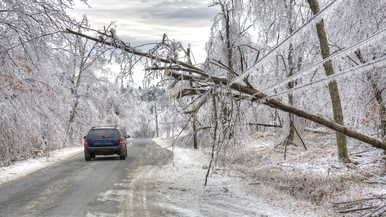
Ice Storm Warning (in effect until 12 p.m. Thursday)
Main impact: Through Thursday morning
Total snow accumulations: 1 to 3 inches
Ice accumulations: Between one to four-tenths of an inch
Winds: Up to 40 mph
Winter Storm Warning (in effect until 12 p.m. Thursday)
Main impact: Through Thursday morning
Total snow/sleet accumulations: 2 to 4 inches, with locally higher amounts possible farther north
Ice accumulations: Between one-tenth to a quarter of an inch
Winds: Up to 40 mph
Ice Storm Warning (in effect until 12 p.m. Thursday)
Main impact: Through Thursday morning
Ice accumulations: Between one quarter to half an inch
Winds: Up to 40 mph
Ice Storm Warning (in effect until 12 p.m. Thursday)
Main impact: Through Thursday morning
Ice accumulations: Between one quarter to half an inch
Winds: Up to 40 mph
Ice Storm Warning (in effect until 12 p.m. Thursday)
Main impact: Through Thursday morning
Ice accumulations: Between one quarter to half an inch
Winds: Up to 40 mph
Our team of meteorologists dives deep into the science of weather and breaks down timely weather data and information. To view more weather and climate stories, check out our weather blogs section.