
Old antique map of Lithuania, by W. Blaeu. 1630-1664
The item displayed on this page has been sold. However, we have a similar map in stock:
Lithuania, by Willem Blaeu. 1643
Magni Ducatus Lithuaniae Caeterarumque Regionum ...
[Item number: 30171]


Printed from two plates and two half plates, joined. The original of this map was made during the last decade of the sixteenth century by the efforts of prince Nikolaj Krzystof Radziwill (Radvillas 1549-1616) and was a collaborative effort. Only the name of the draughtsman, Tomasz Makowski, is known. Alexandrowicz (1989) assumes that there existed a first (now lost) printed state before 1604 of which the printing plate is no longer extant. The second plate of the map was engraved by Hessel Gerritsz and published by Blaeu. Blaeu changed the arrangement of the map sheets; he separated the map of the river Dniepr from the map of Lithuania. The first edition (1631) has a printed latin text on the back; from 1634 on the map was included in the atlas without text on the back.
The Blaeus: Willem Janszoon, Cornelis & Joan
Willem Jansz. Blaeu and his son Joan Blaeu are the seventeenth century's most widely known cartographic publishers.
Willem Jansz. (also written Guilielmus Janssonius) = Willem Janszoon Blaeu was born in Uitgeest (Netherlands), near Alkmaar, in 1571. He studied mathematics under Tycho Brahe and learned the theory and practice of astronomical observations and the art of instrument- and globe-making.
In 1596, he came to Amsterdam, where he settled down as a globe-, instrument- and map-maker. He published his first cartographic work (a globe) in 1599 and probably published his first printed map (a map of the Netherlands) in 1604. He specialised in maritime cartography, published the first edition of the pilot guide Het Licht der Zeevaert in 1608, and was appointed Hydrographer of the V.O.C. (United East India Company) in 1633. After publishing books, wall maps, globes, charts and pilot guides for thirty years, he brought out his first atlas, Atlas Appendix (1630). This was the beginning of the great tradition of atlas-making by the Blaeus.
In 1618, another mapmaker, bookseller and publisher, Johannes Janssonius, established himself in Amsterdam next door to Blaeu's shop. No wonder these two neighbours began accusing each other of copying and stealing their information and became fierce competitors who did not have a good word to say about each other. In about 1621 Willem Jansz. decided to end the confusion between his name and his competitor's and assumed his grandfather's nickname, 'blauwe Willem' ('blue Willem'), as the family name; after that, he called himself Willem Jansz. Blaeu.
Willem Janszoon Blaeu died in 1638, leaving his prospering business to his sons, Cornelis and Joan. We only know that Cornelis's name occurs in the prefaces of books and atlases until c. 1645.
Joan Blaeu, born in Amsterdam in 1596, became a partner in his father’s book trade and printing business. 1638, he was appointed his father’s successor in the Hydrographic Office of the V.O.C. His efforts culminated in the magnificent Atlas Major and the town books of the Netherlands and Italy – works unsurpassed in history and modern times, giving eternal fame to the name of the Blaeu's.
On February 23, 1672, a fire ruined the business. One year later, Dr Joan Blaeu died. The fire of 1672 and the passing away of the director gave rise to a complete sale of the stock of the Blaeu House. Five public auctions dispersed the remaining books, atlases, copperplates, globes, etc., among many other map dealers and publishers in Amsterdam. The majority was acquired by several booksellers acting in partnership.
In the succeeding years, the remaining printing department was left in the hands of the Blaeu family until 1695, when the printing house's inventory was sold at a public auction. That meant the end of the Blaeu's as a printing house of world renown.
Magni Ducatus Lithuaniae Caeterarumque Regionum illi Adiacentium Exacta Descriptio.
Item Number: 26257 Authenticity Guarantee
Category: Antique maps > Europe > Eastern Europe
Old, antique map of Lithuania by W. Blaeu.
Date of the first edition: 1631
Date of this map: 1634-49
Copper engraving, printed on paper.
Size (not including margins): 76 x 74cm (29.6 x 28.9 inches)
Verso: Blank
Condition: Original coloured, a few reinforcements on the back, some creases flattened, good copy.
Condition Rating: A
References: Van der Krogt 2, 1730 I-II:2A; Schilder 4, 29.3-5.
From: Theatrum Orbis Terrarum.. J. Blaeu, 1634-49. (Van der Krogt 2, 2:202)
Printed from two plates and two half plates, joined. The original of this map was made during the last decade of the sixteenth century by the efforts of prince Nikolaj Krzystof Radziwill (Radvillas 1549-1616) and was a collaborative effort. Only the name of the draughtsman, Tomasz Makowski, is known. Alexandrowicz (1989) assumes that there existed a first (now lost) printed state before 1604 of which the printing plate is no longer extant. The second plate of the map was engraved by Hessel Gerritsz and published by Blaeu. Blaeu changed the arrangement of the map sheets; he separated the map of the river Dniepr from the map of Lithuania. The first edition (1631) has a printed latin text on the back; from 1634 on the map was included in the atlas without text on the back.
The Blaeus: Willem Janszoon, Cornelis & Joan
Willem Jansz. Blaeu and his son Joan Blaeu are the seventeenth century's most widely known cartographic publishers.
Willem Jansz. (also written Guilielmus Janssonius) = Willem Janszoon Blaeu was born in Uitgeest (Netherlands), near Alkmaar, in 1571. He studied mathematics under Tycho Brahe and learned the theory and practice of astronomical observations and the art of instrument- and globe-making.
In 1596, he came to Amsterdam, where he settled down as a globe-, instrument- and map-maker. He published his first cartographic work (a globe) in 1599 and probably published his first printed map (a map of the Netherlands) in 1604. He specialised in maritime cartography, published the first edition of the pilot guide Het Licht der Zeevaert in 1608, and was appointed Hydrographer of the V.O.C. (United East India Company) in 1633. After publishing books, wall maps, globes, charts and pilot guides for thirty years, he brought out his first atlas, Atlas Appendix (1630). This was the beginning of the great tradition of atlas-making by the Blaeus.
In 1618, another mapmaker, bookseller and publisher, Johannes Janssonius, established himself in Amsterdam next door to Blaeu's shop. No wonder these two neighbours began accusing each other of copying and stealing their information and became fierce competitors who did not have a good word to say about each other. In about 1621 Willem Jansz. decided to end the confusion between his name and his competitor's and assumed his grandfather's nickname, 'blauwe Willem' ('blue Willem'), as the family name; after that, he called himself Willem Jansz. Blaeu.
Willem Janszoon Blaeu died in 1638, leaving his prospering business to his sons, Cornelis and Joan. We only know that Cornelis's name occurs in the prefaces of books and atlases until c. 1645.
Joan Blaeu, born in Amsterdam in 1596, became a partner in his father’s book trade and printing business. 1638, he was appointed his father’s successor in the Hydrographic Office of the V.O.C. His efforts culminated in the magnificent Atlas Major and the town books of the Netherlands and Italy – works unsurpassed in history and modern times, giving eternal fame to the name of the Blaeu's.
On February 23, 1672, a fire ruined the business. One year later, Dr Joan Blaeu died. The fire of 1672 and the passing away of the director gave rise to a complete sale of the stock of the Blaeu House. Five public auctions dispersed the remaining books, atlases, copperplates, globes, etc., among many other map dealers and publishers in Amsterdam. The majority was acquired by several booksellers acting in partnership.
In the succeeding years, the remaining printing department was left in the hands of the Blaeu family until 1695, when the printing house's inventory was sold at a public auction. That meant the end of the Blaeu's as a printing house of world renown.
Related items
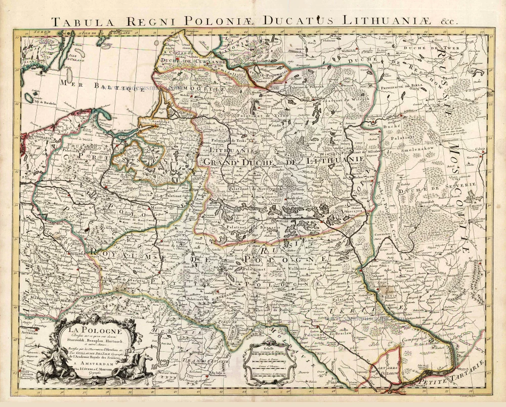
La Pologne Dressée sur ce qu'en ont donné Starovolsk, Beauplan, Hartnoch, et autres auteurs. [Latin title in upper margin:] Tabula Regni Poloniae, Ducatus Lithuaniae &c. 1730
Poland - Lithuania by Guillaume Delisle, published by Covens & Mortier.
[Item number: 25890]
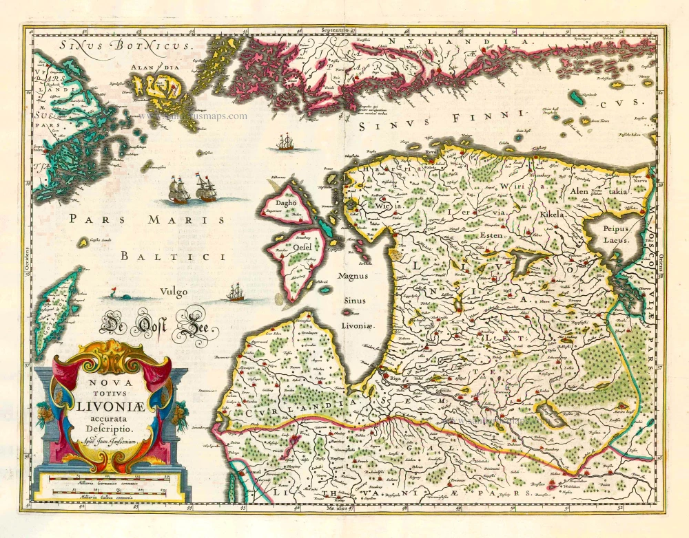
Nova Totius Livoniae accurata Descriptio. 1645-58
Baltics - Livonia by J. Janssonius
[Item number: 26567]