Winter hours: Tuesday - Saturday 10am to 5pm. Close Sundays and Mondays until May. We appreciate your business!

NAU145-Antique-Nautical-Chart-A-New-Chart-of-the-North-Sea--German-Ocean-Europe-General-Nautical-Charts-1840-Blachford-Maps-Of-Antiquity
  • Load image into Gallery viewer, NAU145-Antique-Nautical-Chart-A-New-Chart-of-the-North-Sea--German-Ocean-Europe-General-Nautical-Charts-1840-Blachford-Maps-Of-Antiquity
  • Load image into Gallery viewer, NAU145-Antique-Nautical-Chart-A-New-Chart-of-the-North-Sea--German-Ocean-Europe-General-Nautical-Charts-1840-Blachford-Maps-Of-Antiquity
  • Load image into Gallery viewer, NAU145-Antique-Nautical-Chart-A-New-Chart-of-the-North-Sea--German-Ocean-Europe-General-Nautical-Charts-1840-Blachford-Maps-Of-Antiquity
  • Load image into Gallery viewer, NAU145-Antique-Nautical-Chart-A-New-Chart-of-the-North-Sea--German-Ocean-Europe-General-Nautical-Charts-1840-Blachford-Maps-Of-Antiquity
  • Load image into Gallery viewer, NAU145-Antique-Nautical-Chart-A-New-Chart-of-the-North-Sea--German-Ocean-Europe-General-Nautical-Charts-1840-Blachford-Maps-Of-Antiquity
  • Load image into Gallery viewer, NAU145-Antique-Nautical-Chart-A-New-Chart-of-the-North-Sea--German-Ocean-Europe-General-Nautical-Charts-1840-Blachford-Maps-Of-Antiquity
  • Load image into Gallery viewer, NAU145-Antique-Nautical-Chart-A-New-Chart-of-the-North-Sea--German-Ocean-Europe-General-Nautical-Charts-1840-Blachford-Maps-Of-Antiquity
  • Load image into Gallery viewer, NAU145-Antique-Nautical-Chart-A-New-Chart-of-the-North-Sea--German-Ocean-Europe-General-Nautical-Charts-1840-Blachford-Maps-Of-Antiquity

1840/1843 - A New Chart of the North Sea or German Ocean- Antique Chart

Regular price
$600.00
Sale price
$600.00
Regular price
Sold out
Unit price
per 
Shipping calculated at checkout.

Item number: NAU145
Genuine Antique Nautical Chart

1840/1843

Maker: Blachford


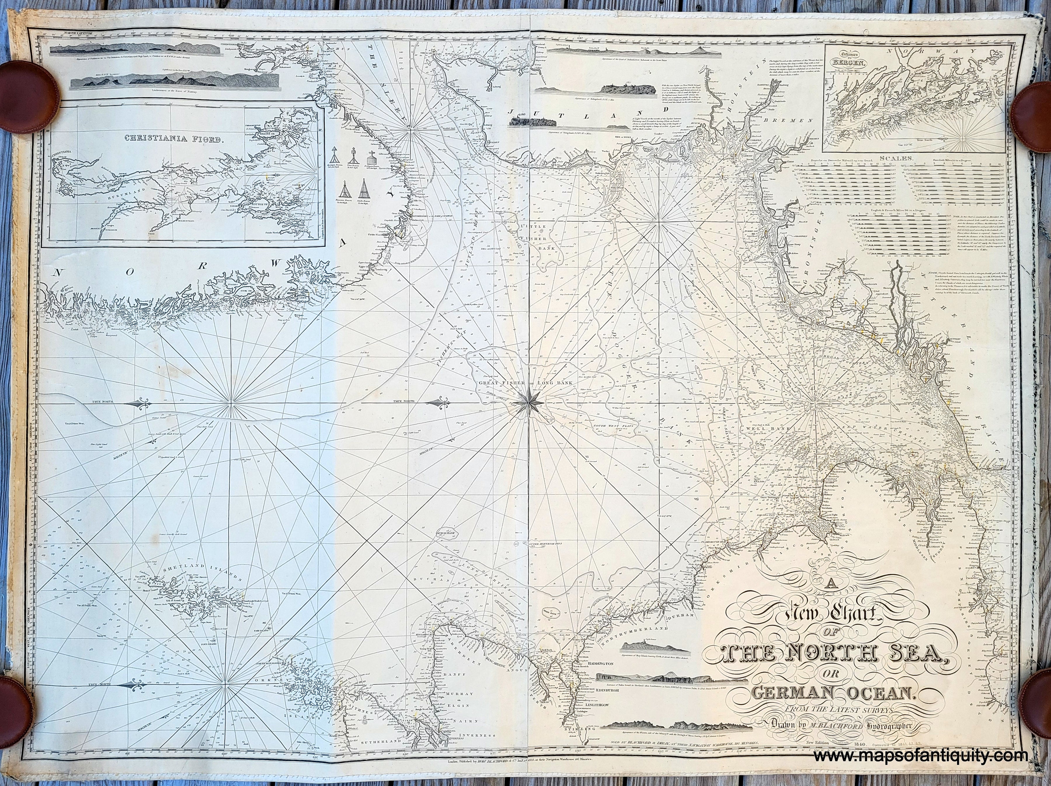
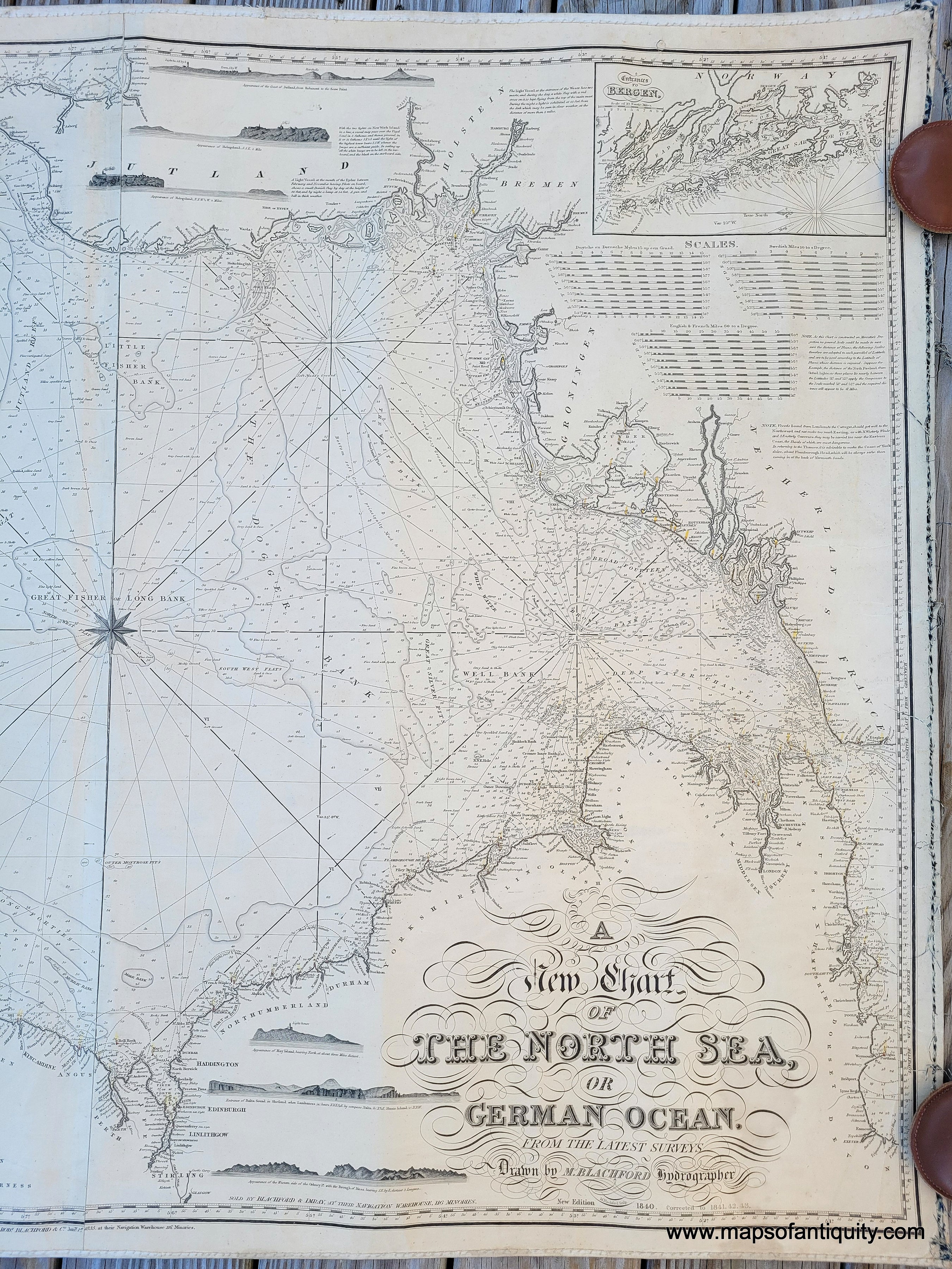
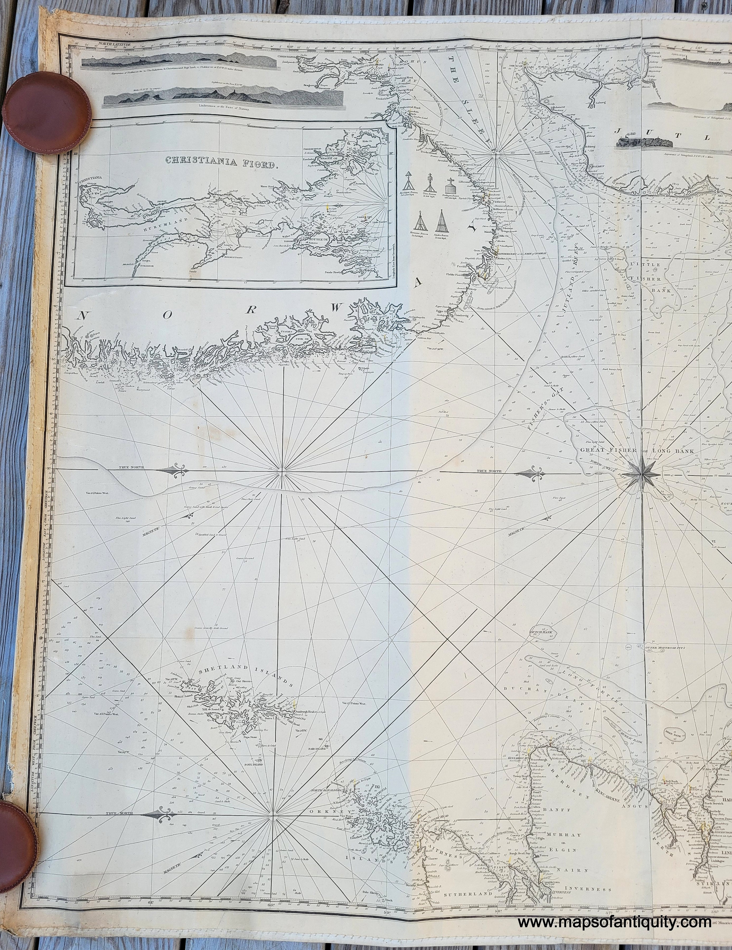
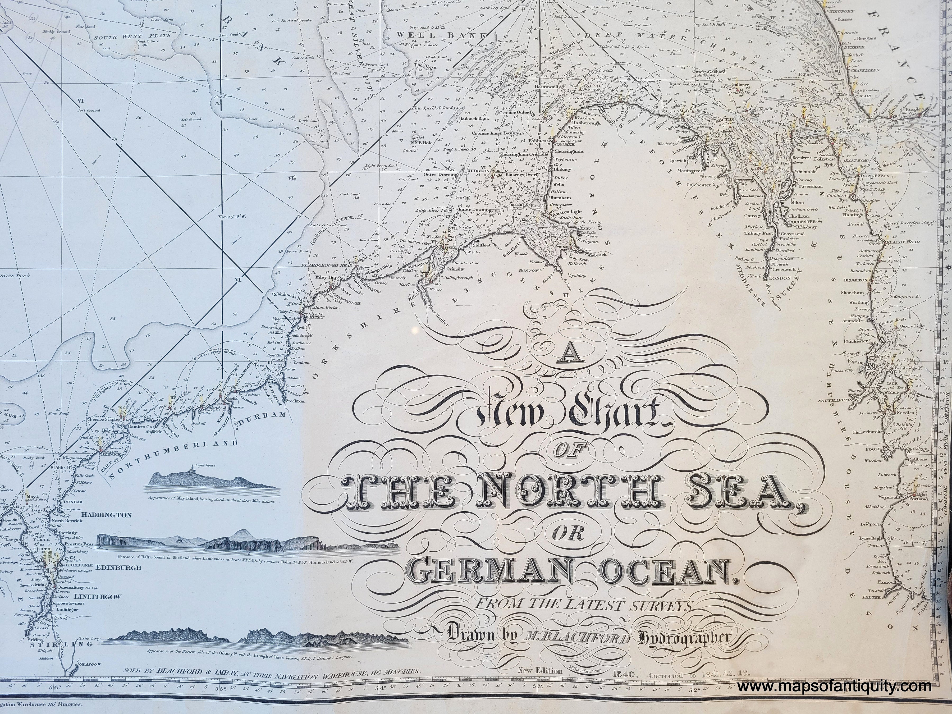
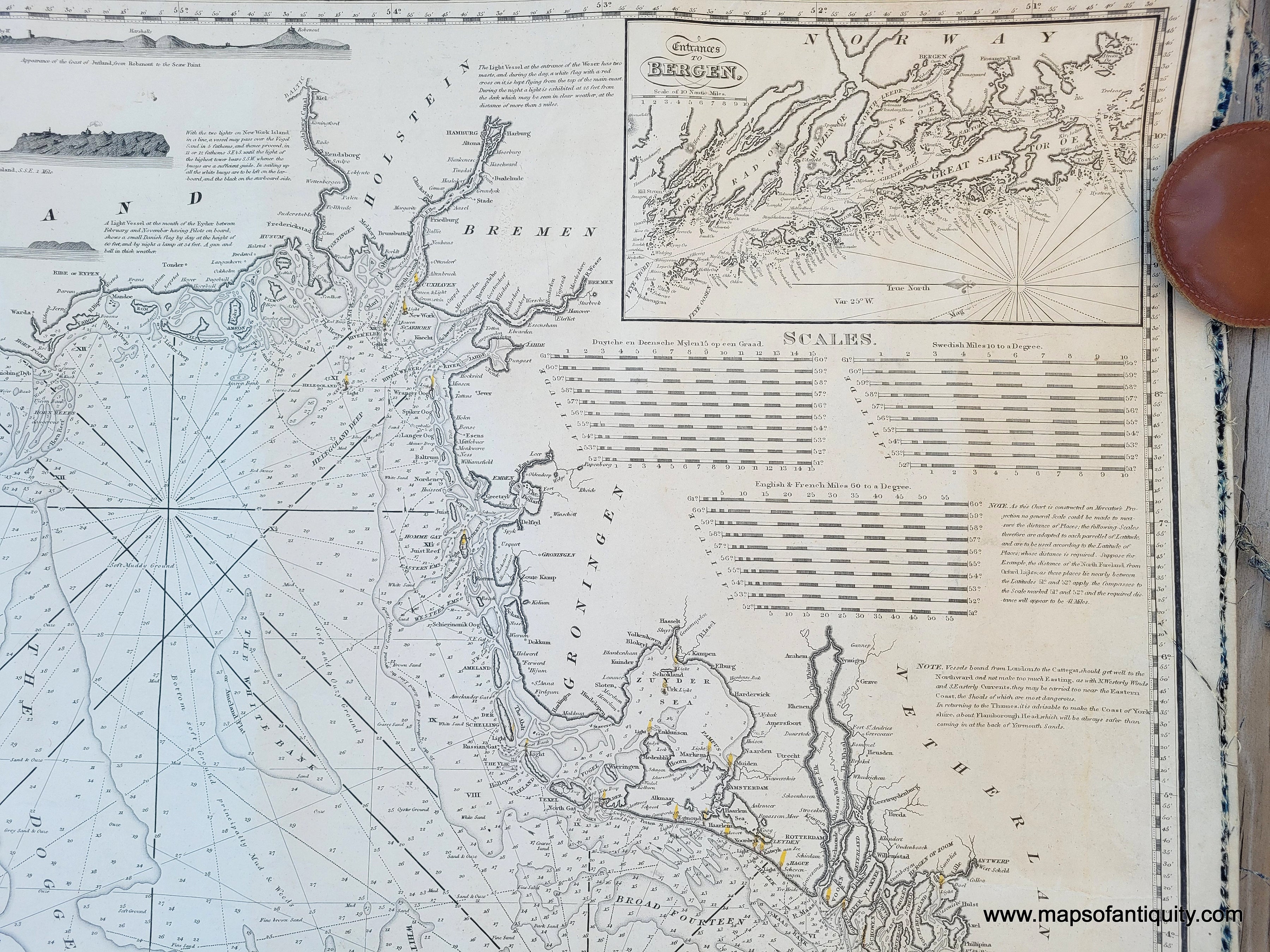
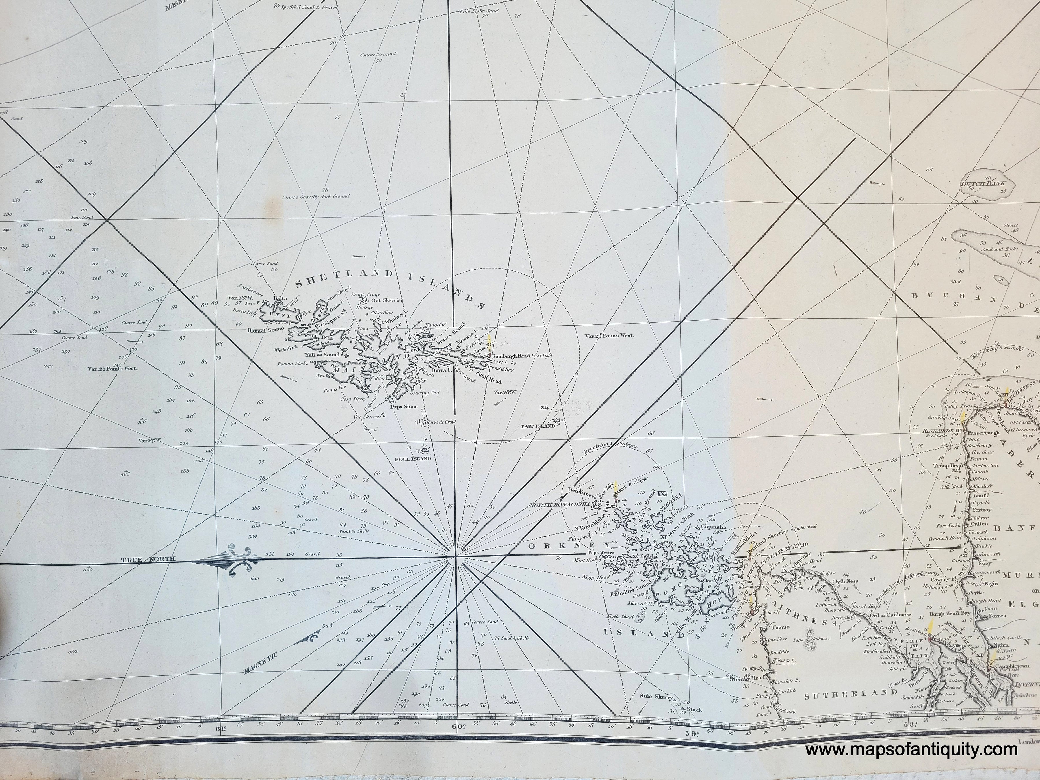
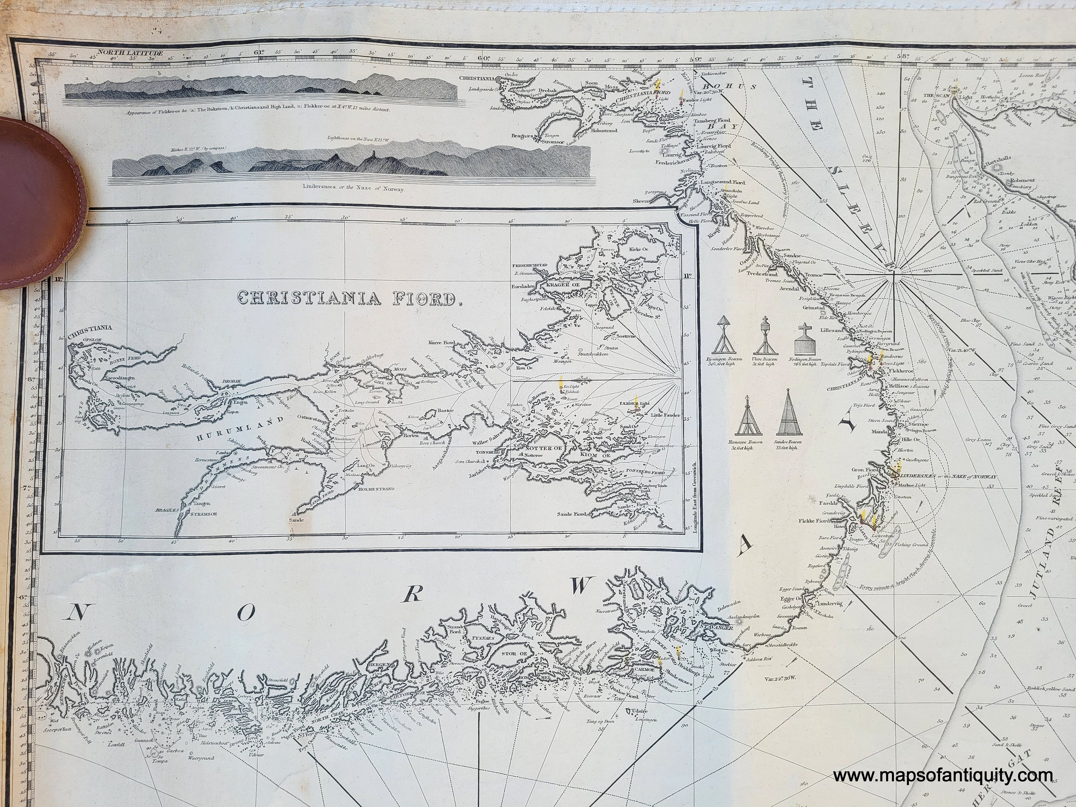
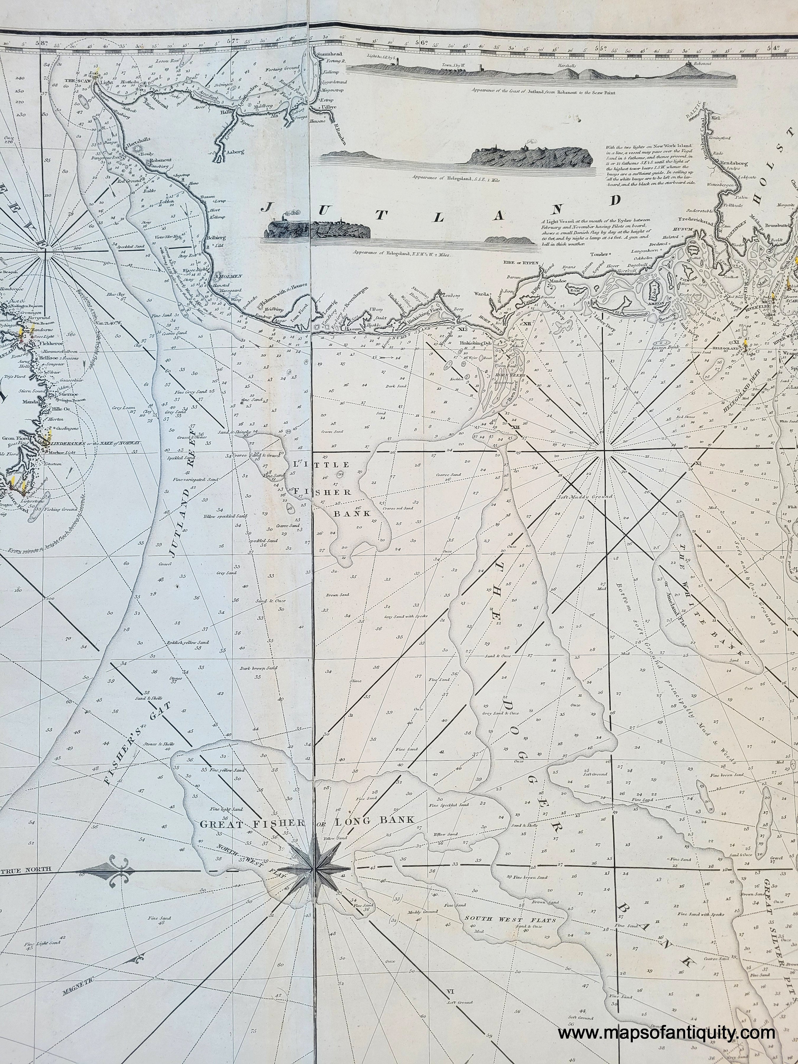
Antique nautical sailing chart of the North Sea, by M. Blachford, 1840 corrected to 1843. Sold by Blachford and Imray. An impressive chart with central compass rose, two inset maps, and many recognition profiles. On this chart North is oriented to the left. This antique chart includes portions of the coasts of the Netherlands, France, Norway, England, Scotland, the Shetland Islands and Jutland (Denmark). Very good condition overall, chart is whole, some minor stains. Some wear at page edges. Measures approx. 35.5 x 47.5 inches. **NOTE- this map requires extra insurance for shipping. If you would like to discuss insurance or shipping costs, please contact us.**


Item Number: NAU145