July 5-6, 2023. The first part of a 7-day trek along the world-famous West Coast Trail
- Region: Pacific Rim National Park Reserve. Traditional territory of the Huu-ay-aht, Ditidaht, and Pacheedaht First Nations
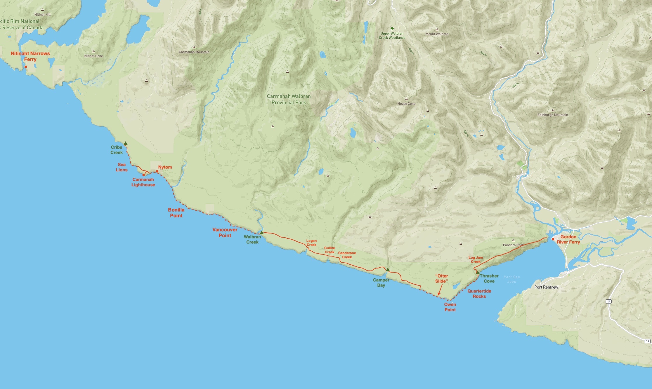
- Distance: Approximately 13 km for this segment (based on the official map, actual distance travelled is longer)
- Total Time: 2 days
This past spring, out of the blue, I was offered the chance to hike the West Coast Trail. This wasn’t something that was ever on my radar, being a Rockies hiker and scrambler. A 7 day long coastal trek was well outside of anything I had experience with. But, I had been wanting to start doing some longer backpacking trips, and I’d be going along with people I knew from previous hikes and got along well with. It would give me the chance to buy some new gear, and see and do things that would be entirely new. So, I jumped at the chance.
The West Coast Trail is in Pacific Rim National Park Reserve on Vancouver Island. It’s officially said to be 75 km long but hikers who measure the distance they’ve travelled find that their treks are notably longer, up to about 90 km according to one gentleman we encountered. The trail was created when the federal government developed rescue infrastructure on the coast of Vancouver Island. The section of coastline traversed by the trail was known as the Graveyard of the Pacific due to the large number of shipwrecks. After a particularly shocking episode where the ship “Valencia” sank, resulting in more than 125 fatalities, demands grew for the government to act. Lighthouses were built, lifesaving stations were established, and a trail was developed to allow for rescuers to reach victims and for victims to to reach help. Though its function in rescuing shipwreck victims is now in the far past, the trail lives on as one of the world’s premier multi-day hikes.
Preparation for the West Coast Trail would be a post unto itself. There’s the whole topic of equipment and pack weights. Physical fitness is definitely an asset, too. Then there’s the logistics. All hikers have to make a reservation ahead of time detailing their start and end dates and what entry and exit points they plan to use. Only a certain number of hikers are allowed on the trail at any given time. You also need to arrange to get yourself to the trailhead and then make sure you have transportation on the other side to bring you back. If you’re flying in, you need to remember you can’t fly with bear spray or camp fuel so you have to ensure you have time to pick some up or have someone else bring it.
For my trip the plan was to travel the trail from south to north, starting at Gordon River and finishing at Pachena Bay. This would mean that we’d be dealing with the most difficult terrain in our first few days. On the bright side, we’d be fresh and energetic as we travelled the challenging portions. On the down side, our packs would be the heaviest they’d be for the whole trip and we would have no “warm up” to get into the swing of things before dealing with the difficult terrain. In the end, I’m very happy we went south to north.
Day 1: Gordon River to Thrasher Cove

After flying in to Victoria the night before, I got on the West Coast Trail Express bus early in the morning on July 5. I had made reservations back in April for a ride from Victoria to Gordon River on Day 1 and for a return trip to Victoria from Pachena Bay on Day 7. The ride to Gordon River was pleasant and got us there in plenty of time for our mandatory briefing at 10 AM.
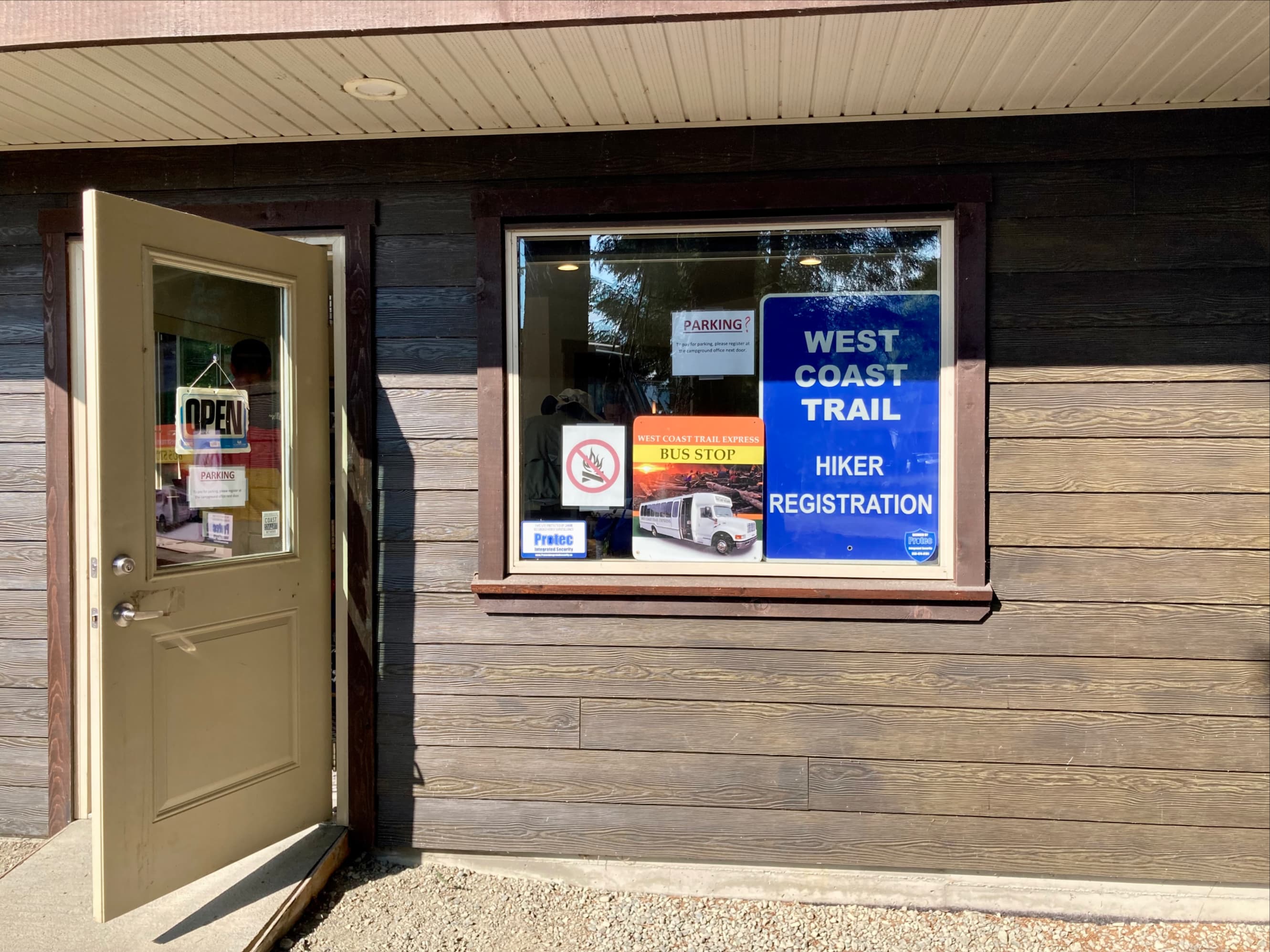
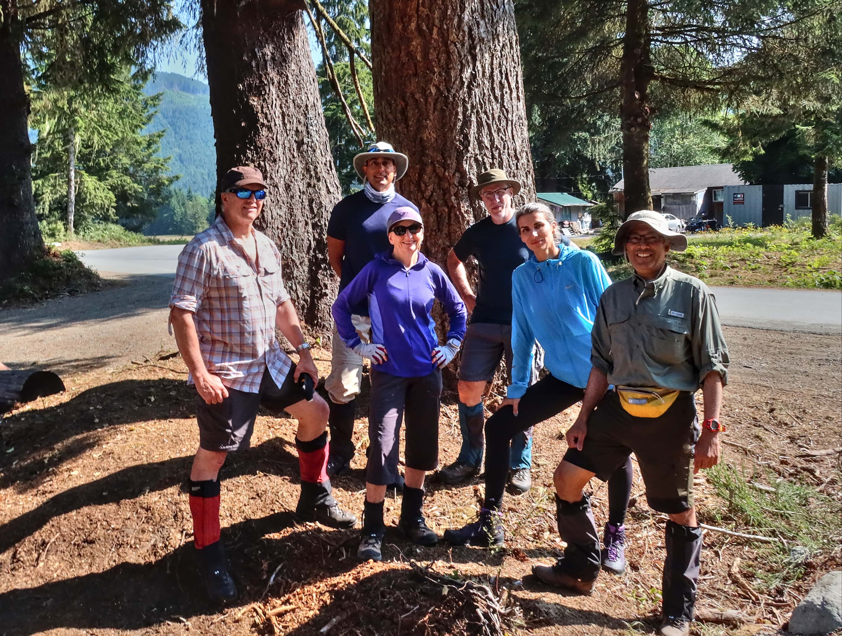
Our briefing covered a number of safety essentials and wasn’t too long. Before we got started we had a chance to take a group photo. Then we followed the park ranger down the road a short distance to the ferry.

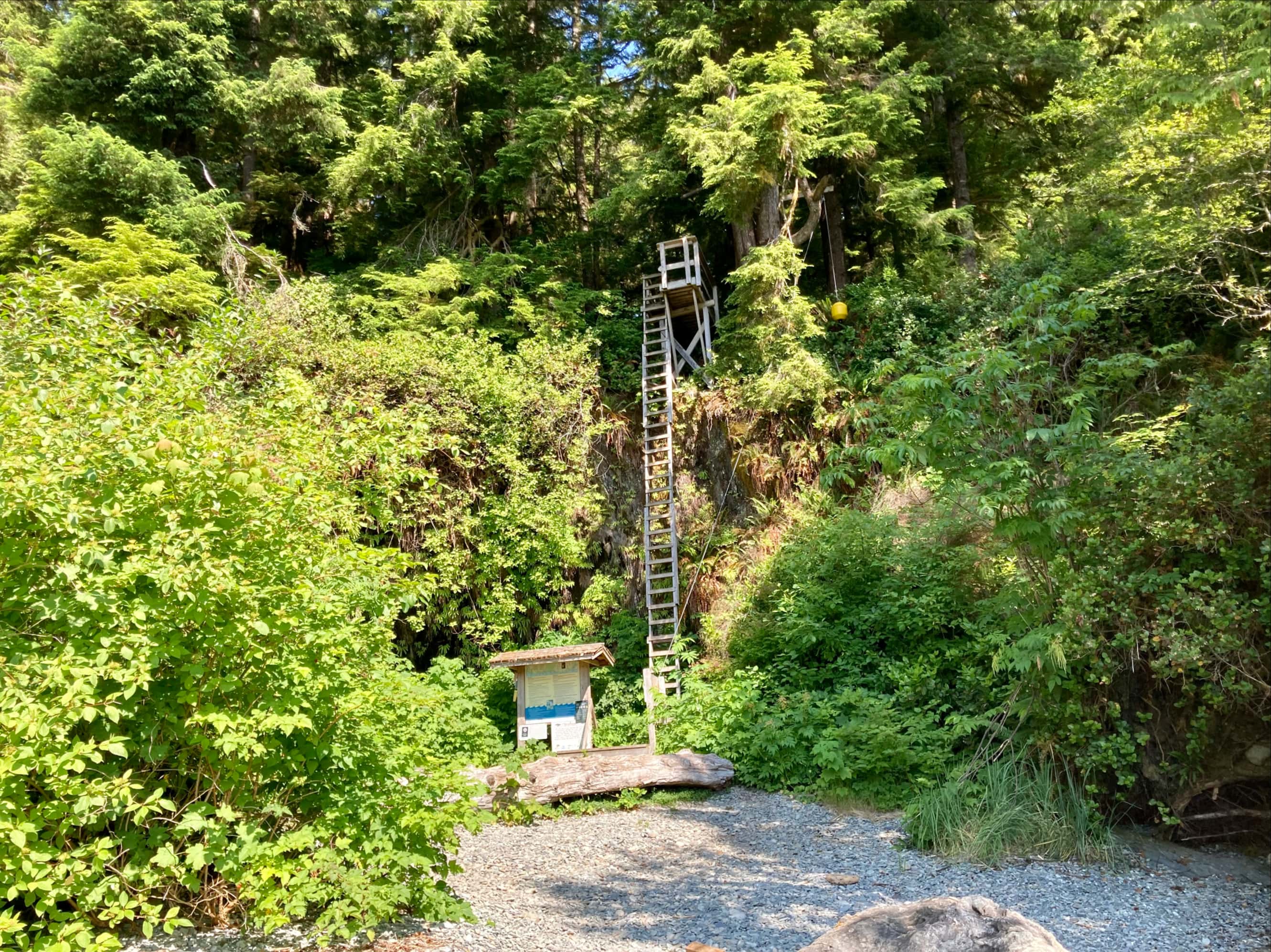
The ferry ride was quite short and brought us across the river to the actual trailhead. The operator brought the bow of the boat up onto the beach, then the front of the boat lowered to form a ramp, like some kind of D-Day landing craft. We stepped onto the beach and faced our first of many, many ladders.


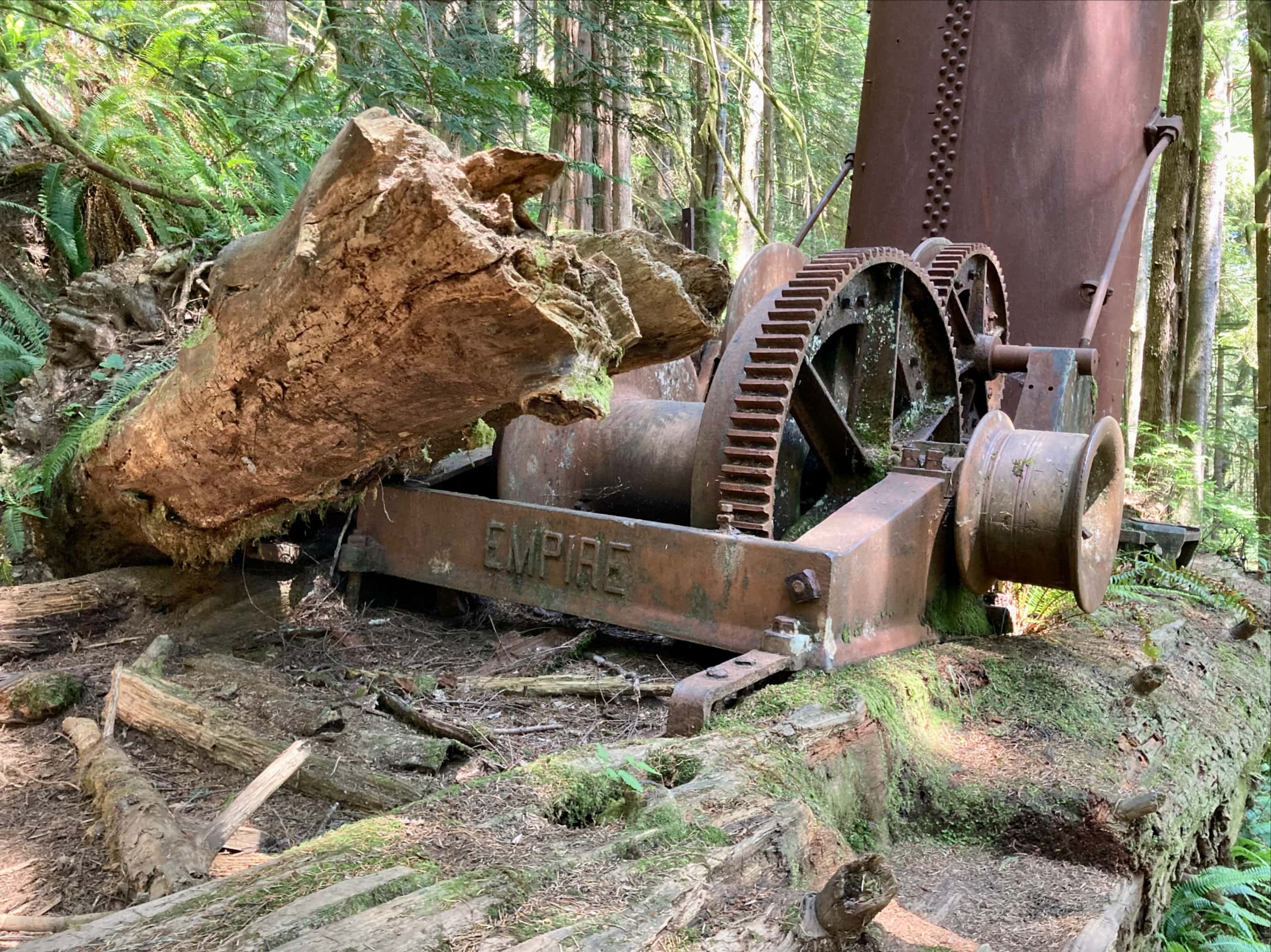
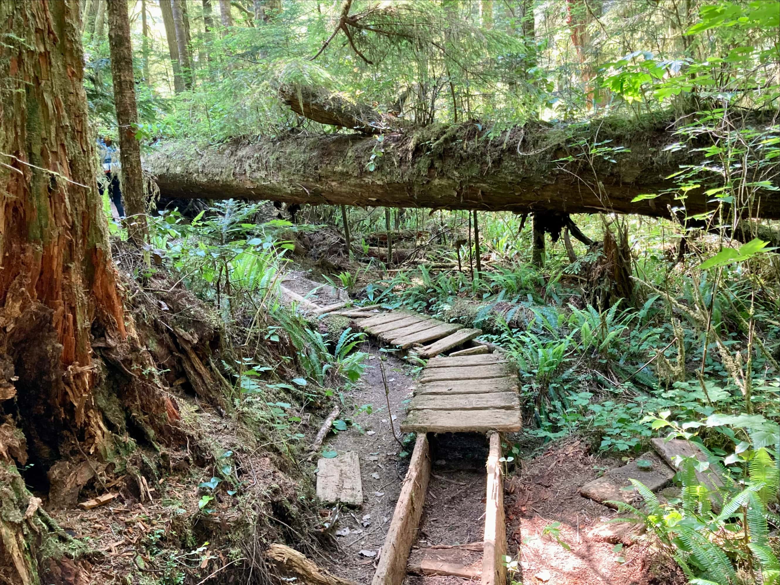
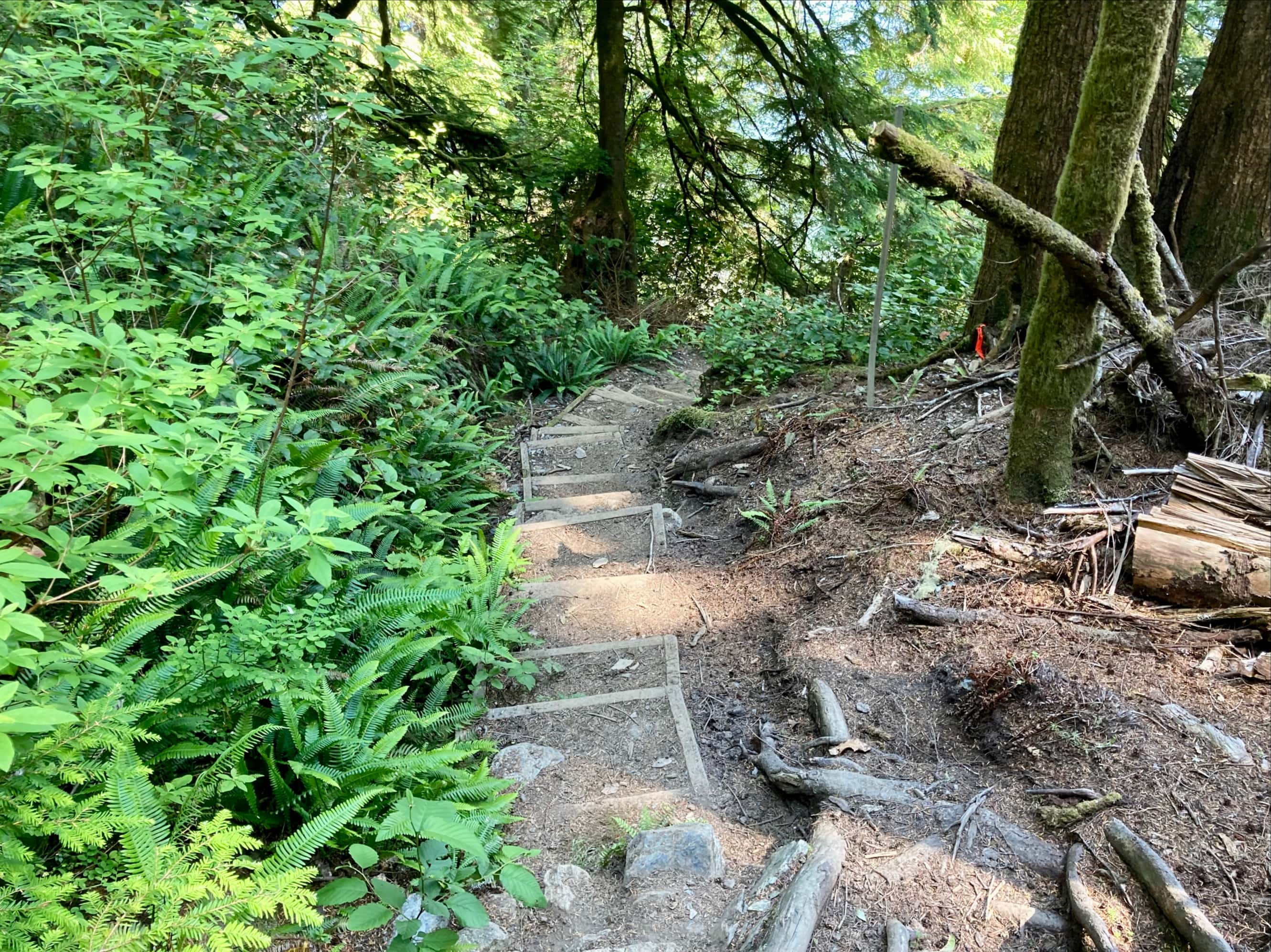
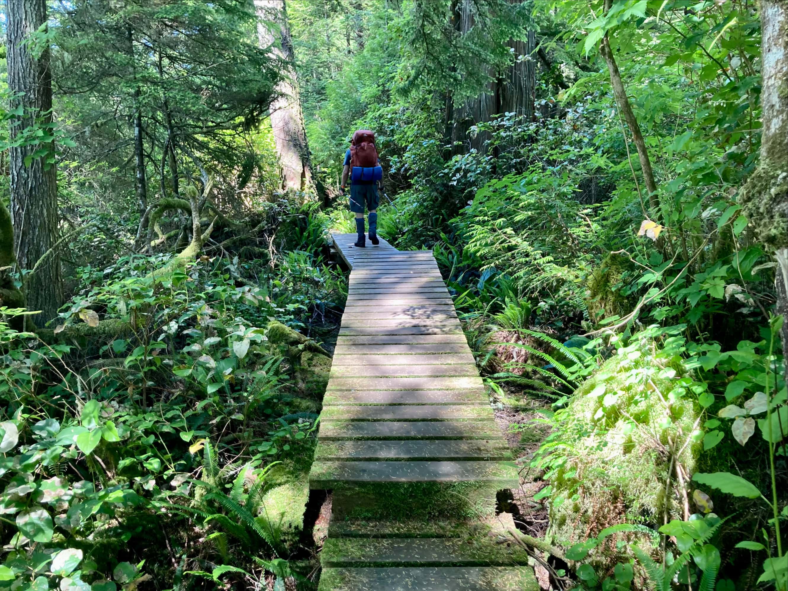
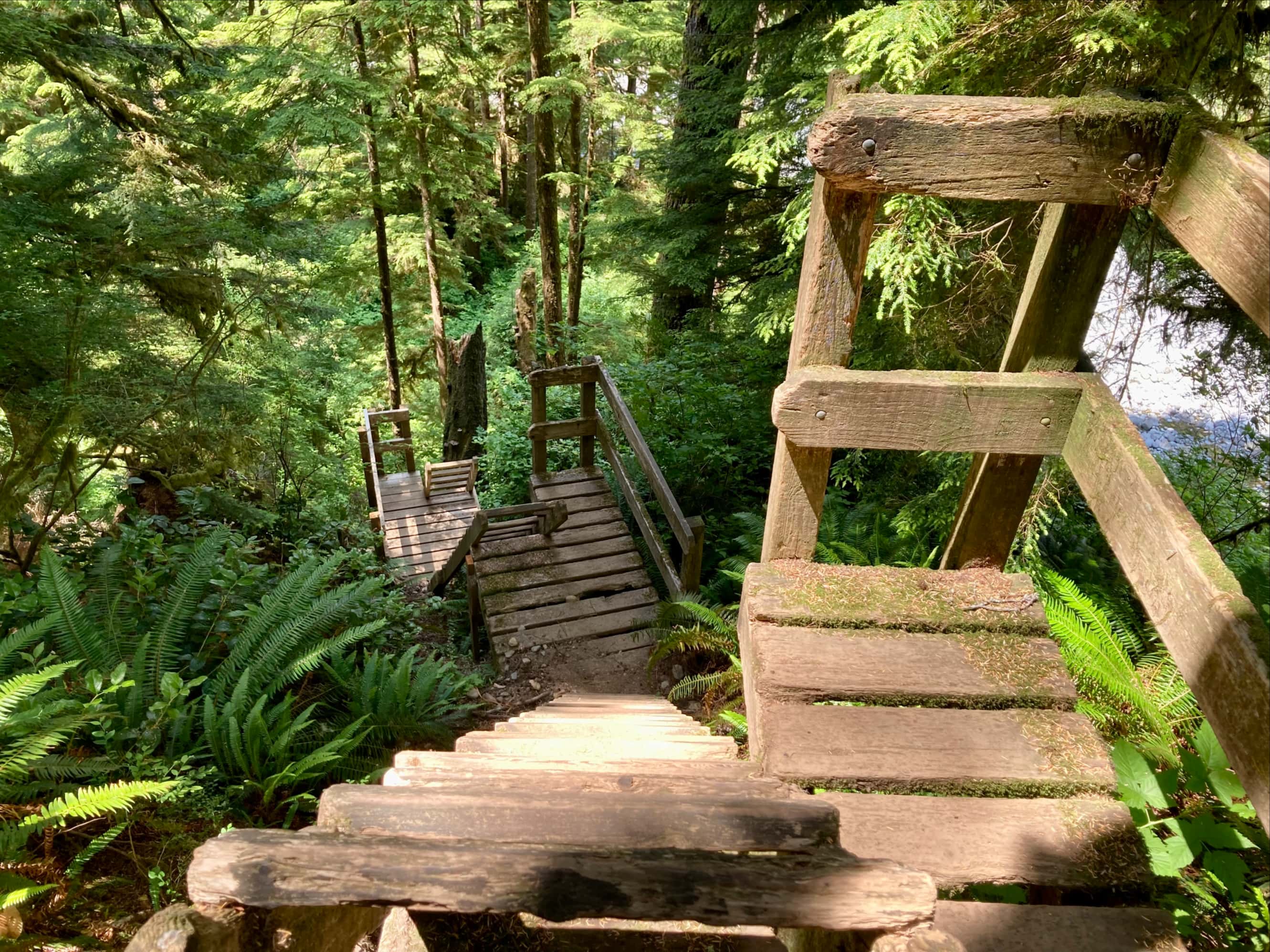
Once at the top of the ladder, we set off along the forest trail. It was in decent condition and quite dry. There were more ladders along with bridges and boardwalks. Most were in reasonably good shape, though a few really needed maintenance. Though the trail undulated up and down, it was generally gaining elevation. We passed an old donkey engine on the trail as well as an old barrel with rocks piled on top of it. I know that the highest point on the trail was somewhere in that area, so maybe that was some sort of cairn? Not far beyond there we filled up our water at Log Jam Creek then followed the steeply descending trail to Thrasher Cove campsite.


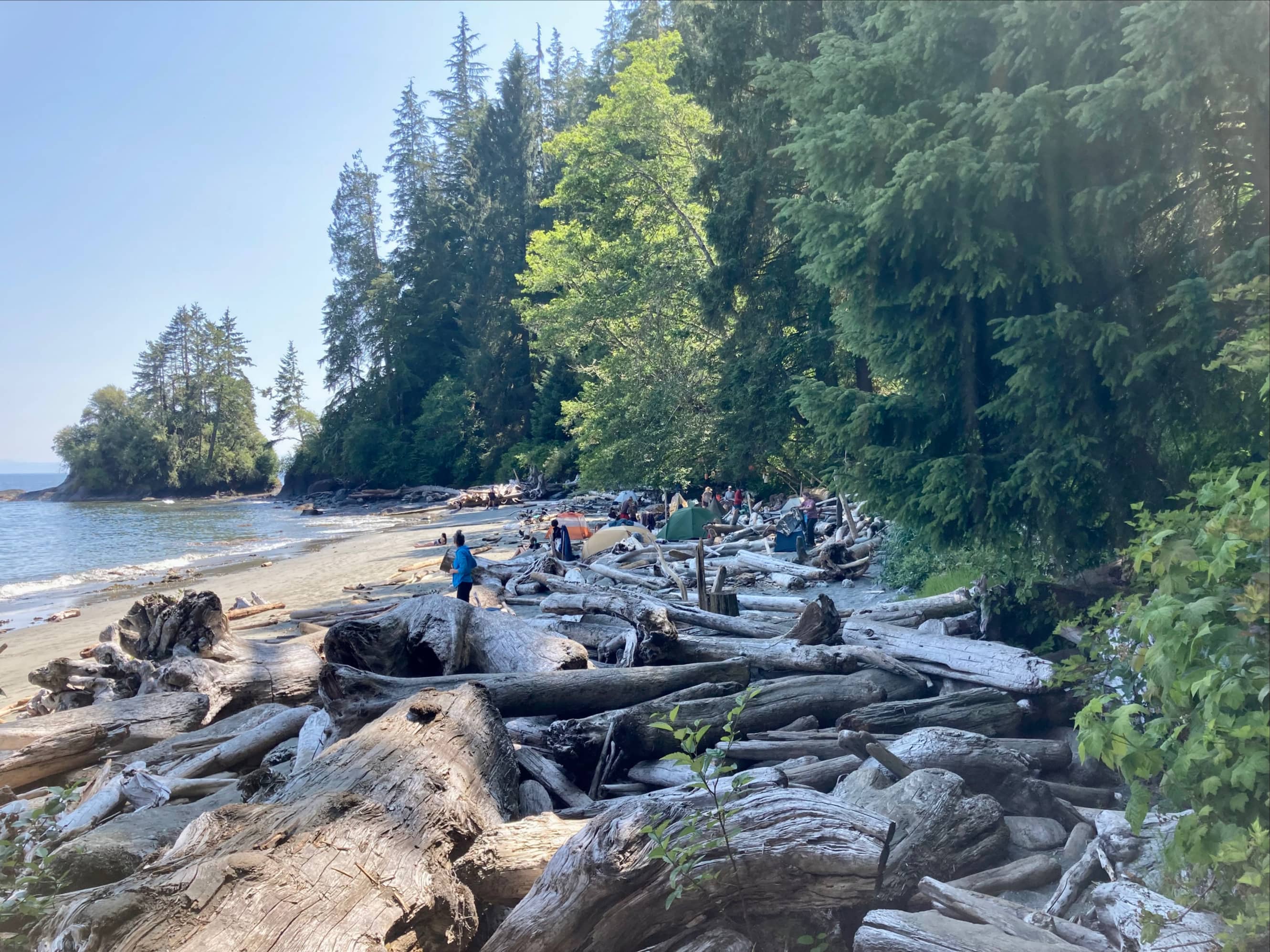
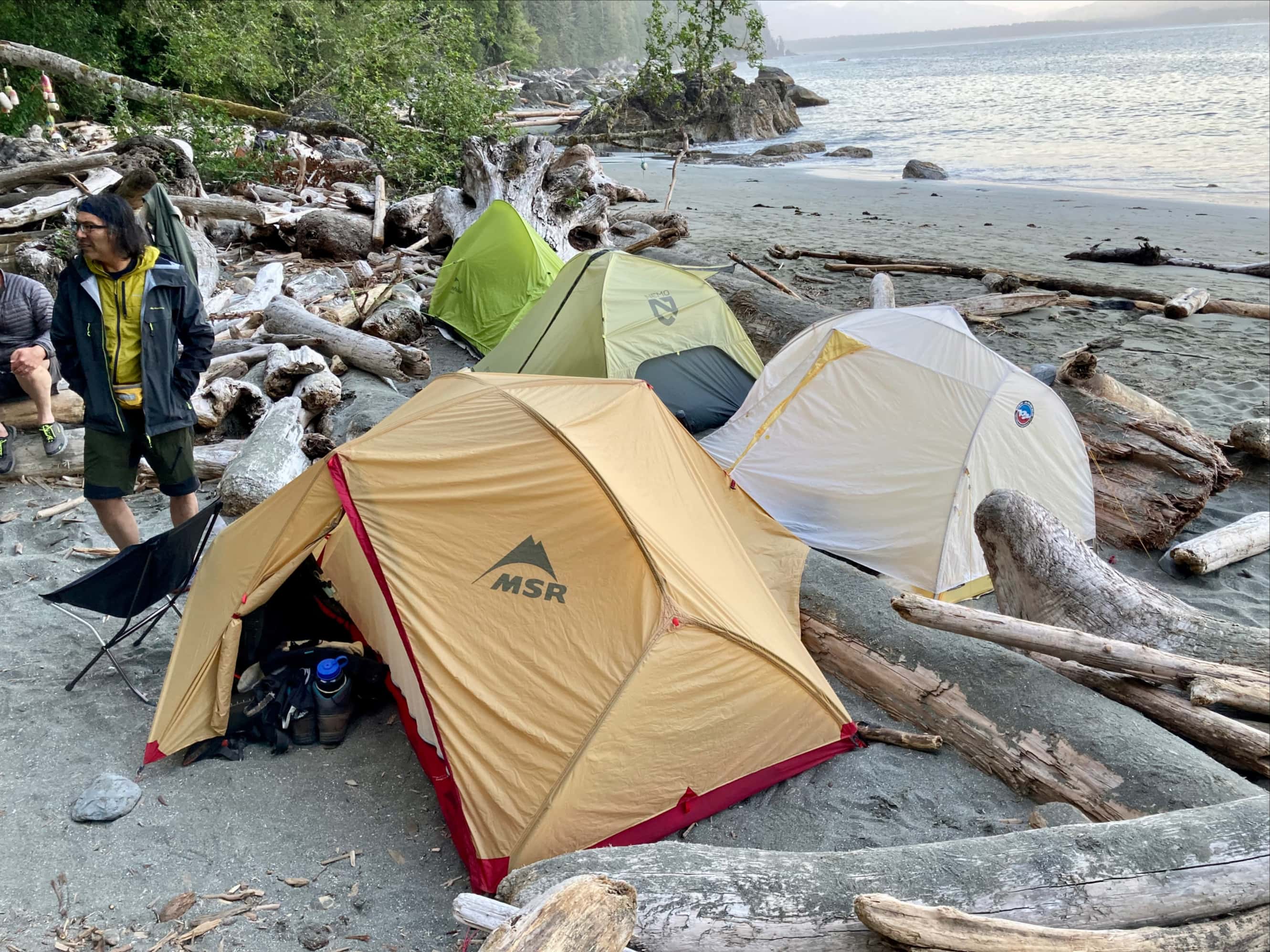
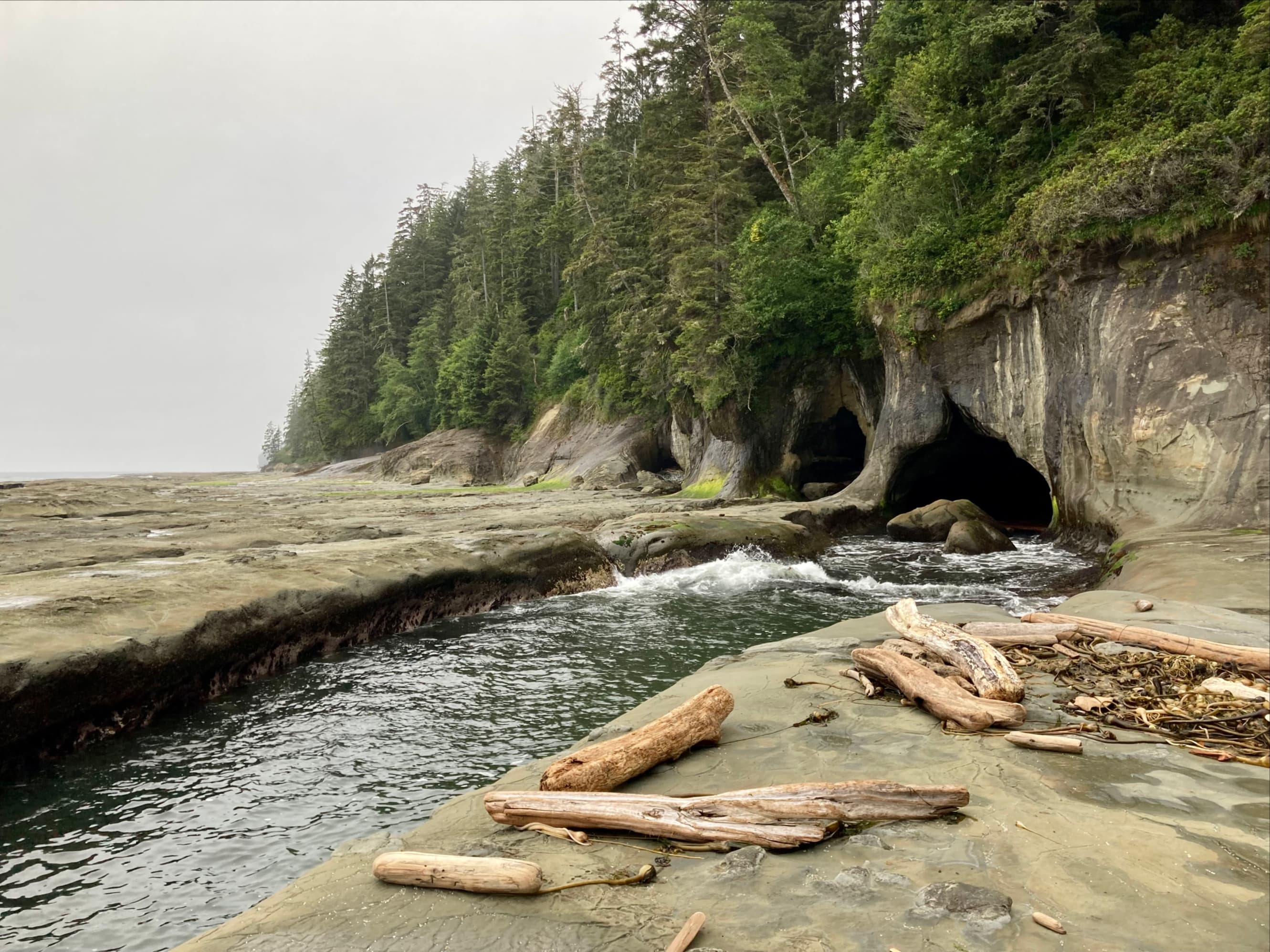
Thrasher Cove was extremely crowded. This wasn’t a surprise – at the orientation briefing we were told that the tents would be close enough to share pegs. We managed to find some spots to pitch our tents then I took a quick dip in the very cold ocean. That evening we gathered for our first supper on the trail and to make our plans for the following day. There are two ways to get to Camper Bay from Thrasher Cove – inland or along the beach. We wanted to take the beach route so we could see the famous caves at Owen Point. Tide tables became important at this point. At the orientation, we’d all been provided with waterproof maps of the trail. It showed where it was possible to proceed along the beach, and at what tide levels it was possible to do so. To get around Owen Point we’d need the tide to be below 1.8 m. According to our tables, low tide would be 0.1 m at 0955 and the next high tide would be 3.2 m at 1624. If we got off to an early start we’d have plenty of time.
With the plan in place for the next day, we spent the evening exploring the area around the campsite.


Day 2: Thrasher Cove to Camper Bay
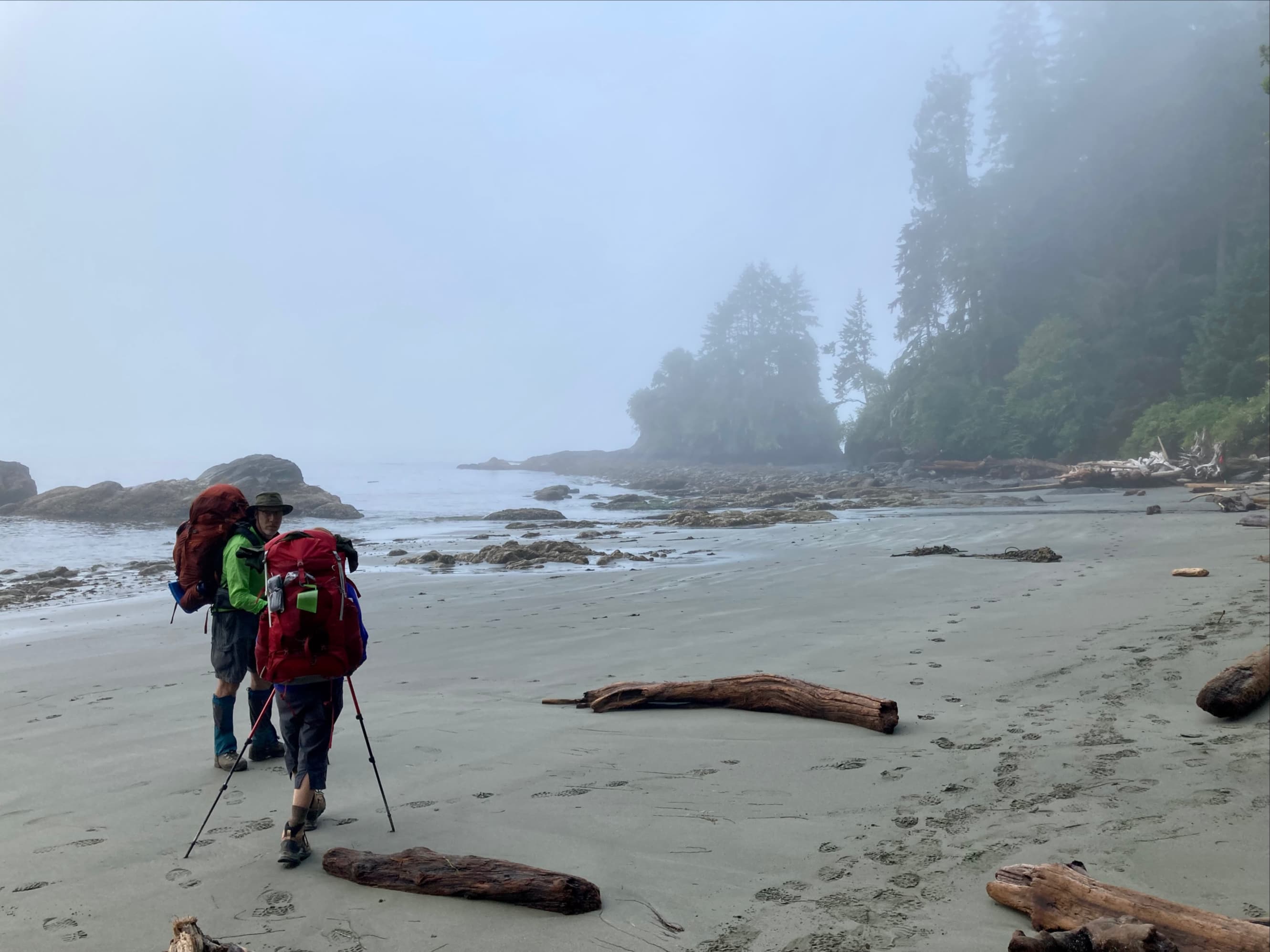
We set out a little after 0700 from Thrasher Cove. Our route would take us along the beach to a boulder field called the Quartertide Rocks. This section would be slow going, we knew, as well as potentially hazardous terrain. We’d also been given a heads-up during our orientation to watch out for the “Otter Slide” – a section of steeply angled shelf which frequently dumped hikers onto the rocks below. Parks Canada had roped off the area to help remind hikers to pass below the slope. It was also marked on the official map (though it wasn’t identified by its amusing name).
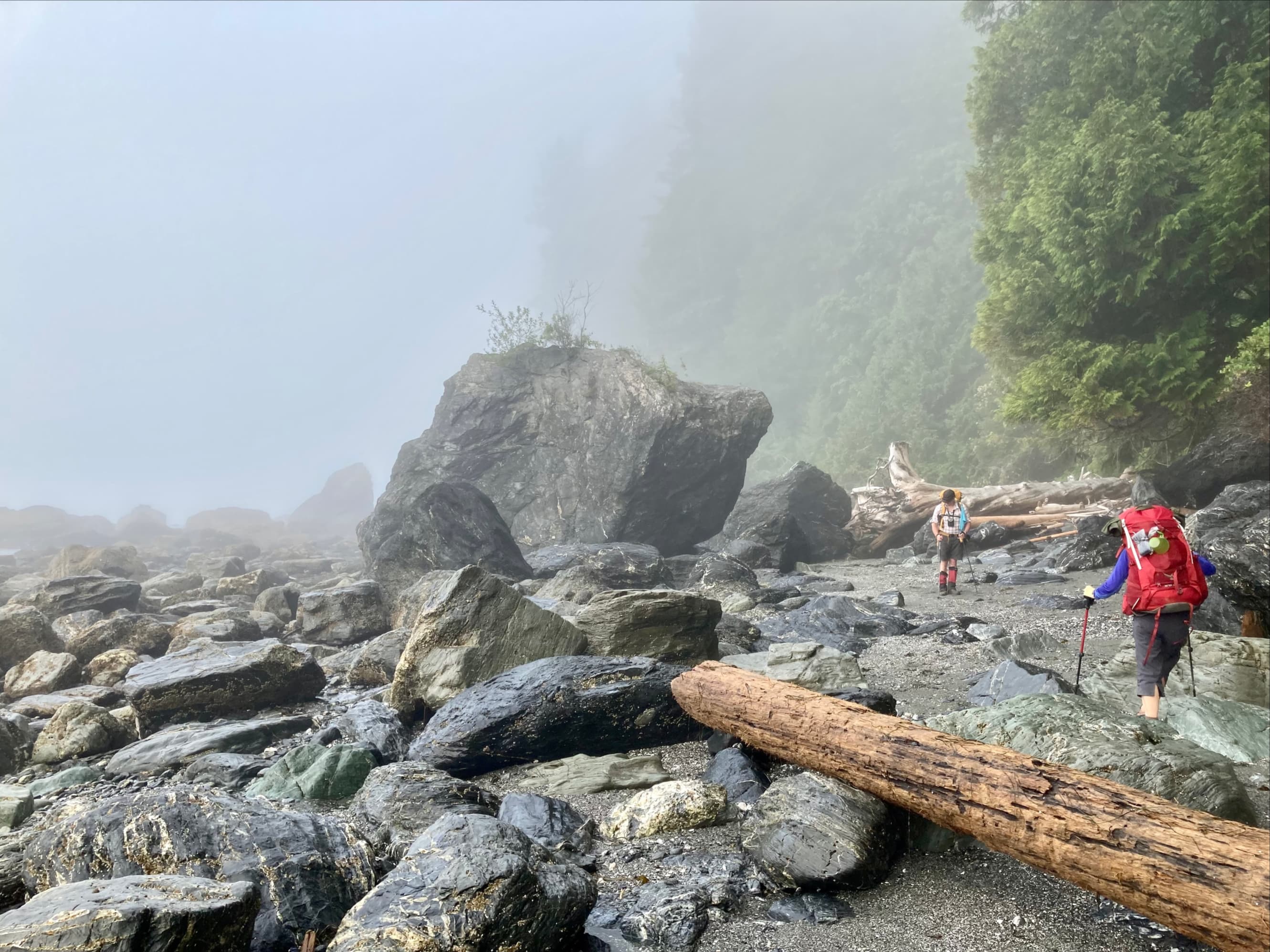

Travel through the boulders was slow. They were wet, barnacle-encrusted, slimy in places, and criss-crossed with huge logs. We’d been told that previous hikers had injured themselves when one of these big logs shifted, so we were all being careful. Despite this, I still managed to take a hard fall when a big log shifted under me. I remember realizing it was happening, and realizing that I couldn’t do anything to stop it. I stuck an arm out to brace myself, then I think I flipped over and landed on my pack. My hiking crew rushed in to recover me and got me sat up on another, more stationary log. In retrospect, the potential for severe injury from that fall was huge. I was very lucky – aside from a badly gouged hand I was alright. Before the feeling came back I ripped away some of the ragged skin, then Steve irrigated the hand with clean water and I wiped it down with iodine. Looking at the wound, I was satisfied the bleeding wasn’t too bad and that it was probably manageable with appropriate dressing changes (I’m a surgeon, so I felt like I was on pretty firm ground here). We applied some polysporin and gauze pads then wrapped everything with a gauze roll. It looked pretty good – Steve had a knack for this. The bleeding was slowed and I didn’t think it’d soak through the dressing. I checked myself over and nothing else was injured. We got up and pressed on – me feeling pretty shaky as the adrenaline left my system.
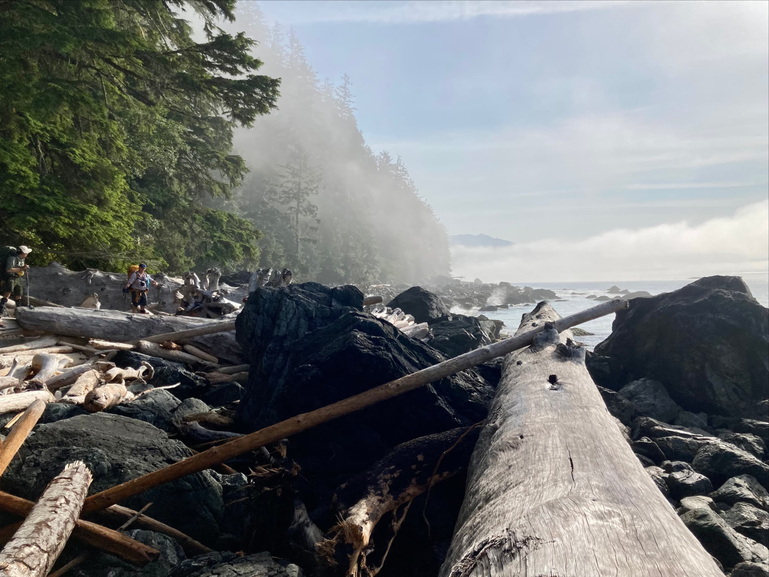

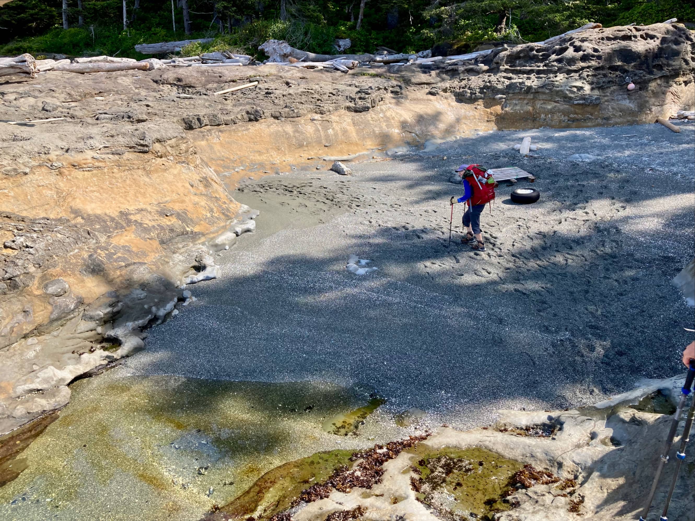
We were near the end of the boulders by that time. Once we got our hiking pace back we made good time. Travel through the boulders was at roughly 1 km/h but the terrain soon became a much friendlier combination of sandy beach and rock shelf. Our early start meant we had plenty of time to get to Owen Point.


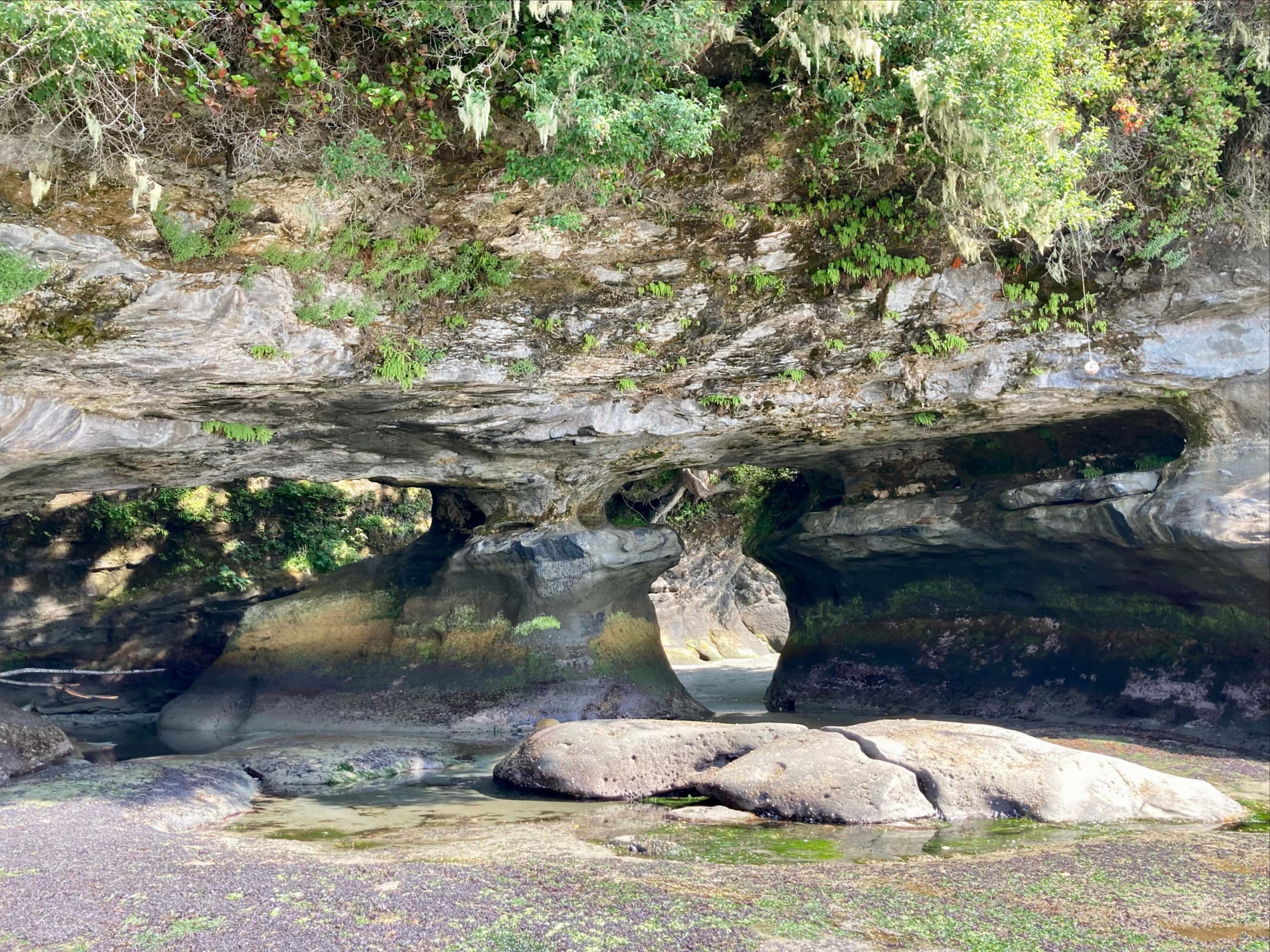
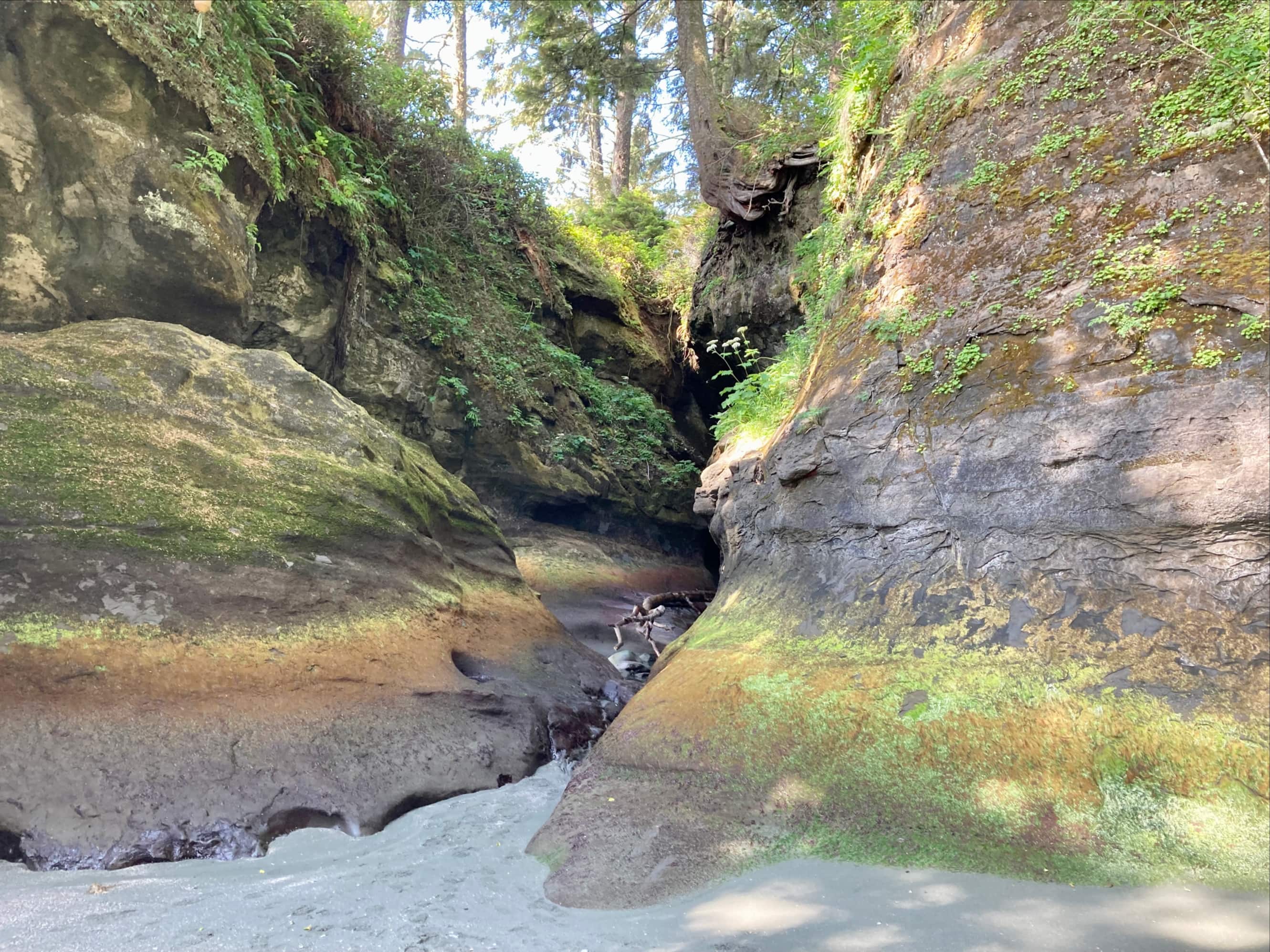


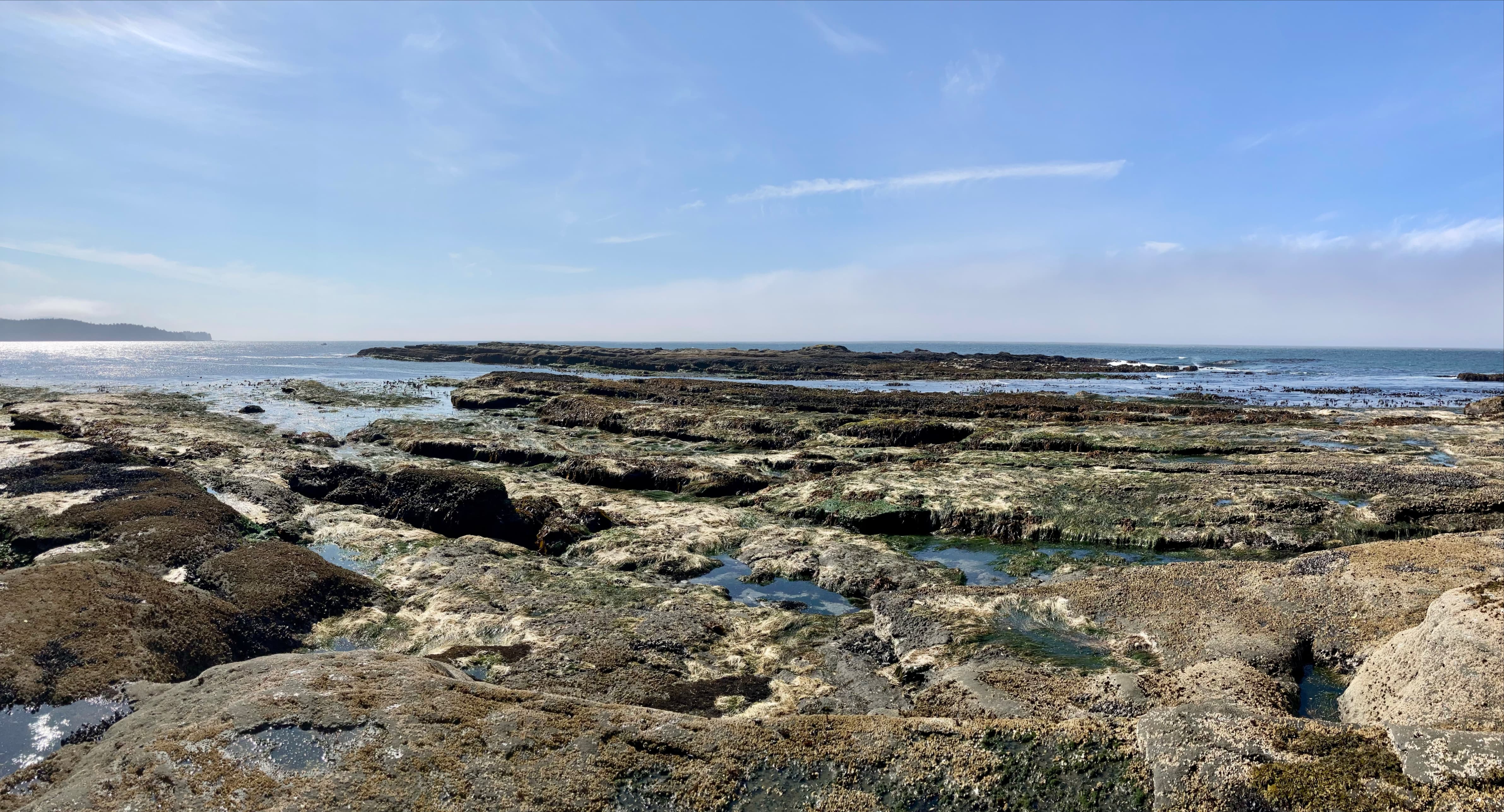
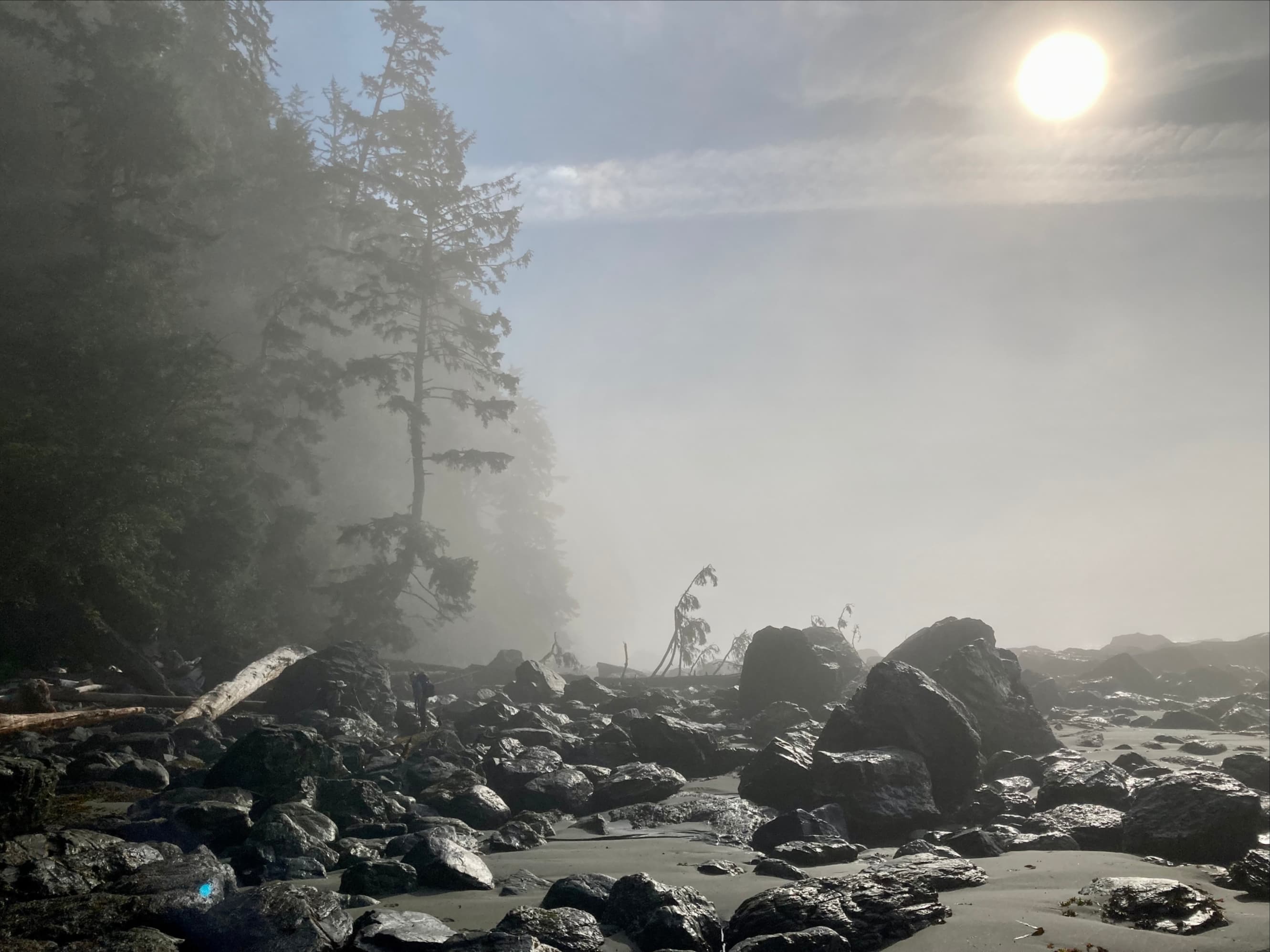
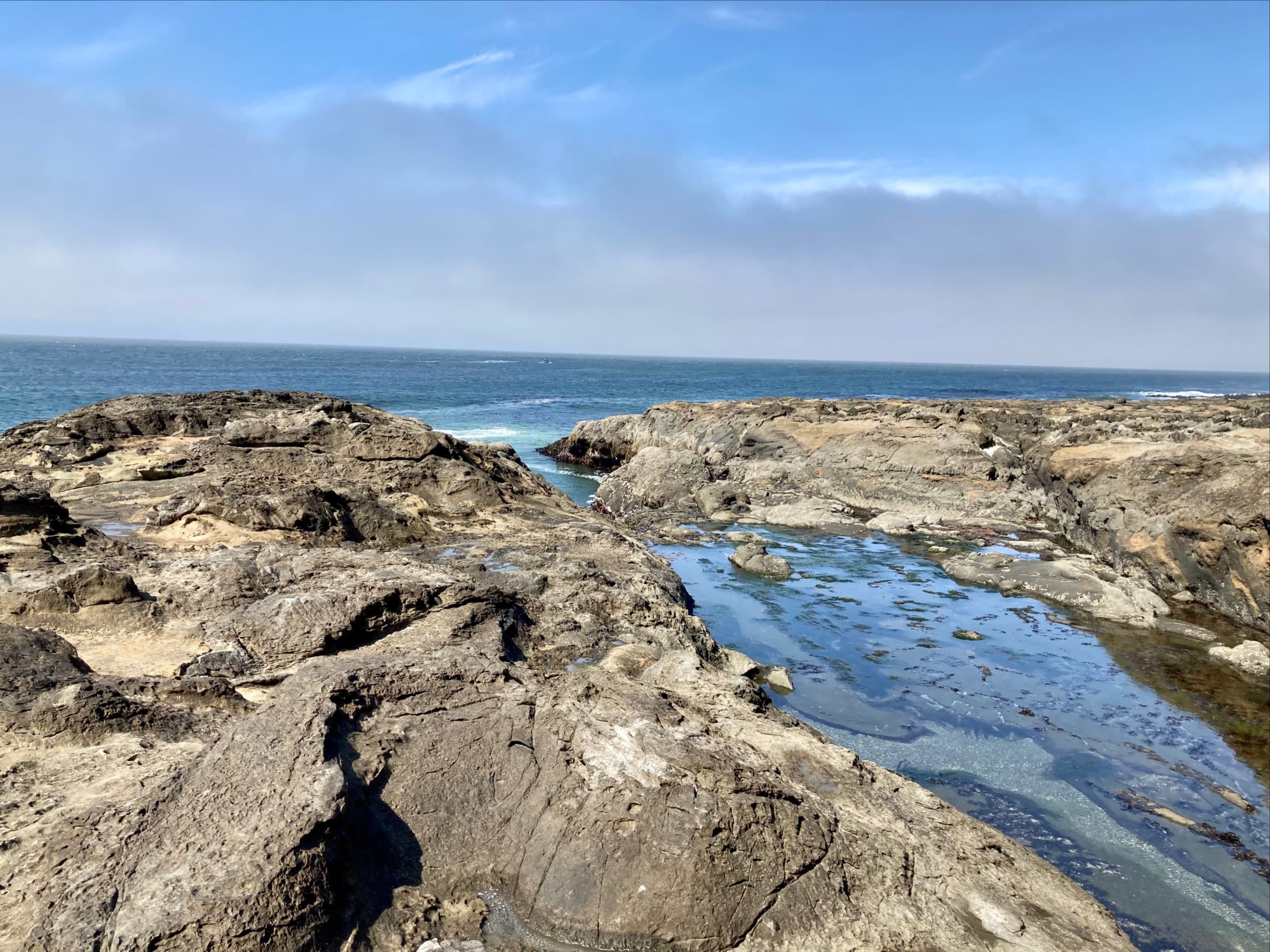
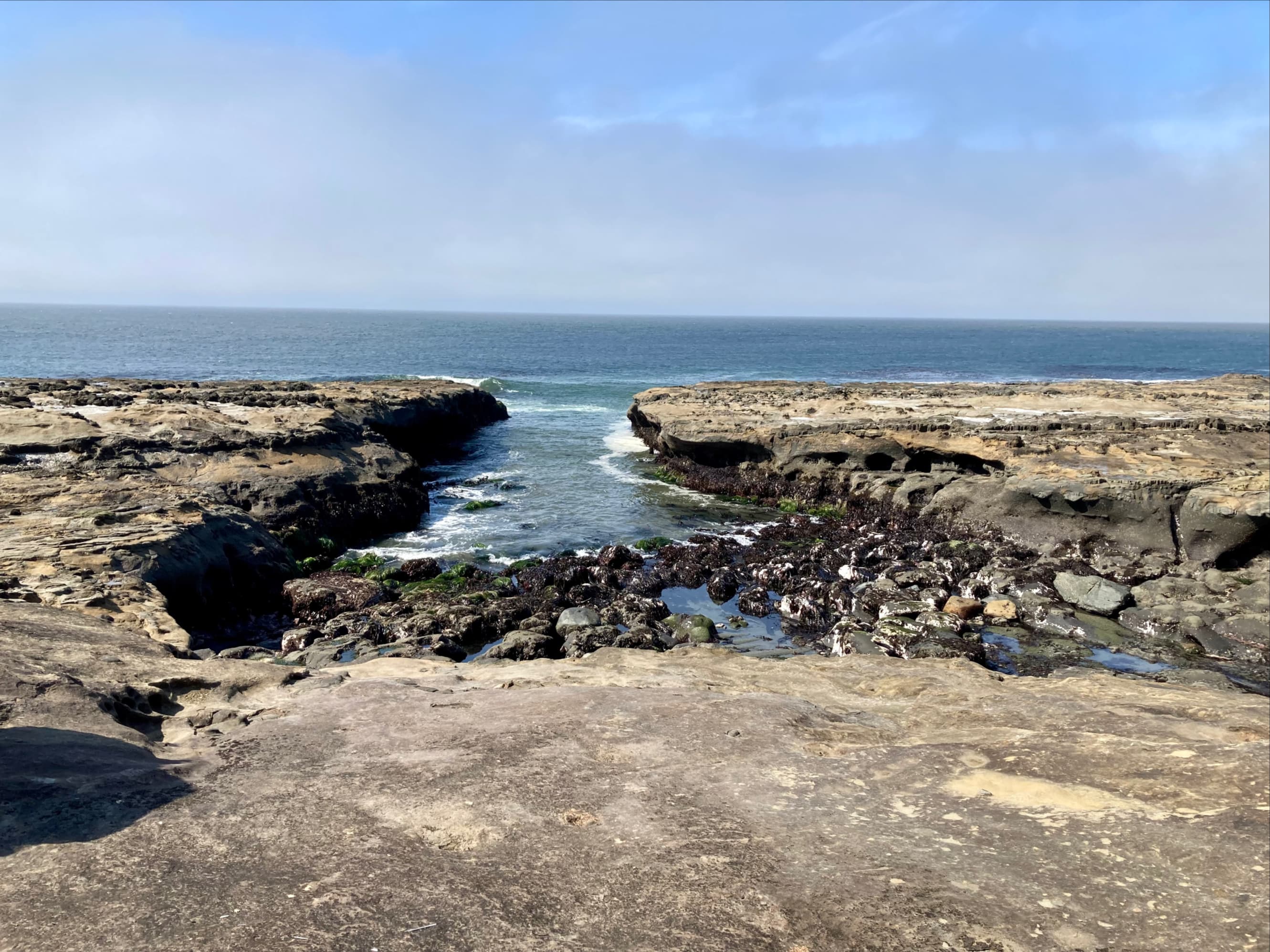
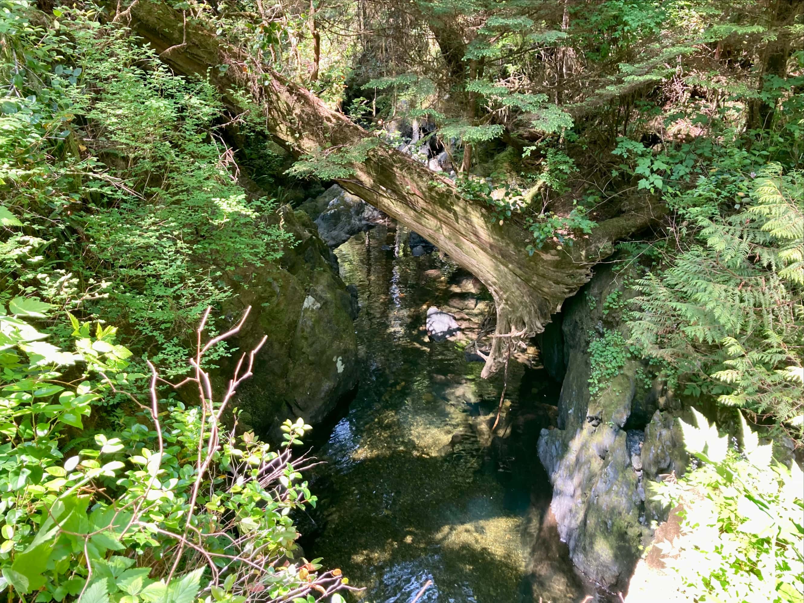
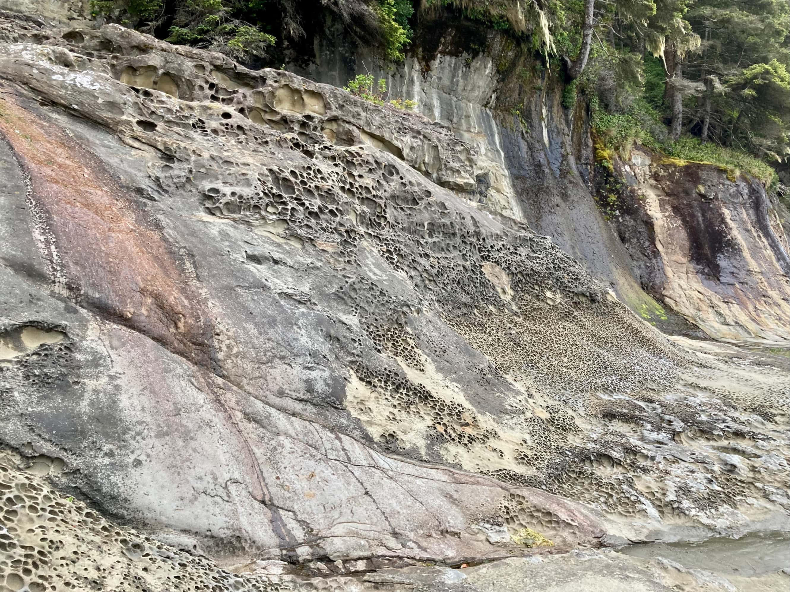
Once around Owen Point we started to get acquainted with some new hazards – surge channels. These are rocky inlets of varying width that fill with turbulent water when reached by incoming waves. Some of the were dry-bottomed with the low tide, others still had water in them. It wasn’t hard to understand just how dangerous it would be to fall into one. Most were straightforward to cross, and others could be circumvented on short inland paths. We kept our eyes open for the “Otter Slide”. We knew we wanted to get off the beach at “Beach Access A”, which was a short distance beyond that landmark. Beach access points are marked along the trail with buoys strung in tree branches at the edge of the forest.

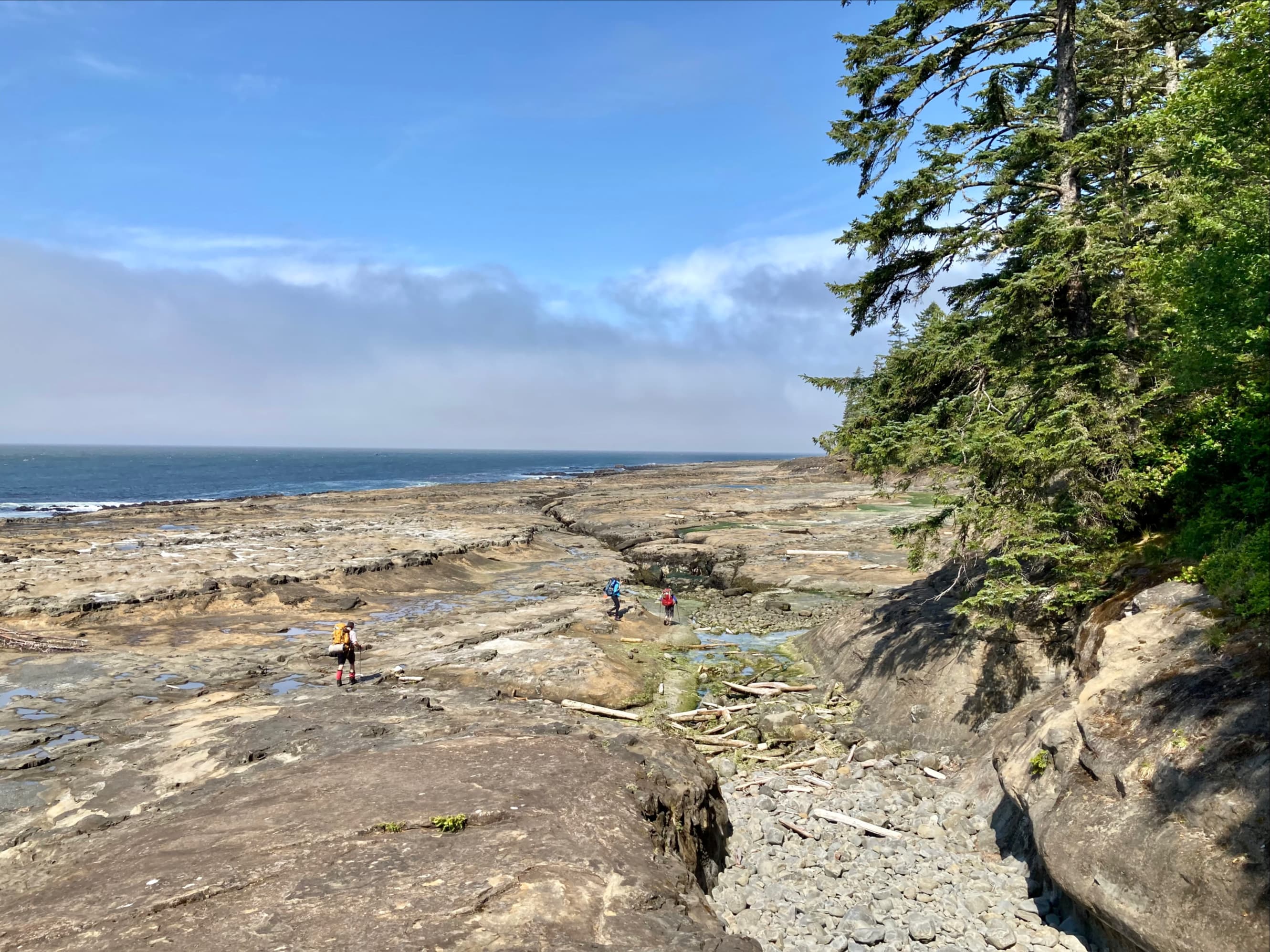


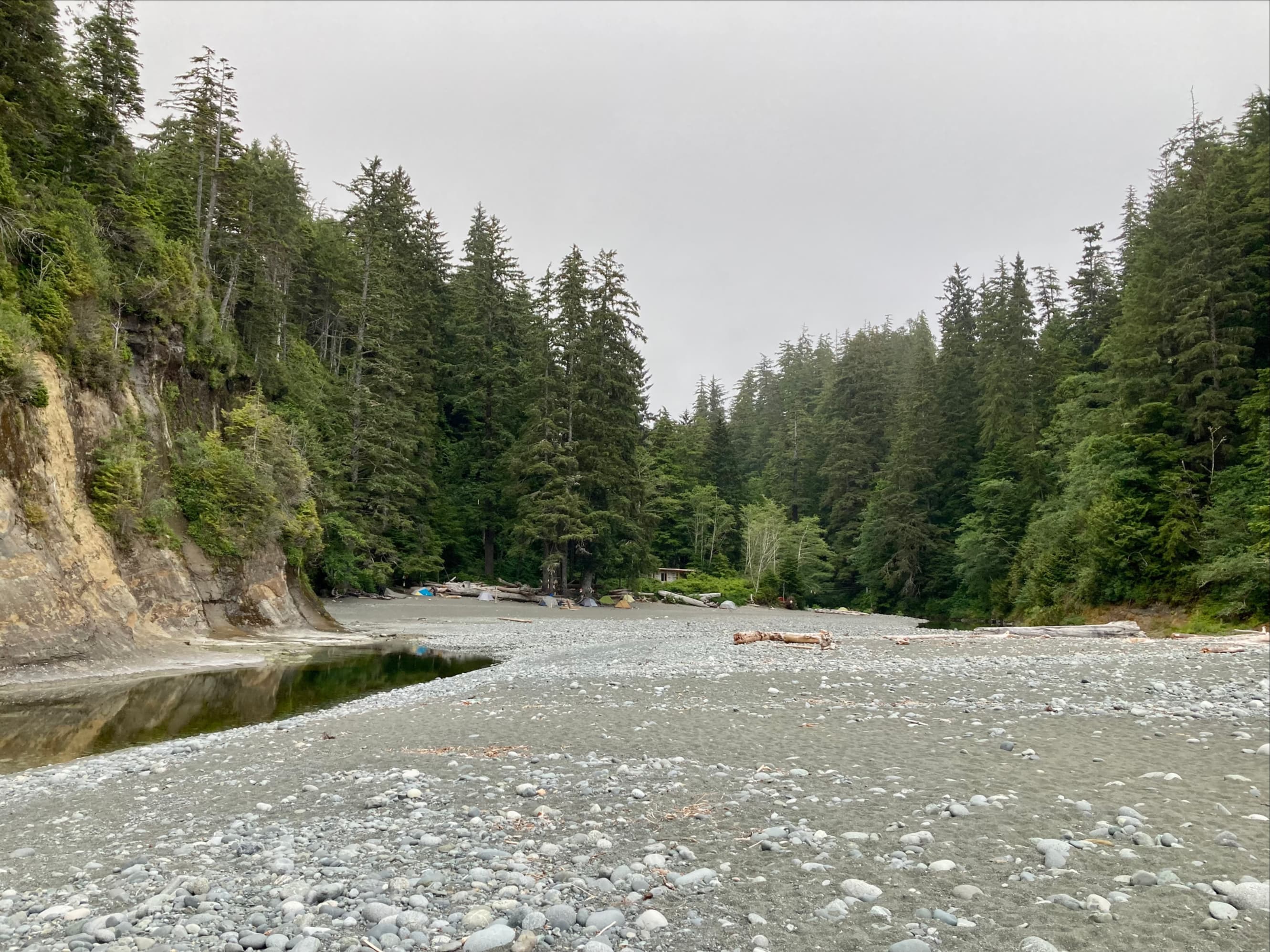
Once we were off the beach, we were back onto boardwalks and ladders. As we finally got near Camper Bay we encountered our first cable car. The creek was so low that we didn’t really have to use it, but we tried it anyway. After a tough day of hiking it was very nice to finally make it to our campsite for the night. As we walked towards the beach, we passed a couple guys constructing a new Guardian cabin. They looked at my bloody bandages with some concern. I reassured them that the situation was manageable. Later, they very kindly opened up the contents of their construction site first aid kit so we could grab a little extra gauze to bring along with us. Camper Bay was far less crowded than Thrasher Cove, and the tenting sites were set very far back from the tide line.


Since the next leg of our journey would be entirely inland we didn’t need to plan around tide times. We enjoyed a very peaceful night under the shelter of a huge tree.

Click here for the next post – West Coast Trail Part 2: Camper Bay to Cribs Creek.

Thank you for sharing this gre
LikeLike
Very nice post Par and what a spectacular start of the trail. I have never seen such a ladder to be used in a hiking trail.
Very nice description too with beautiful photos.
Thanks for sharing and greetings from Greece.
LikeLiked by 1 person
Thanks, Olympus! Yes, the ladders were definitely unique, and in the next section there are many more, and they’re much taller.
LikeLiked by 1 person