GPS : 46.371924, -60.700238
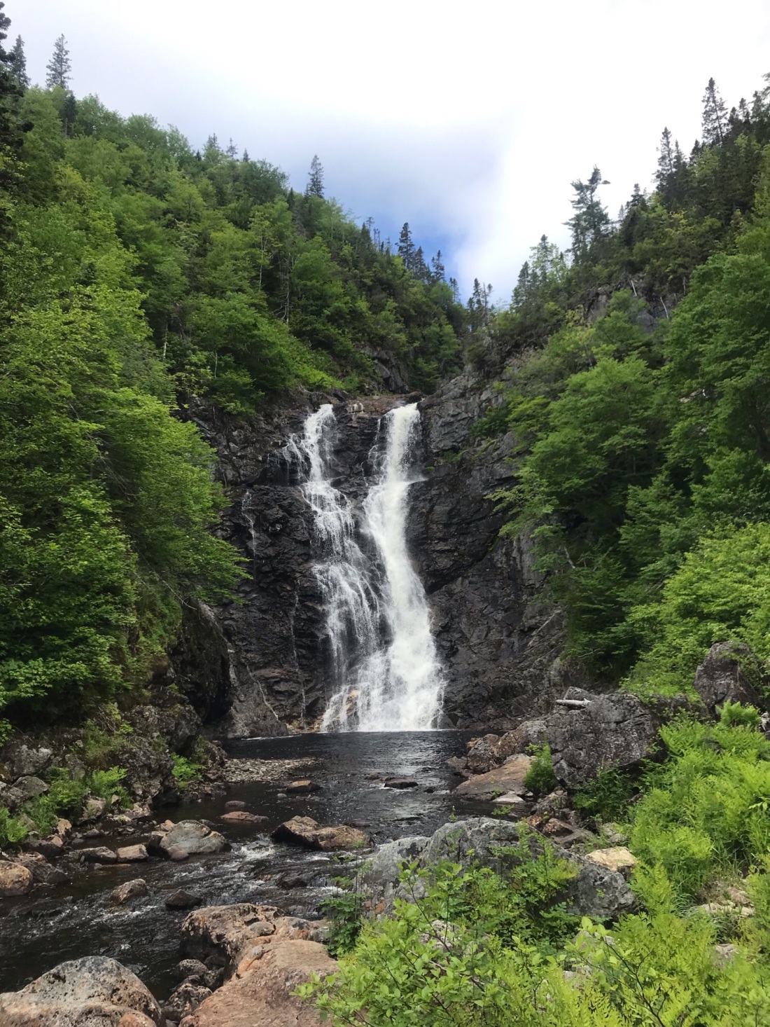
Claimed to be the tallest waterfall in Nova Scotia. The journey is long but it is well worth it. The falls drop in approx. 100 ft at a 90-degree angle into a very large pool at its base. This pool is deep and wide before the river narrows out and continues downstream.
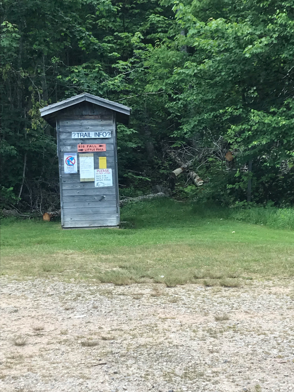
Important Information – These falls are located in a designated Provincial Park with a provided parking area. There is signage stating to go left or right when in the parking lot. View the photo below. The left trailhead is towards little falls and the right trailhead is towards big falls. You want to go right. The trail on the right starts up a hill. This trail is human trafficked so expect to walk on exposed tree roots, rocks, gravel, and mud/dirt throughout. Signage along the way is minimal but pretty clear. These falls give you the chance to swim and not jump. The pool is big and deep enough for a plunge but finding somewhere to jump from would be difficult. These falls are a reward from a very long hike. Everything I found online had different lengths and none seemed to be accurate unless I walk very fast. The hike in and hike out combined took 4.5 hours for myself and 3 others with a few breaks. A measuring app present recorded just shy of 8kms each way creating a total of approx 17kms. As I mentioned this is in a Provincial Park so when arriving near the park you will see signage for the park and a gravel road leading you to the general parking area. This road is gravel, has a few steep inclines and some potholes.
Directions – If you are traveling from Halifax you will head towards Truro on Highway 102(Veterans Memorial Highway). Once reaching Truro you will drive past Truro to exit 15W towards Cape Breton on Highway 104(Trans-Canada Highway). Following until you reach the Canso Causeway. Once you cross the Canso Causeway into Cape Breton you will drive past the roundabout on your left and turn left onto Highway 105(Trans-Canada Highway) heading towards Baddeck/Sydney/Cheticamp. This Highway will bring you to a fork in the road. At this location Highway, 105 will continue right and the Cabot Trail will start on your Left. Continue right on Highway 105 towards Baddeck. Following Highway 105 until you reach the Cabot Trail on your left which is the finishing point from where it started back before Baddeck. Following the Cabot Trail into North River Bridge looking for Oregon Rd on your left just after the bridge. You will see a Provincial sign saying Park North River on the right-hand side of the road. Drive-up Oregon Rd for 3.5kms and arrive at the general parking area.
