
 The Aerial Archaeological Mapping Explorer tool has been made available by Historic England. It displays archaeological evidence that has been mapped and recorded from aerial photographs across England.
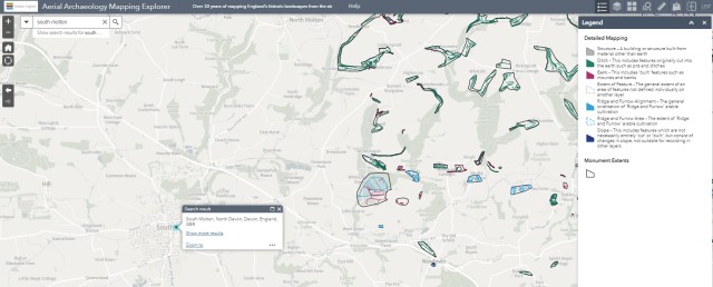
It is possible to explore layers of archaeology in your local area, or concentrate on specific sites across the whole country. By clicking on a project area, it is possible to open further information. By zooming in, pop ups take you to the complete archaeological record for your chosen location.
Web Link:
https://historicengland.org.uk/research/results/aerial-archaeology-mapping-explorer/
